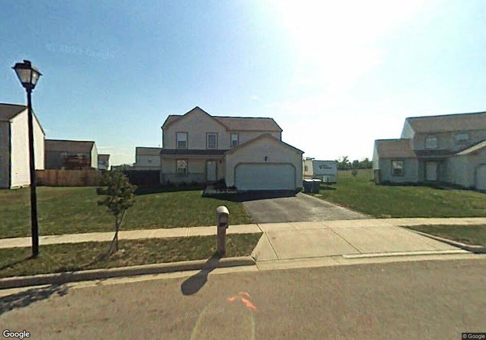
44 River Ct South Bloomfield, OH 43103
Estimated Value: $341,000 - $359,000
4
Beds
3
Baths
2,250
Sq Ft
$156/Sq Ft
Est. Value
About This Home
This home is located at 44 River Ct, South Bloomfield, OH 43103 and is currently estimated at $350,577, approximately $155 per square foot. 44 River Ct is a home located in Pickaway County.
Ownership History
Date
Name
Owned For
Owner Type
Purchase Details
Closed on
Aug 20, 2021
Sold by
Hatfield Enterprises Llc
Bought by
Coe Mackenzie A and Coe Meghan E
Current Estimated Value
Home Financials for this Owner
Home Financials are based on the most recent Mortgage that was taken out on this home.
Original Mortgage
$231,600
Outstanding Balance
$210,279
Interest Rate
2.8%
Mortgage Type
New Conventional
Estimated Equity
$140,298
Purchase Details
Closed on
Mar 31, 2021
Sold by
Sears Jamie and Quicken Loans Inc
Bought by
Hatfield Enterprises Llc
Purchase Details
Closed on
Jan 12, 2018
Sold by
Ragan Leigh Ann
Bought by
Sears Jamie
Home Financials for this Owner
Home Financials are based on the most recent Mortgage that was taken out on this home.
Original Mortgage
$163,975
Interest Rate
4.5%
Mortgage Type
FHA
Create a Home Valuation Report for This Property
The Home Valuation Report is an in-depth analysis detailing your home's value as well as a comparison with similar homes in the area
Home Values in the Area
Average Home Value in this Area
Purchase History
| Date | Buyer | Sale Price | Title Company |
|---|---|---|---|
| Coe Mackenzie A | $289,500 | Stewart Title Company | |
| Coe Mackenzie A | $289,500 | Stewart Title | |
| Hatfield Enterprises Llc | $210,200 | None Available | |
| Sears Jamie | $167,000 | Title Source Inc |
Source: Public Records
Mortgage History
| Date | Status | Borrower | Loan Amount |
|---|---|---|---|
| Open | Coe Mackenzie A | $231,600 | |
| Closed | Coe Mackenzie A | $231,600 | |
| Previous Owner | Sears Jamie | $163,975 |
Source: Public Records
Tax History Compared to Growth
Tax History
| Year | Tax Paid | Tax Assessment Tax Assessment Total Assessment is a certain percentage of the fair market value that is determined by local assessors to be the total taxable value of land and additions on the property. | Land | Improvement |
|---|---|---|---|---|
| 2024 | -- | $89,090 | $9,530 | $79,560 |
| 2023 | $3,043 | $89,090 | $9,530 | $79,560 |
| 2022 | $2,718 | $65,320 | $7,990 | $57,330 |
| 2021 | $2,574 | $65,320 | $7,990 | $57,330 |
| 2020 | $3,548 | $65,320 | $7,990 | $57,330 |
| 2019 | $2,306 | $62,100 | $7,990 | $54,110 |
| 2018 | $2,560 | $62,100 | $7,990 | $54,110 |
| 2017 | $3,369 | $62,100 | $7,990 | $54,110 |
| 2016 | $2,091 | $49,230 | $7,960 | $41,270 |
| 2015 | $2,092 | $49,230 | $7,960 | $41,270 |
| 2014 | $2,094 | $49,230 | $7,960 | $41,270 |
| 2013 | $2,267 | $51,510 | $7,960 | $43,550 |
Source: Public Records
Map
Nearby Homes
- 52 River Bend Dr
- 5310 Pear Ln Unit Lot 127
- Beacon Plan at Day Farm - Maple Street Collection
- Greenbriar Plan at Day Farm - Maple Street Collection
- Jensen Plan at Day Farm - Maple Street Collection
- Breckenridge Plan at Day Farm - Maple Street Collection
- Yosemite Plan at Day Farm - Maple Street Collection
- Danville Plan at Day Farm - Maple Street Collection
- Fairfax Plan at Day Farm - Maple Street Collection
- Cumberland Plan at Day Farm - Maple Street Collection
- Wesley Plan at Day Farm - Maple Street Collection
- Chestnut Plan at Day Farm
- Cooper Plan at Day Farm
- Bradford Plan at Day Farm
- Ironwood Plan at Day Farm
- Ashton Plan at Day Farm
- Empress Plan at Day Farm
- Norway Plan at Day Farm
- Spruce Plan at Day Farm
- Juniper Plan at Day Farm
- 44 River Ct
- 42 River Ct
- 42 River Ct
- 55 River Bend Dr
- 57 River Bend Dr
- 53 River Bend Dr
- 43 River Ct
- 5073 River Bend Dr
- 5059 River Bend Dr
- 5085 River Bend Dr
- 5097 River Bend Dr
- 5067 River Bend Dr
- 5077 River Bend Dr
- 5057 River Bend Dr Unit Lot 35
- 5083 River Bend Dr Unit Lot 48
- 5075 River Bend Dr Unit Lot 44
- 5058 River Bend Dr
- 5064 River Bend Dr
- 5062 River Bend Dr
- 5068 River Bend Dr