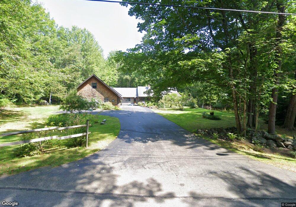
44 Road Between the Ponds Parsonsfield, ME 04047
Estimated Value: $528,000 - $580,000
4
Beds
2
Baths
2,274
Sq Ft
$241/Sq Ft
Est. Value
About This Home
This home is located at 44 Road Between the Ponds, Parsonsfield, ME 04047 and is currently estimated at $547,732, approximately $240 per square foot. 44 Road Between the Ponds is a home located in York County with nearby schools including Ossipee Valley Christian School.
Ownership History
Date
Name
Owned For
Owner Type
Purchase Details
Closed on
Aug 28, 2025
Sold by
Teets Terry R and Teets Lynne C
Bought by
Lazorchak Dawn and Lazorchak Kenneth
Current Estimated Value
Home Financials for this Owner
Home Financials are based on the most recent Mortgage that was taken out on this home.
Original Mortgage
$250,000
Outstanding Balance
$249,784
Interest Rate
6.74%
Mortgage Type
New Conventional
Estimated Equity
$297,948
Purchase Details
Closed on
Jun 1, 2012
Sold by
Buchanan William J and Buchanan Nicole
Bought by
Teets Terry R and Teets Lynne C
Home Financials for this Owner
Home Financials are based on the most recent Mortgage that was taken out on this home.
Original Mortgage
$199,500
Interest Rate
3.9%
Mortgage Type
Commercial
Create a Home Valuation Report for This Property
The Home Valuation Report is an in-depth analysis detailing your home's value as well as a comparison with similar homes in the area
Home Values in the Area
Average Home Value in this Area
Purchase History
| Date | Buyer | Sale Price | Title Company |
|---|---|---|---|
| Lazorchak Dawn | $550,000 | -- | |
| Teets Terry R | -- | -- | |
| Teets Terry R | -- | -- | |
| Teets Terry R | -- | -- |
Source: Public Records
Mortgage History
| Date | Status | Borrower | Loan Amount |
|---|---|---|---|
| Open | Lazorchak Dawn | $250,000 | |
| Previous Owner | Teets Terry R | $199,500 |
Source: Public Records
Tax History Compared to Growth
Tax History
| Year | Tax Paid | Tax Assessment Tax Assessment Total Assessment is a certain percentage of the fair market value that is determined by local assessors to be the total taxable value of land and additions on the property. | Land | Improvement |
|---|---|---|---|---|
| 2024 | $4,253 | $253,128 | $61,500 | $191,628 |
| 2023 | $4,101 | $253,128 | $61,500 | $191,628 |
| 2022 | $3,923 | $253,128 | $61,500 | $191,628 |
| 2021 | $3,911 | $253,128 | $61,500 | $191,628 |
| 2020 | $3,835 | $253,128 | $61,500 | $191,628 |
| 2019 | $3,772 | $253,128 | $61,500 | $191,628 |
| 2017 | $2,275 | $253,128 | $61,500 | $191,628 |
| 2016 | $3,772 | $253,128 | $61,500 | $191,628 |
| 2015 | $3,797 | $253,128 | $61,500 | $191,628 |
| 2013 | $3,696 | $253,128 | $61,500 | $191,628 |
Source: Public Records
Map
Nearby Homes
- Lot #00 North Rd
- Lot# 01 North Rd
- Lot #02 North Rd
- 27 Nocturne Rd
- 20 Hollyhock Farm Ln
- R13/038 Weeks Rd
- 178 Maplecrest Rd
- 424 Maplecrest Rd
- Lot 5 Fenderson Rd
- 9 Penny Ln
- 8 Pennie Ln
- Lot 1 Moulton Hill Rd
- Lot #5 Jordan Heights Rd
- 27 Lynn Dr
- 32 Summer St
- 266 S Hiram Rd
- 42 Pine St
- 35 Pine St
- 0 S River Ln Unit 1641807
- R3-32 Ossipee Trail
- 30 Road Between the Ponds
- 47 Road Between the Ponds
- 12 Ansell Ln
- 60 Road Between the Ponds
- 26 Road Between the Ponds
- 60 the Road Between the Ponds
- 61 Road Between the Ponds
- 64 Road Between the Ponds
- 65 Road Between the Ponds
- 95 Orchard Rd
- 71 Road Between the Ponds
- 98 Orchard Rd
- 2 Road Between the Ponds
- 81 Orchard Rd
- 80 Road Between the Ponds
- 80 Road Between the Ponds Unit 19/021
- 0 Road Between the Ponds Pineri Ln Unit 1108732
- 813 Pendexter Rd
- 54 Lily Bay Ln
- 91 Road Between the Ponds