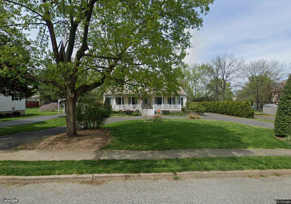
44 S Locust Ave Marlton, NJ 08053
Estimated Value: $769,000 - $978,000
4
Beds
5
Baths
3,422
Sq Ft
$258/Sq Ft
Est. Value
About This Home
This home is located at 44 S Locust Ave, Marlton, NJ 08053 and is currently estimated at $882,259, approximately $257 per square foot. 44 S Locust Ave is a home located in Burlington County with nearby schools including Marlton Middle School, Cherokee High School, and Lenape High School.
Ownership History
Date
Name
Owned For
Owner Type
Purchase Details
Closed on
Oct 30, 2008
Sold by
Medrick Andrew M and Medrick Linda
Bought by
Ingram William M and Ingram Jill B
Current Estimated Value
Home Financials for this Owner
Home Financials are based on the most recent Mortgage that was taken out on this home.
Original Mortgage
$150,000
Outstanding Balance
$98,707
Interest Rate
6.13%
Mortgage Type
Purchase Money Mortgage
Estimated Equity
$783,552
Purchase Details
Closed on
Apr 13, 1995
Sold by
Ruggierio Samuel and Ruggierio Edith M
Bought by
Medrick Andrew and Medrick Linda
Create a Home Valuation Report for This Property
The Home Valuation Report is an in-depth analysis detailing your home's value as well as a comparison with similar homes in the area
Home Values in the Area
Average Home Value in this Area
Purchase History
| Date | Buyer | Sale Price | Title Company |
|---|---|---|---|
| Ingram William M | $525,000 | Surety Title Corporation | |
| Medrick Andrew | $53,000 | United Title & Abstract |
Source: Public Records
Mortgage History
| Date | Status | Borrower | Loan Amount |
|---|---|---|---|
| Open | Ingram William M | $150,000 |
Source: Public Records
Tax History Compared to Growth
Tax History
| Year | Tax Paid | Tax Assessment Tax Assessment Total Assessment is a certain percentage of the fair market value that is determined by local assessors to be the total taxable value of land and additions on the property. | Land | Improvement |
|---|---|---|---|---|
| 2025 | $17,348 | $508,000 | $117,600 | $390,400 |
| 2024 | $16,322 | $508,000 | $117,600 | $390,400 |
| 2023 | $16,322 | $508,000 | $117,600 | $390,400 |
| 2022 | $15,591 | $508,000 | $117,600 | $390,400 |
| 2021 | $15,225 | $508,000 | $117,600 | $390,400 |
| 2020 | $15,027 | $508,000 | $117,600 | $390,400 |
| 2019 | $14,905 | $508,000 | $117,600 | $390,400 |
| 2018 | $14,696 | $508,000 | $117,600 | $390,400 |
| 2017 | $14,524 | $508,000 | $117,600 | $390,400 |
| 2016 | $14,168 | $508,000 | $117,600 | $390,400 |
| 2015 | $13,919 | $508,000 | $117,600 | $390,400 |
| 2014 | $13,523 | $508,000 | $117,600 | $390,400 |
Source: Public Records
Map
Nearby Homes
- 42 S Locust Ave
- 31 Flintstone Dr
- 61 S Maple Ave
- 30 Cooper Ave
- 15 W Main St
- 5 Marlborough Ave
- 20 Marlborough Ave
- 22 Bettlewood Rd
- 29 Marlborough Ave
- 100 Cambridge Ave
- 118 Cambridge Ave
- 1 Sunnyside Ct
- 607 Lindsey Ct
- 128 Cambridge Ave
- 7 Quaker St
- 78 Kent Ave
- 31 Ashley Ct
- 63 Banner Ct Unit 63
- 38 Ashley Ct Unit 38
- 22 Hawk Ln