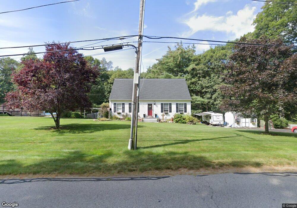
44 S Spencer Rd Spencer, MA 01562
Estimated Value: $495,935 - $567,000
4
Beds
2
Baths
1,914
Sq Ft
$283/Sq Ft
Est. Value
About This Home
This home is located at 44 S Spencer Rd, Spencer, MA 01562 and is currently estimated at $541,984, approximately $283 per square foot. 44 S Spencer Rd is a home located in Worcester County with nearby schools including David Prouty High School.
Ownership History
Date
Name
Owned For
Owner Type
Purchase Details
Closed on
Jun 1, 2011
Sold by
Lemieux Harry B and Lemieux Gail M
Bought by
Keefe Francis X and Keefe Michelle L
Current Estimated Value
Home Financials for this Owner
Home Financials are based on the most recent Mortgage that was taken out on this home.
Original Mortgage
$255,660
Outstanding Balance
$178,056
Interest Rate
4.85%
Mortgage Type
Purchase Money Mortgage
Estimated Equity
$363,928
Purchase Details
Closed on
Jun 30, 1997
Sold by
Thomas Rita N
Bought by
Lemieux Harry B and Lemieux Gail M
Purchase Details
Closed on
Nov 17, 1992
Sold by
South Spencer Rt
Bought by
Thomas Daniel and Thomas Rita N
Purchase Details
Closed on
Jun 19, 1992
Sold by
Prouty Charles N and Prouty Steven
Bought by
South Spencer Rt
Purchase Details
Closed on
Jun 3, 1992
Sold by
Prouty Charles N and Prouty Steven L
Bought by
South Spencer Rt
Create a Home Valuation Report for This Property
The Home Valuation Report is an in-depth analysis detailing your home's value as well as a comparison with similar homes in the area
Home Values in the Area
Average Home Value in this Area
Purchase History
| Date | Buyer | Sale Price | Title Company |
|---|---|---|---|
| Keefe Francis X | $254,000 | -- | |
| Lemieux Harry B | $127,000 | -- | |
| Thomas Daniel | $111,675 | -- | |
| South Spencer Rt | $25,000 | -- | |
| South Spencer Rt | $46,250 | -- |
Source: Public Records
Mortgage History
| Date | Status | Borrower | Loan Amount |
|---|---|---|---|
| Open | Keefe Francis X | $255,660 | |
| Previous Owner | South Spencer Rt | $15,000 | |
| Previous Owner | South Spencer Rt | $111,000 | |
| Previous Owner | South Spencer Rt | $40,000 |
Source: Public Records
Tax History Compared to Growth
Tax History
| Year | Tax Paid | Tax Assessment Tax Assessment Total Assessment is a certain percentage of the fair market value that is determined by local assessors to be the total taxable value of land and additions on the property. | Land | Improvement |
|---|---|---|---|---|
| 2025 | $56 | $480,200 | $61,900 | $418,300 |
| 2024 | $5,151 | $450,300 | $61,900 | $388,400 |
| 2023 | $4,948 | $410,300 | $61,900 | $348,400 |
| 2022 | $4,709 | $357,800 | $56,500 | $301,300 |
| 2021 | $4,615 | $328,700 | $56,500 | $272,200 |
| 2020 | $4,266 | $302,100 | $56,500 | $245,600 |
| 2019 | $4,019 | $290,000 | $51,700 | $238,300 |
| 2018 | $3,664 | $273,000 | $58,900 | $214,100 |
| 2017 | $3,604 | $257,800 | $56,500 | $201,300 |
| 2016 | $3,387 | $237,000 | $51,400 | $185,600 |
| 2015 | $3,266 | $238,900 | $56,300 | $182,600 |
| 2014 | $3,142 | $238,900 | $56,300 | $182,600 |
Source: Public Records
Map
Nearby Homes