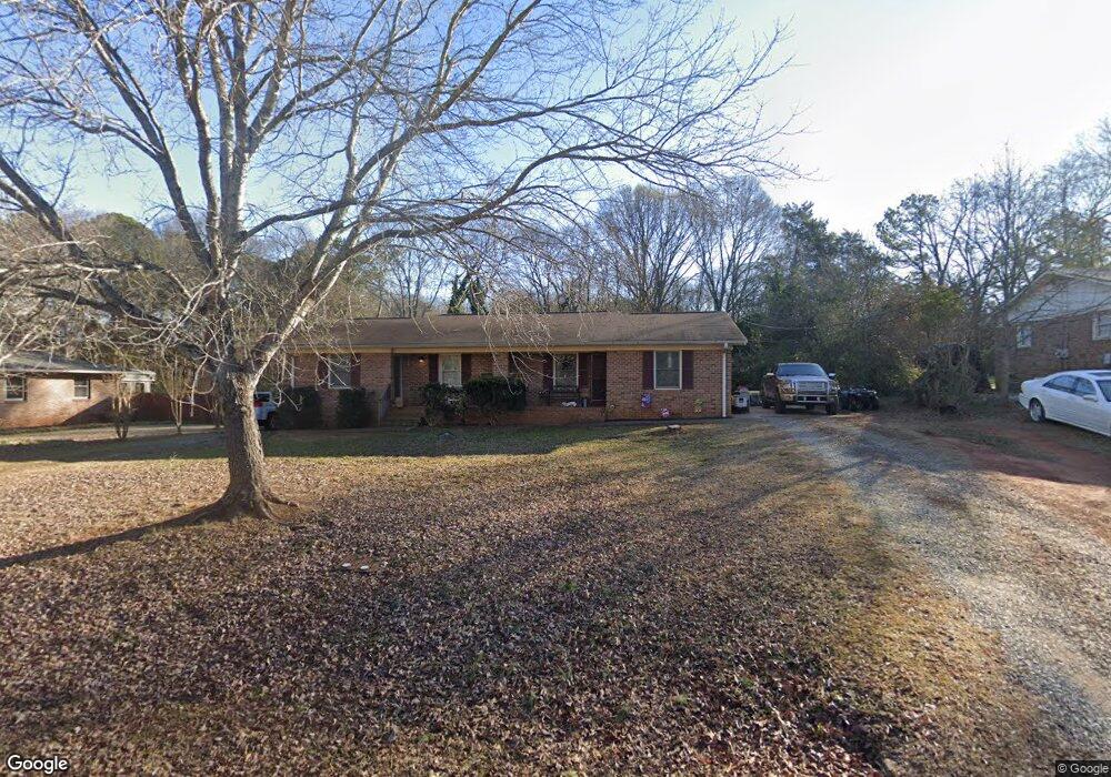
44 Thrasher Dr Unit A AND B Watkinsville, GA 30677
Estimated Value: $248,000 - $401,000
--
Bed
2
Baths
1,632
Sq Ft
$191/Sq Ft
Est. Value
About This Home
This home is located at 44 Thrasher Dr Unit A AND B, Watkinsville, GA 30677 and is currently estimated at $311,187, approximately $190 per square foot. 44 Thrasher Dr Unit A AND B is a home located in Oconee County with nearby schools including Oconee County Elementary School, Oconee County Primary School, and Oconee County Middle School.
Ownership History
Date
Name
Owned For
Owner Type
Purchase Details
Closed on
Aug 29, 2018
Sold by
Dan Ford Rentals Llc
Bought by
Gord Ford Llc
Current Estimated Value
Purchase Details
Closed on
Aug 20, 2014
Sold by
Shedd Donald H
Bought by
Dan Ford Rentals Llc
Purchase Details
Closed on
Oct 12, 1994
Bought by
Shedd Donald H
Create a Home Valuation Report for This Property
The Home Valuation Report is an in-depth analysis detailing your home's value as well as a comparison with similar homes in the area
Home Values in the Area
Average Home Value in this Area
Purchase History
| Date | Buyer | Sale Price | Title Company |
|---|---|---|---|
| Gord Ford Llc | -- | -- | |
| Dan Ford Rentals Llc | $99,000 | -- | |
| Shedd Donald H | $65,000 | -- | |
| Clarke Amanda | $48,700 | -- |
Source: Public Records
Tax History Compared to Growth
Tax History
| Year | Tax Paid | Tax Assessment Tax Assessment Total Assessment is a certain percentage of the fair market value that is determined by local assessors to be the total taxable value of land and additions on the property. | Land | Improvement |
|---|---|---|---|---|
| 2024 | $2,562 | $97,458 | $24,000 | $73,458 |
| 2023 | $2,181 | $92,308 | $24,000 | $68,308 |
| 2022 | $1,976 | $81,050 | $24,000 | $57,050 |
| 2021 | $1,576 | $60,219 | $12,000 | $48,219 |
| 2020 | $1,364 | $51,492 | $8,000 | $43,492 |
| 2019 | $1,367 | $51,310 | $8,000 | $43,310 |
| 2018 | $1,160 | $42,722 | $8,000 | $34,722 |
| 2017 | $1,067 | $39,028 | $8,000 | $31,028 |
| 2016 | $1,049 | $38,231 | $8,000 | $30,231 |
| 2015 | $1,031 | $37,423 | $8,000 | $29,423 |
| 2014 | $1,034 | $36,706 | $10,000 | $26,706 |
| 2013 | -- | $34,732 | $10,000 | $24,732 |
Source: Public Records
Map
Nearby Homes
- 170 Elliot Cir
- 2051 Simonton Bridge Rd
- 1010 Jeremy Dr
- 1320 Katie Ln
- 86 Cedar Dr
- 88 Cedar Dr
- 1051 Simonton Way
- 96 Morrison St Unit 53
- 92 Morrison St Unit 54
- 90 Morrison St Unit 55
- 96 Morrison St
- 90 Morrison St
- 1001 Moreland Dr
- 1240 Summit Dr
- 2885 Electric Ave
- 3030 Electric Ave
- 2625 Electric Ave
- 2845 Electric Ave
- 2765 Electric Ave
- 2725 Electric Ave
- 44 Thrasher Dr
- 38 Thrasher Dr
- 48 Thrasher Dr
- 130 Elliot Cir
- 120 Elliot Cir
- 140 Elliot Cir
- 0 Pecan Bluff Subdivision
- 110 Elliot Cir
- 100 Pecan Bluff Dr
- 110 Pecan Bluff Dr Unit 22
- 110 Pecan Bluff Dr
- 51 Thrasher Dr
- 120 Pecan Bluff Dr Unit 21
- 120 Pecan Bluff Dr
- 130 Pecan Bluff Dr Unit 130
- 130 Pecan Bluff Dr Unit 20
- 130 Pecan Bluff Dr
- 56 Thrasher Dr
- 0000 Pecan Bluff Dr
- 0 Pecan Bluff Dr Unit 936890