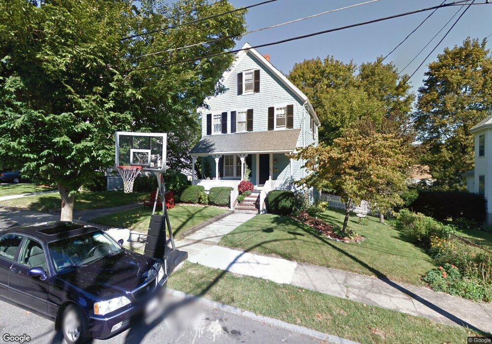
44 Wave Ave Wakefield, MA 01880
Lakeside NeighborhoodEstimated Value: $829,000 - $861,935
3
Beds
2
Baths
1,683
Sq Ft
$504/Sq Ft
Est. Value
About This Home
This home is located at 44 Wave Ave, Wakefield, MA 01880 and is currently estimated at $848,984, approximately $504 per square foot. 44 Wave Ave is a home located in Middlesex County with nearby schools including Wakefield Memorial High School, St Joseph School, and Odyssey Day School.
Ownership History
Date
Name
Owned For
Owner Type
Purchase Details
Closed on
Sep 29, 1999
Sold by
Abcouwer Leslie L and Abcouwer Steve F
Bought by
Tipton Cynthia L and Tipton David J
Current Estimated Value
Home Financials for this Owner
Home Financials are based on the most recent Mortgage that was taken out on this home.
Original Mortgage
$241,400
Interest Rate
7.85%
Mortgage Type
Purchase Money Mortgage
Purchase Details
Closed on
Jun 21, 1993
Sold by
Long Walter B and Long Susan
Bought by
Abcouwer Steven F and Abcouwer Leslie L
Home Financials for this Owner
Home Financials are based on the most recent Mortgage that was taken out on this home.
Original Mortgage
$148,000
Interest Rate
7.38%
Mortgage Type
Purchase Money Mortgage
Create a Home Valuation Report for This Property
The Home Valuation Report is an in-depth analysis detailing your home's value as well as a comparison with similar homes in the area
Home Values in the Area
Average Home Value in this Area
Purchase History
| Date | Buyer | Sale Price | Title Company |
|---|---|---|---|
| Tipton Cynthia L | $268,250 | -- | |
| Abcouwer Steven F | $185,000 | -- |
Source: Public Records
Mortgage History
| Date | Status | Borrower | Loan Amount |
|---|---|---|---|
| Open | Abcouwer Steven F | $220,000 | |
| Closed | Abcouwer Steven F | $241,400 | |
| Previous Owner | Abcouwer Steven F | $148,000 | |
| Previous Owner | Abcouwer Steven F | $148,500 |
Source: Public Records
Tax History
| Year | Tax Paid | Tax Assessment Tax Assessment Total Assessment is a certain percentage of the fair market value that is determined by local assessors to be the total taxable value of land and additions on the property. | Land | Improvement |
|---|---|---|---|---|
| 2025 | $8,679 | $764,700 | $377,900 | $386,800 |
| 2024 | $8,764 | $779,000 | $385,000 | $394,000 |
| 2023 | $7,905 | $673,900 | $350,900 | $323,000 |
| 2022 | $7,356 | $597,100 | $310,500 | $286,600 |
| 2021 | $7,126 | $559,800 | $286,900 | $272,900 |
| 2020 | $6,621 | $518,500 | $265,700 | $252,800 |
| 2019 | $6,384 | $497,600 | $255,000 | $242,600 |
| 2018 | $6,071 | $468,800 | $240,200 | $228,600 |
| 2017 | $5,792 | $444,500 | $227,700 | $216,800 |
| 2016 | $5,575 | $413,300 | $208,400 | $204,900 |
| 2015 | $5,467 | $405,600 | $204,500 | $201,100 |
| 2014 | $4,988 | $390,300 | $196,700 | $193,600 |
Source: Public Records
Map
Nearby Homes
- 29 Cordis St
- 16 Pleasant St
- 67 Woodcrest Dr
- 270 Lowell St
- 43-45 Crescent St
- 68 Preston St Unit 6D
- 25 Juniper Ave
- 395 Vernon St
- 62 Foundry St Unit 310
- 62 Foundry St Unit 312
- 62 Foundry St Unit 204
- 62 Foundry St Unit 202
- 62 Foundry St Unit 208
- 62 Foundry St Unit 414
- 21 Herbert St Unit A
- 69 Foundry St Unit 310
- 69 Foundry St Unit 416
- 50 Quannapowitt Pkwy
- 248 Albion St Unit 231
- 248 Albion St Unit 321
Your Personal Tour Guide
Ask me questions while you tour the home.