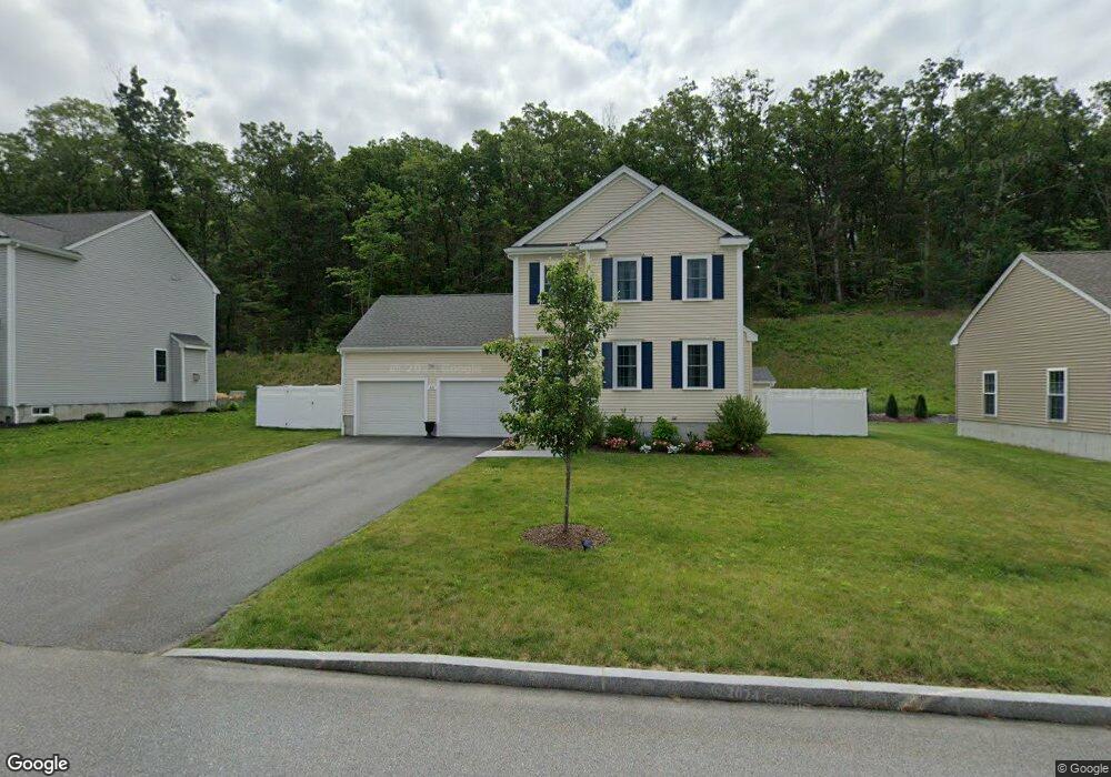
44 Westview Ave Millbury, MA 01527
Estimated Value: $500,000 - $714,000
3
Beds
2
Baths
1,608
Sq Ft
$380/Sq Ft
Est. Value
About This Home
This home is located at 44 Westview Ave, Millbury, MA 01527 and is currently estimated at $611,177, approximately $380 per square foot. 44 Westview Ave is a home with nearby schools including Elmwood Street Elementary School, Raymond E. Shaw Elementary School, and Millbury Junior/Senior High School.
Ownership History
Date
Name
Owned For
Owner Type
Purchase Details
Closed on
Dec 28, 2017
Sold by
Hayr Llc
Bought by
Morin-Hafford Bonnie L
Current Estimated Value
Home Financials for this Owner
Home Financials are based on the most recent Mortgage that was taken out on this home.
Original Mortgage
$310,000
Outstanding Balance
$260,449
Interest Rate
3.95%
Mortgage Type
New Conventional
Estimated Equity
$350,728
Create a Home Valuation Report for This Property
The Home Valuation Report is an in-depth analysis detailing your home's value as well as a comparison with similar homes in the area
Home Values in the Area
Average Home Value in this Area
Purchase History
| Date | Buyer | Sale Price | Title Company |
|---|---|---|---|
| Morin-Hafford Bonnie L | $351,550 | -- | |
| Morin-Hafford Bonnie L | $351,550 | -- |
Source: Public Records
Mortgage History
| Date | Status | Borrower | Loan Amount |
|---|---|---|---|
| Open | Morin-Hafford Bonnie L | $310,000 | |
| Closed | Morin-Hafford Bonnie L | $310,000 |
Source: Public Records
Tax History
| Year | Tax Paid | Tax Assessment Tax Assessment Total Assessment is a certain percentage of the fair market value that is determined by local assessors to be the total taxable value of land and additions on the property. | Land | Improvement |
|---|---|---|---|---|
| 2025 | $7,369 | $550,300 | $130,000 | $420,300 |
| 2024 | $6,759 | $510,900 | $120,400 | $390,500 |
| 2023 | $6,459 | $447,000 | $84,400 | $362,600 |
| 2022 | $5,774 | $384,900 | $81,100 | $303,800 |
| 2021 | $5,691 | $368,800 | $81,100 | $287,700 |
| 2020 | $5,572 | $363,500 | $81,100 | $282,400 |
| 2019 | $5,280 | $333,100 | $61,400 | $271,700 |
| 2018 | $301 | $18,420 | $18,420 | $0 |
| 2017 | $303 | $18,420 | $18,420 | $0 |
Source: Public Records
Map
Nearby Homes
- 8 Nightview Place
- 12 Irene Ct
- 7 Barbara St
- 1459 Grafton Rd
- 2 Diane St
- 11 Maplewood Rd
- 6 Nathaniel St
- 300 Millbury Ave
- 7 Clarissa St
- 25 Upton St
- 1195 Grafton St Unit 29
- 1195 Grafton St Unit 19
- 1195 Grafton St Unit 39
- 9 Marissa Cir
- 12 Bruce St
- 330 Sunderland Rd Unit 80
- 47 Pointe Rok Dr Unit 47,G
- 3 Julien Ave
- 2 Salisbury St
- 266 Massasoit Rd
- 46 Westview Ave
- 42 Westview Ave
- 45 Westview Ave
- 43 Westview Ave
- 48 Westview Ave
- 47 Westview Ave
- 40 Westview Ave
- 41 Westview Ave
- 49 Westview Ave
- 50 Westview Ave
- 38 Westview Ave
- 51 Westview Ave
- 36 Westview Ave
- 52 Westview Ave
- 43 Skyview Dr
- 39 Westview Ave
- 53 Westview Ave
- 34 Westview Ave
- 37 Westview Ave
- 41 Skyview Dr
Your Personal Tour Guide
Ask me questions while you tour the home.