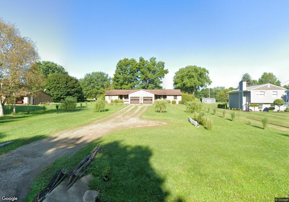
44 Wolf Rd Mansfield, OH 44903
Estimated Value: $229,000 - $279,608
4
Beds
2
Baths
2,112
Sq Ft
$115/Sq Ft
Est. Value
About This Home
This home is located at 44 Wolf Rd, Mansfield, OH 44903 and is currently estimated at $242,902, approximately $115 per square foot. 44 Wolf Rd is a home located in Richland County with nearby schools including Madison High School, St. Mary Catholic School, and Temple-Christian School.
Ownership History
Date
Name
Owned For
Owner Type
Purchase Details
Closed on
Oct 13, 2017
Sold by
Kunnas Florence L and Kunnas Florence
Bought by
Atwell Donald E and Phillips Donna J
Current Estimated Value
Home Financials for this Owner
Home Financials are based on the most recent Mortgage that was taken out on this home.
Original Mortgage
$71,250
Interest Rate
3.82%
Mortgage Type
New Conventional
Purchase Details
Closed on
Jun 14, 2012
Sold by
Kunnas Richard E and Kunnas Florence L
Bought by
Kunnas Florence L
Purchase Details
Closed on
Aug 31, 2004
Sold by
Squires Dean C and Squires Cathy M
Bought by
Kunnas Richard E and Kunnas Florence L
Home Financials for this Owner
Home Financials are based on the most recent Mortgage that was taken out on this home.
Original Mortgage
$85,600
Interest Rate
6.1%
Mortgage Type
Purchase Money Mortgage
Create a Home Valuation Report for This Property
The Home Valuation Report is an in-depth analysis detailing your home's value as well as a comparison with similar homes in the area
Home Values in the Area
Average Home Value in this Area
Purchase History
| Date | Buyer | Sale Price | Title Company |
|---|---|---|---|
| Atwell Donald E | $95,000 | Southern Title | |
| Kunnas Florence L | -- | Attorney | |
| Kunnas Richard E | $107,000 | Chicago Title |
Source: Public Records
Mortgage History
| Date | Status | Borrower | Loan Amount |
|---|---|---|---|
| Closed | Atwell Donald E | $71,250 | |
| Closed | Kunnas Richard E | $85,600 |
Source: Public Records
Tax History
| Year | Tax Paid | Tax Assessment Tax Assessment Total Assessment is a certain percentage of the fair market value that is determined by local assessors to be the total taxable value of land and additions on the property. | Land | Improvement |
|---|---|---|---|---|
| 2024 | $3,923 | $76,070 | $8,710 | $67,360 |
| 2023 | $3,923 | $76,070 | $8,710 | $67,360 |
| 2022 | $2,970 | $52,850 | $6,920 | $45,930 |
| 2021 | $2,969 | $52,850 | $6,920 | $45,930 |
| 2020 | $2,992 | $52,850 | $6,920 | $45,930 |
| 2019 | $2,719 | $44,790 | $5,870 | $38,920 |
| 2018 | $2,697 | $44,790 | $5,870 | $38,920 |
| 2017 | $2,220 | $44,790 | $5,870 | $38,920 |
| 2016 | $1,873 | $30,940 | $5,690 | $25,250 |
| 2015 | $1,873 | $30,940 | $5,690 | $25,250 |
| 2014 | $1,836 | $30,940 | $5,690 | $25,250 |
| 2012 | $868 | $31,900 | $5,870 | $26,030 |
Source: Public Records
Map
Nearby Homes
- 2385 Bryonaire Dr
- 474 Biscayne Dr
- 754 Touby Ln
- 0 McBride Road Parcel # 1 Unit 9066028
- 620 Running Brook Way
- 2264 Crider Rd
- 945 Pike Dr
- 1674 Honeysuckle Dr
- 0 Mcelroy Rd
- 1990 Woodmont Rd
- 1476 Park Ave E
- 690 Ashland Rd
- 1303 Park Ave E
- 59 Ridge Rd S
- 632 Coachman Rd
- 0 Mount Zion Rd Unit 226009674
- 0 Mount Zion Rd Unit 9072801
- 683 Coachman Rd
- 602 Champion Rd
- 615 Champion Rd
Your Personal Tour Guide
Ask me questions while you tour the home.