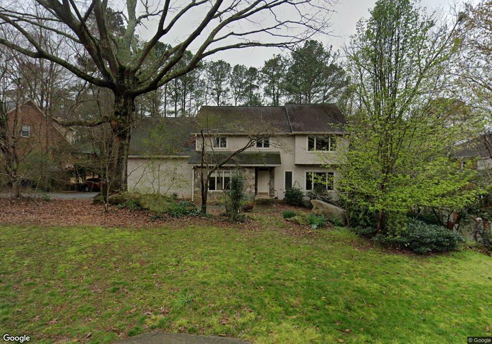
440 Breakwater Ridge NE Unit 3 Atlanta, GA 30328
Estimated Value: $931,213 - $1,106,000
4
Beds
5
Baths
3,960
Sq Ft
$258/Sq Ft
Est. Value
About This Home
This home is located at 440 Breakwater Ridge NE Unit 3, Atlanta, GA 30328 and is currently estimated at $1,020,303, approximately $257 per square foot. 440 Breakwater Ridge NE Unit 3 is a home located in Fulton County with nearby schools including Spalding Drive Elementary School, Sandy Springs Middle School, and North Springs High School.
Ownership History
Date
Name
Owned For
Owner Type
Purchase Details
Closed on
Jul 8, 1998
Sold by
Cohen Stanley A and Cohen Judith A
Bought by
St Amand Karen G & Michael D
Current Estimated Value
Home Financials for this Owner
Home Financials are based on the most recent Mortgage that was taken out on this home.
Original Mortgage
$227,150
Interest Rate
6.85%
Mortgage Type
New Conventional
Create a Home Valuation Report for This Property
The Home Valuation Report is an in-depth analysis detailing your home's value as well as a comparison with similar homes in the area
Home Values in the Area
Average Home Value in this Area
Purchase History
| Date | Buyer | Sale Price | Title Company |
|---|---|---|---|
| St Amand Karen G & Michael D | $295,000 | -- |
Source: Public Records
Mortgage History
| Date | Status | Borrower | Loan Amount |
|---|---|---|---|
| Previous Owner | St Amand Karen G & Michael D | $227,150 |
Source: Public Records
Tax History Compared to Growth
Tax History
| Year | Tax Paid | Tax Assessment Tax Assessment Total Assessment is a certain percentage of the fair market value that is determined by local assessors to be the total taxable value of land and additions on the property. | Land | Improvement |
|---|---|---|---|---|
| 2025 | $5,098 | $271,960 | $104,600 | $167,360 |
| 2023 | $5,098 | $271,960 | $104,600 | $167,360 |
| 2022 | $4,808 | $233,080 | $82,800 | $150,280 |
| 2021 | $4,784 | $226,600 | $78,880 | $147,720 |
| 2020 | $4,828 | $226,600 | $78,880 | $147,720 |
| 2019 | $4,636 | $226,600 | $78,880 | $147,720 |
| 2018 | $6,186 | $203,920 | $41,280 | $162,640 |
| 2017 | $3,564 | $117,480 | $24,200 | $93,280 |
| 2016 | $3,563 | $117,480 | $24,200 | $93,280 |
| 2015 | $3,575 | $117,480 | $24,200 | $93,280 |
| 2014 | $3,695 | $117,480 | $24,200 | $93,280 |
Source: Public Records
Map
Nearby Homes
- Lot 6 N Riverside Cir
- 340 River Knoll Dr NW
- 435 Johnson Ferry Rd NW
- 100 Barnard Place NW
- 255 Black Water Cove NW
- 175 River Court Pkwy NW
- 7127 Riverside Dr NW
- 265 Marchand Ct NW
- 570 Old Harbor Dr NW Unit 3
- 502 Old Harbor Dr NW
- 38 Parkside Cir
- 70 Parkside Cir
- 1002 Saddle Hill
- 715 Amberidge Trail NW
- 6795 Brandon Mill Rd NW Unit 3
- 4755 Columns Dr SE
- 1070 Brockton Close
- 960 Lost Forest Dr NW
- 415 River Valley Rd NW
- 430 Breakwater Ridge NE
- 435 Breakwater Ridge NE
- 420 Breakwater Ridge NE
- 310 Crosstree Ln NE
- 425 Breakwater Ridge NE
- 110 Bowline Cir NE
- 300 Crosstree Ln NE
- 505 Cutwater Trail
- 112 Bowline Cir
- 100 Bowline Cir NE Unit 4
- 410 Breakwater Ridge NE
- 100 Marsh Glen Point NW
- 290 Crosstree Ln NE
- 0 Cutwater Trail
- 515 Cutwater Trail NE
- 500 Cutwater Trail NE Unit 3
- 400 Breakwater Ridge NE
- 110 Marsh Glen Point NW
- 0 Crosstree Ln Unit 9006295
- 0 Crosstree Ln Unit 8463972