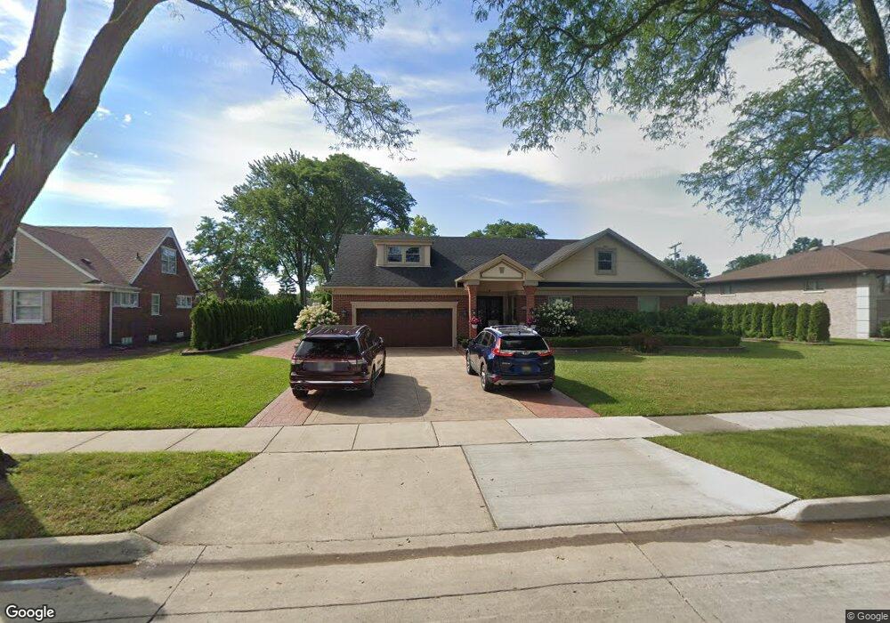
440 Brentwood Dr Unit Bldg-Unit Dearborn, MI 48124
Golfcrest NeighborhoodEstimated Value: $991,034 - $1,207,000
3
Beds
4
Baths
3,066
Sq Ft
$349/Sq Ft
Est. Value
About This Home
This home is located at 440 Brentwood Dr Unit Bldg-Unit, Dearborn, MI 48124 and is currently estimated at $1,070,009, approximately $348 per square foot. 440 Brentwood Dr Unit Bldg-Unit is a home located in Wayne County with nearby schools including Howard Elementary School, Bryant Middle School, and Dearborn High School.
Ownership History
Date
Name
Owned For
Owner Type
Purchase Details
Closed on
Nov 7, 2024
Sold by
Bazzi Moussa and Bazzi Samia
Bought by
Moussa Bazzi And Samia Bazzi Living Trust and Bazzi
Current Estimated Value
Purchase Details
Closed on
Jul 13, 2018
Sold by
Jaafar Michael and Jaafar Rema
Bought by
Bazzi Moussa and Bazzi Samia
Purchase Details
Closed on
Nov 7, 2012
Sold by
Abdallah Mahde
Bought by
Jaafar Michael and Beydoun Rema
Purchase Details
Closed on
Oct 26, 2010
Sold by
Comerica Bank
Bought by
Abdallah Mahde
Purchase Details
Closed on
Aug 21, 2006
Sold by
Sherf Mary E
Bought by
Comerica Bank Of Detroit and Mary E Sherf Trust
Create a Home Valuation Report for This Property
The Home Valuation Report is an in-depth analysis detailing your home's value as well as a comparison with similar homes in the area
Home Values in the Area
Average Home Value in this Area
Purchase History
| Date | Buyer | Sale Price | Title Company |
|---|---|---|---|
| Moussa Bazzi And Samia Bazzi Living Trust | -- | None Listed On Document | |
| Bazzi Moussa | $623,000 | Michigan Title Insurance Age | |
| Jaafar Michael | $300,000 | Minnesota Title Agency | |
| Abdallah Mahde | $210,000 | Nta | |
| Comerica Bank Of Detroit | -- | Minnesota Title Agency |
Source: Public Records
Tax History Compared to Growth
Tax History
| Year | Tax Paid | Tax Assessment Tax Assessment Total Assessment is a certain percentage of the fair market value that is determined by local assessors to be the total taxable value of land and additions on the property. | Land | Improvement |
|---|---|---|---|---|
| 2025 | $12,793 | $425,700 | $0 | $0 |
| 2024 | $12,793 | $490,300 | $0 | $0 |
| 2023 | $12,106 | $366,200 | $0 | $0 |
| 2022 | $13,578 | $354,800 | $0 | $0 |
| 2021 | $15,777 | $321,100 | $0 | $0 |
| 2019 | $15,355 | $243,300 | $0 | $0 |
| 2018 | $8,539 | $208,700 | $0 | $0 |
| 2017 | $2,450 | $188,000 | $0 | $0 |
| 2016 | $7,989 | $180,500 | $0 | $0 |
| 2015 | $15,097 | $201,850 | $0 | $0 |
| 2013 | $14,625 | $146,250 | $0 | $0 |
| 2011 | -- | $146,250 | $0 | $0 |
Source: Public Records
Map
Nearby Homes
- 27 Shady Hollow Dr
- 21800 Morley Ave Unit 707
- 21800 Morley Ave Unit 116
- 21800 Morley Ave Unit 211
- 21800 Morley Ave Unit 601
- 9 West Ln
- 323 Tannahill St
- 830 S Brady Rd
- 636 Morley Ct
- 22811 Marlboro St
- 718 S Military St
- 22905 Marlboro St
- 1821 Golfview Dr
- 1 W Village Ln Unit 48
- 23153 Marlboro St
- 22264 Abbey Ln Unit 24
- 22620 Newman St
- 23211 Myrtle St
- 21984 Wildwood St
- 22700 Garrison St Unit 404
- 440 Brentwood Dr
- 300 Brentwood Dr
- 410 Brentwood Dr
- 433 Meadowlane Rd
- 411 Meadowlane Rd
- 501 Meadowlane Rd
- 451 Brentwood Dr
- 431 Brentwood Dr
- 514 Brentwood Dr
- 505 Brentwood Dr Unit Bldg-Unit
- 505 Brentwood Dr
- 22100 Willoway Rd
- 525 Meadowlane Rd
- 340 Brentwood Dr
- 536 Brentwood Dr
- 22009 Willoway Rd
- 531 Brentwood Dr
- 410 Meadowlane Rd
- 460 Woodcrest Dr
- 440 Meadowlane Rd