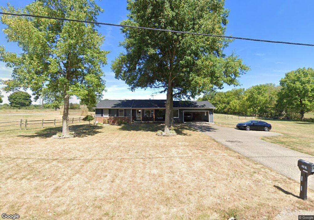
440 Coonpath Rd NE Lancaster, OH 43130
Estimated Value: $308,000 - $351,000
3
Beds
3
Baths
1,506
Sq Ft
$219/Sq Ft
Est. Value
About This Home
This home is located at 440 Coonpath Rd NE, Lancaster, OH 43130 and is currently estimated at $329,333, approximately $218 per square foot. 440 Coonpath Rd NE is a home located in Fairfield County.
Ownership History
Date
Name
Owned For
Owner Type
Purchase Details
Closed on
Sep 24, 2021
Sold by
Step 1 Llc
Bought by
Pugh Richard T
Current Estimated Value
Home Financials for this Owner
Home Financials are based on the most recent Mortgage that was taken out on this home.
Original Mortgage
$168,000
Interest Rate
2.99%
Mortgage Type
New Conventional
Purchase Details
Closed on
Oct 29, 2015
Sold by
Stepleton Paul R and Stepleton Paula
Bought by
Step 1 Llc
Purchase Details
Closed on
Nov 27, 2002
Sold by
Mandrell J Edward
Bought by
Stepleton Paul R and Stepleton Paula
Purchase Details
Closed on
Nov 29, 1991
Sold by
Kilbarger James R
Bought by
Mandrell James R
Create a Home Valuation Report for This Property
The Home Valuation Report is an in-depth analysis detailing your home's value as well as a comparison with similar homes in the area
Purchase History
| Date | Buyer | Sale Price | Title Company |
|---|---|---|---|
| Pugh Richard T | $210,000 | None Available | |
| Step 1 Llc | -- | Attorney | |
| Stepleton Paul R | $106,000 | -- | |
| Mandrell James R | $105,000 | -- |
Source: Public Records
Mortgage History
| Date | Status | Borrower | Loan Amount |
|---|---|---|---|
| Previous Owner | Pugh Richard T | $168,000 |
Source: Public Records
Tax History
| Year | Tax Paid | Tax Assessment Tax Assessment Total Assessment is a certain percentage of the fair market value that is determined by local assessors to be the total taxable value of land and additions on the property. | Land | Improvement |
|---|---|---|---|---|
| 2025 | $7,689 | $108,220 | $22,750 | $85,470 |
| 2024 | $7,689 | $79,190 | $16,560 | $62,630 |
| 2023 | $3,184 | $79,190 | $16,560 | $62,630 |
| 2022 | $3,224 | $79,190 | $16,560 | $62,630 |
| 2021 | $2,643 | $61,790 | $15,050 | $46,740 |
| 2020 | $843 | $61,790 | $15,050 | $46,740 |
| 2019 | $2,430 | $61,790 | $15,050 | $46,740 |
| 2018 | $756 | $55,810 | $15,050 | $40,760 |
| 2017 | $2,324 | $55,810 | $15,050 | $40,760 |
| 2016 | $2,159 | $55,810 | $15,050 | $40,760 |
| 2015 | $2,154 | $53,980 | $15,050 | $38,930 |
| 2014 | $2,057 | $53,980 | $15,050 | $38,930 |
| 2013 | $2,057 | $53,980 | $15,050 | $38,930 |
Source: Public Records
Map
Nearby Homes
- 0 Tschopp Rd NE Unit Lot 17 225027320
- 0 Tschopp Rd NE Unit Lot 33 225027324
- 0 Fremar Rd NE Unit Lot1 225007256
- 245 Rainbow Dr NE
- 850 Marquette Dr NE
- 0 Marquette Dr NE Unit Lot 16 225027323
- 0 Marquette Dr NE Unit Lot 5
- 0 Marquette Dr NE Unit Lot 4 225007276
- 4070 Tschopp Rd NE
- 1826 Pleasantview Dr NE
- 0 Old Millersport Rd NE Unit 225010386
- 2927 Lancaster-Kirkersville Rd NW
- 1916 Country Place
- 0 Stringtown Rd NW
- 1908 Branch Place
- 3485 Lancaster-Kirkersville Rd NW
- 4400 Old Millersport Rd NE
- 1101 Beechwood Dr NE
- 0 Lucille Dr NE
- 2021 Rainbow Dr NE
- 440 Coonpath Rd NE
- 394 Coonpath Rd NE
- 505 Coonpath Rd NE
- 596 Coonpath Rd NE
- 595 Coonpath Rd NE
- 640 Coonpath Rd NE
- 637 Coonpath Rd NE
- 270 Coonpath Rd NE
- 260 Coonpath Rd NE
- 180 Coonpath Rd NE
- 228 Coonpath Rd NE
- 664 Coonpath Rd NE
- 334 Fremar Rd NE
- 665 Coonpath Rd NE
- 685 Coonpath Rd NE
- 174 Coonpath Rd NE
- 713 Coonpath Rd NE
- 734 Coonpath Rd NE
- 182 Coonpath Rd NE
- 772 Coonpath Rd NE
Your Personal Tour Guide
Ask me questions while you tour the home.