Estimated Value: $328,721 - $713,000
--
Bed
--
Bath
1,832
Sq Ft
$325/Sq Ft
Est. Value
About This Home
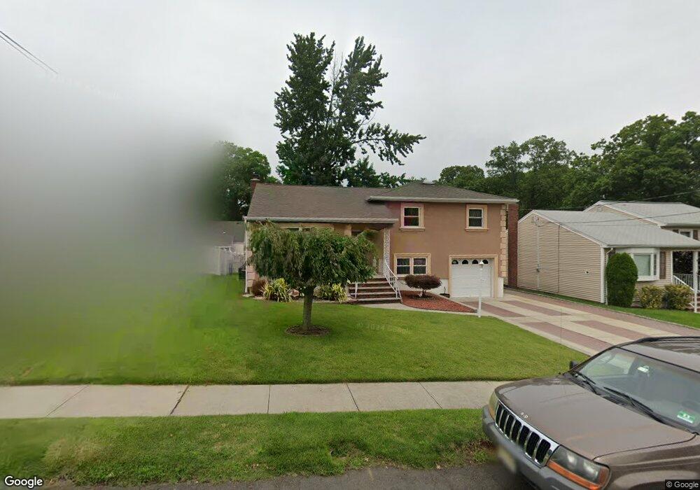
This home is located at 440 Durling Rd, Union, NJ 07083 and is currently estimated at $595,680, approximately $325 per square foot. 440 Durling Rd is a home located in Union County with nearby schools including Washington Elementary School, Union High School, and Jewish Educational Center Lower School.
Ownership History
Date
Name
Owned For
Owner Type
Purchase Details
Closed on
Jan 25, 2022
Sold by
Hatzisavvas Janyneton D and Hatzisavvas G S
Bought by
Hatzisavvas Janyneton D
Current Estimated Value
Home Financials for this Owner
Home Financials are based on the most recent Mortgage that was taken out on this home.
Original Mortgage
$229,000
Outstanding Balance
$211,779
Interest Rate
3.22%
Mortgage Type
New Conventional
Estimated Equity
$383,901
Purchase Details
Closed on
Oct 22, 2004
Sold by
Platoff Wasil
Bought by
Hatzisavvas Janyneton and Hatzisavvas Savvas
Create a Home Valuation Report for This Property
The Home Valuation Report is an in-depth analysis detailing your home's value as well as a comparison with similar homes in the area
Home Values in the Area
Average Home Value in this Area
Purchase History
| Date | Buyer | Sale Price | Title Company |
|---|---|---|---|
| Hatzisavvas Janyneton D | -- | Westcor Land Title | |
| Hatzisavvas Janyneton | $295,000 | -- |
Source: Public Records
Mortgage History
| Date | Status | Borrower | Loan Amount |
|---|---|---|---|
| Open | Hatzisavvas Janyneton D | $229,000 |
Source: Public Records
Tax History Compared to Growth
Tax History
| Year | Tax Paid | Tax Assessment Tax Assessment Total Assessment is a certain percentage of the fair market value that is determined by local assessors to be the total taxable value of land and additions on the property. | Land | Improvement |
|---|---|---|---|---|
| 2025 | $12,047 | $53,900 | $21,100 | $32,800 |
| 2024 | $11,680 | $53,900 | $21,100 | $32,800 |
| 2023 | $11,680 | $53,900 | $21,100 | $32,800 |
| 2022 | $11,274 | $53,900 | $21,100 | $32,800 |
| 2021 | $11,000 | $53,900 | $21,100 | $32,800 |
| 2020 | $10,781 | $53,900 | $21,100 | $32,800 |
| 2019 | $10,636 | $53,900 | $21,100 | $32,800 |
| 2018 | $10,455 | $53,900 | $21,100 | $32,800 |
| 2017 | $10,300 | $53,900 | $21,100 | $32,800 |
| 2016 | $10,049 | $53,900 | $21,100 | $32,800 |
| 2015 | $9,883 | $53,900 | $21,100 | $32,800 |
| 2014 | $9,661 | $53,900 | $21,100 | $32,800 |
Source: Public Records
Map
Nearby Homes
- 309 Palisade Rd Unit 323
- 1031 Lowden Ave
- 275 Clermont Terrace
- 749 Cleveland Ave Unit 751
- 138 Monmouth Rd Unit 40
- 757 Floral Ave Unit 59
- 1084 Woodland Ave
- 137-139 Monmouth Rd
- 45 Summit Rd Unit 47
- 161 Morristown Rd Unit 63
- 1134-1138 Kipling Rd
- 13 Berkeley Place Unit 15
- 13-15 Hillside Rd
- 790 Green Ln Unit A1
- 795 Colonial Arms Rd
- 717 Winchester Ave
- 842 Travers St
- 35 Bellewood Place Unit 37
- 686 Gates Terrace
- 819 Greenwich Ln