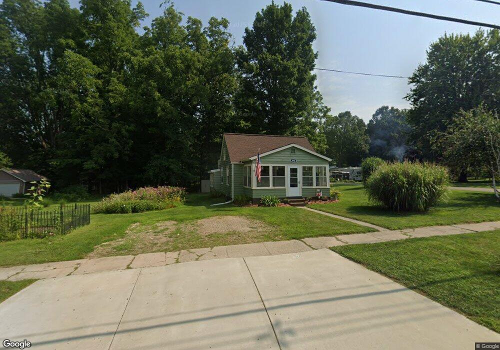
440 Hanover St Concord, MI 49237
Estimated Value: $132,898 - $198,000
2
Beds
1
Bath
1,143
Sq Ft
$143/Sq Ft
Est. Value
About This Home
This home is located at 440 Hanover St, Concord, MI 49237 and is currently estimated at $163,475, approximately $143 per square foot. 440 Hanover St is a home located in Jackson County with nearby schools including Concord Elementary School, Concord Middle School, and Concord High School.
Ownership History
Date
Name
Owned For
Owner Type
Purchase Details
Closed on
Jan 24, 2018
Sold by
Reid William T
Bought by
Brown Reid Kimberly
Current Estimated Value
Purchase Details
Closed on
Aug 21, 2009
Sold by
Reid William T
Bought by
Reid William T and Brown Reid Kimberly
Home Financials for this Owner
Home Financials are based on the most recent Mortgage that was taken out on this home.
Original Mortgage
$42,000
Interest Rate
5.28%
Mortgage Type
New Conventional
Purchase Details
Closed on
Jan 6, 2000
Sold by
George Michael A and George Jeanne I
Bought by
Mcgee Heather
Home Financials for this Owner
Home Financials are based on the most recent Mortgage that was taken out on this home.
Original Mortgage
$55,550
Interest Rate
7.89%
Purchase Details
Closed on
Sep 1, 1992
Bought by
George
Create a Home Valuation Report for This Property
The Home Valuation Report is an in-depth analysis detailing your home's value as well as a comparison with similar homes in the area
Home Values in the Area
Average Home Value in this Area
Purchase History
| Date | Buyer | Sale Price | Title Company |
|---|---|---|---|
| Brown Reid Kimberly | -- | None Available | |
| Reid William T | -- | At | |
| Reid William T | $60,000 | At | |
| Mcgee Heather | $58,500 | -- | |
| George | $35,000 | -- |
Source: Public Records
Mortgage History
| Date | Status | Borrower | Loan Amount |
|---|---|---|---|
| Previous Owner | Reid William T | $42,000 | |
| Previous Owner | Mcgee Heather | $55,550 |
Source: Public Records
Tax History Compared to Growth
Tax History
| Year | Tax Paid | Tax Assessment Tax Assessment Total Assessment is a certain percentage of the fair market value that is determined by local assessors to be the total taxable value of land and additions on the property. | Land | Improvement |
|---|---|---|---|---|
| 2025 | $1,040 | $46,300 | $46,300 | $0 |
| 2024 | $803 | $45,600 | $45,600 | $0 |
| 2023 | $769 | $42,600 | $42,600 | $0 |
| 2022 | $1,358 | $41,900 | $41,900 | $0 |
| 2021 | $1,336 | $36,900 | $36,900 | $0 |
| 2020 | $1,322 | $32,100 | $0 | $0 |
| 2019 | $1,290 | $31,100 | $0 | $0 |
| 2018 | $1,348 | $33,000 | $0 | $0 |
| 2017 | $1,248 | $30,600 | $0 | $0 |
| 2016 | $284 | $30,150 | $30,150 | $0 |
| 2015 | -- | $25,950 | $25,950 | $0 |
| 2014 | -- | $24,850 | $0 | $0 |
| 2013 | -- | $24,850 | $24,850 | $0 |
Source: Public Records
Map
Nearby Homes
- 731 Sears Rd
- 313 Michigan St
- 229 S Concord St
- 209 Hanover St
- 213 Railroad St
- 0 River Bend Drive Lot #11
- 0 River Bend Drive Lot #4
- 0 River Bend Drive Lot #3
- 0 River Bend Drive Lot #5
- 0 River Bend Drive Lot #9
- 0 River Bend Drive Lot #10
- 516 Cecil Dr
- 5354 Albion Rd
- 0 Albion Rd
- 270 Wood Hills Dr
- 7210 Pulaski Rd Rd
- 0 River Bend Drive Lot #2
- 0 River Bend Drive Lot #1
- 385 Wood Hills Dr
- V/L N Concord Rd