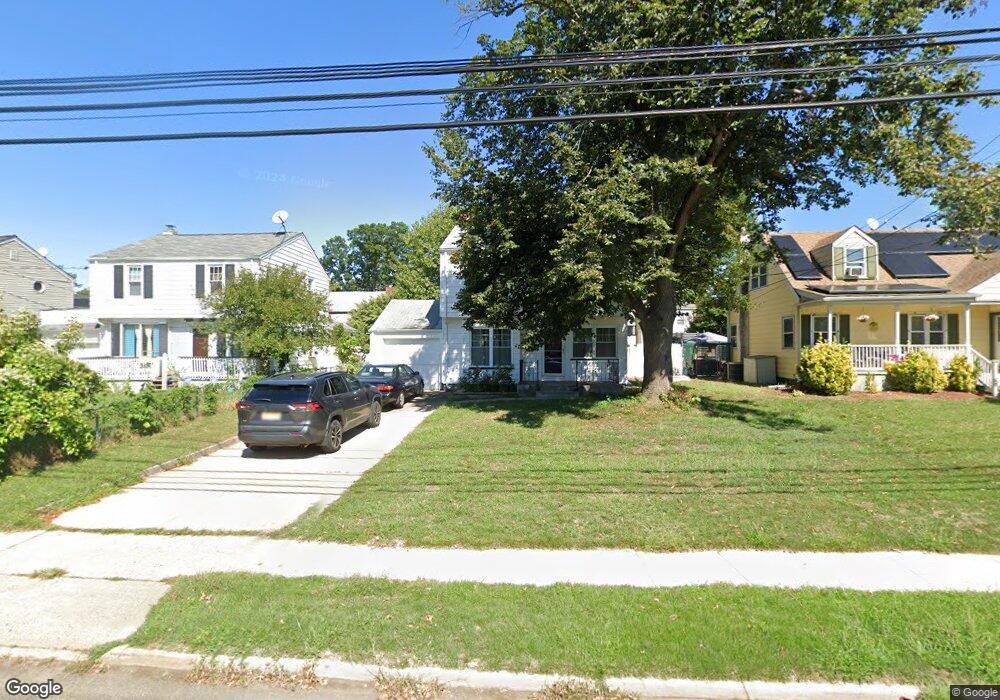
440 Massachusetts Ave Trenton, NJ 08629
Estimated Value: $290,000 - $364,000
--
Bed
--
Bath
1,112
Sq Ft
$279/Sq Ft
Est. Value
About This Home
This home is located at 440 Massachusetts Ave, Trenton, NJ 08629 and is currently estimated at $310,145, approximately $278 per square foot. 440 Massachusetts Ave is a home located in Mercer County with nearby schools including Kuser Elementary School, Emily C. Reynolds Middle School, and Steinert - Hamilton High East.
Ownership History
Date
Name
Owned For
Owner Type
Purchase Details
Closed on
Aug 28, 2000
Sold by
Stawski Edward
Bought by
Mentee Edwin and Mentee Mama
Current Estimated Value
Home Financials for this Owner
Home Financials are based on the most recent Mortgage that was taken out on this home.
Original Mortgage
$65,600
Outstanding Balance
$23,841
Interest Rate
8.06%
Mortgage Type
Purchase Money Mortgage
Estimated Equity
$286,304
Create a Home Valuation Report for This Property
The Home Valuation Report is an in-depth analysis detailing your home's value as well as a comparison with similar homes in the area
Home Values in the Area
Average Home Value in this Area
Purchase History
| Date | Buyer | Sale Price | Title Company |
|---|---|---|---|
| Mentee Edwin | $82,000 | -- |
Source: Public Records
Mortgage History
| Date | Status | Borrower | Loan Amount |
|---|---|---|---|
| Open | Mentee Edwin | $65,600 |
Source: Public Records
Tax History Compared to Growth
Tax History
| Year | Tax Paid | Tax Assessment Tax Assessment Total Assessment is a certain percentage of the fair market value that is determined by local assessors to be the total taxable value of land and additions on the property. | Land | Improvement |
|---|---|---|---|---|
| 2025 | $4,222 | $119,800 | $25,800 | $94,000 |
| 2024 | $3,957 | $119,800 | $25,800 | $94,000 |
| 2023 | $3,957 | $119,800 | $25,800 | $94,000 |
| 2022 | $3,895 | $119,800 | $25,800 | $94,000 |
| 2021 | $4,604 | $119,800 | $25,800 | $94,000 |
| 2020 | $4,173 | $119,800 | $25,800 | $94,000 |
| 2019 | $4,067 | $119,800 | $25,800 | $94,000 |
| 2018 | $3,963 | $119,800 | $25,800 | $94,000 |
| 2017 | $3,860 | $119,800 | $25,800 | $94,000 |
| 2016 | $3,318 | $122,700 | $28,700 | $94,000 |
| 2015 | $4,883 | $96,900 | $21,200 | $75,700 |
| 2014 | $4,788 | $96,900 | $21,200 | $75,700 |
Source: Public Records
Map
Nearby Homes
- 1524 Elizabeth Ave
- 618 Atlantic Ave
- 480 S Logan Ave
- 235 Darcy Ave
- 448 Lynwood Ave
- 365 Cleveland Ave
- 1427 Hamilton Ave
- 20 Charlotte Ave
- 224 Garfield Ave
- 1301 Greenwood Ave
- 151 S Logan Ave
- 254 S Olden Ave
- 194 Atlantic Ave
- 51 Charlotte Ave
- 19 Scammel Ave
- 116 Cleveland Ave
- 238 S Walter Ave
- 631 S Olden Ave
- 1110 Hamilton Ave
- 263 S Walter Ave
- 434 Massachusetts Ave
- 446 Massachusetts Ave
- 428 Massachusetts Ave
- 435 Atlantic Ave
- 441 Atlantic Ave
- 429 Atlantic Ave
- 447 Atlantic Ave
- 422 Massachusetts Ave
- 423 Atlantic Ave
- 65 Quincy Ave
- 73 Quincy Ave
- 59 Quincy Ave
- 417 Atlantic Ave
- 416 Massachusetts Ave
- 551 Atlantic Ave
- 411 Atlantic Ave
- 434 Atlantic Ave
- 428 Atlantic Ave
- 440 Atlantic Ave
- 410 Massachusetts Ave