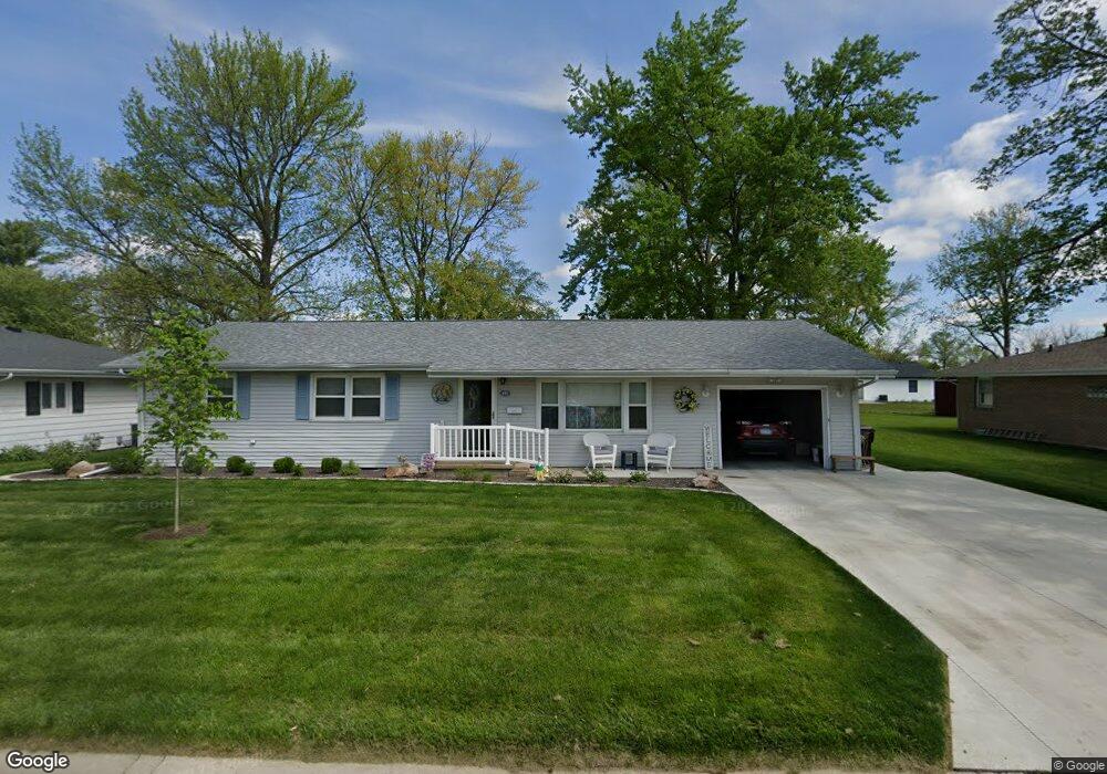
440 Mayfair Dr Lincoln, IL 62656
Estimated Value: $167,117 - $225,000
3
Beds
--
Bath
1,288
Sq Ft
$143/Sq Ft
Est. Value
About This Home
This home is located at 440 Mayfair Dr, Lincoln, IL 62656 and is currently estimated at $183,779, approximately $142 per square foot. 440 Mayfair Dr is a home located in Logan County with nearby schools including Adams Elementary School, Washington-Monroe Elementary School, and Lincoln Junior High School.
Ownership History
Date
Name
Owned For
Owner Type
Purchase Details
Closed on
Sep 2, 2022
Sold by
Masterson Fangju and Masterson Larry W
Bought by
Marten Carol R
Current Estimated Value
Home Financials for this Owner
Home Financials are based on the most recent Mortgage that was taken out on this home.
Original Mortgage
$116,000
Outstanding Balance
$111,458
Interest Rate
6%
Mortgage Type
New Conventional
Estimated Equity
$72,321
Purchase Details
Closed on
Jan 18, 2017
Sold by
Masterson Larry W
Bought by
Masterson Larry W and Masterson Fangju
Purchase Details
Closed on
Sep 18, 2008
Sold by
Masterson Larry W
Bought by
Masterson Larry W
Create a Home Valuation Report for This Property
The Home Valuation Report is an in-depth analysis detailing your home's value as well as a comparison with similar homes in the area
Home Values in the Area
Average Home Value in this Area
Purchase History
| Date | Buyer | Sale Price | Title Company |
|---|---|---|---|
| Marten Carol R | $145,000 | None Available | |
| Masterson Larry W | -- | -- | |
| Masterson Larry W | $112,000 | -- |
Source: Public Records
Mortgage History
| Date | Status | Borrower | Loan Amount |
|---|---|---|---|
| Open | Marten Carol R | $116,000 |
Source: Public Records
Tax History Compared to Growth
Tax History
| Year | Tax Paid | Tax Assessment Tax Assessment Total Assessment is a certain percentage of the fair market value that is determined by local assessors to be the total taxable value of land and additions on the property. | Land | Improvement |
|---|---|---|---|---|
| 2024 | $3,338 | $47,410 | $9,370 | $38,040 |
| 2023 | $3,584 | $43,900 | $8,680 | $35,220 |
| 2022 | $3,457 | $41,030 | $8,110 | $32,920 |
| 2021 | $2,406 | $39,400 | $7,790 | $31,610 |
| 2020 | $2,609 | $38,810 | $7,670 | $31,140 |
| 2019 | $2,679 | $38,050 | $7,520 | $30,530 |
| 2018 | $2,637 | $37,300 | $7,370 | $29,930 |
| 2017 | $3,120 | $37,300 | $7,370 | $29,930 |
| 2016 | $3,038 | $37,260 | $7,360 | $29,900 |
| 2015 | $2,863 | $35,500 | $7,260 | $28,240 |
| 2014 | $2,863 | $35,500 | $7,260 | $28,240 |
| 2013 | $2,863 | $33,700 | $6,890 | $26,810 |
| 2012 | $2,863 | $34,300 | $7,010 | $27,290 |
Source: Public Records
Map
Nearby Homes
- 102 Crestwood Dr
- 145 Half Moon St
- 103 Crestwood Dr
- 180 Regent St
- 1354 Airport Rd
- 1019 N Mclean St
- 1503 N Kankakee St
- 2294 Railsplitter Ave
- 1208 N Kankakee St
- 1431 N Ottawa St
- 2354 Railsplitter Ave
- 1204 N Ottawa St
- 1107 N Kankakee St
- 311 Davenport St
- 1624 Delavan St
- 915 Peoria St
- 315 N Sherman St
- 1227 Delavan St
- 1225 Delavan St
- 6 Meadow Ln
- 430 Mayfair Dr
- 450 Mayfair Dr
- 205 Half Moon St
- 420 Mayfair Dr
- 435 Mayfair Dr
- 195 Half Moon St
- 215 Half Moon St
- 425 Mayfair Dr
- 445 Mayfair Dr
- 185 Half Moon St
- 415 Mayfair Dr
- 455 Mayfair Dr
- 475 Northgate St
- 410 Mayfair Dr
- 425 Northgate St
- 200 Half Moon St
- 105 Churchill Ln
- 405 Mayfair Dr
- 465 Mayfair Dr
- 175 Half Moon St