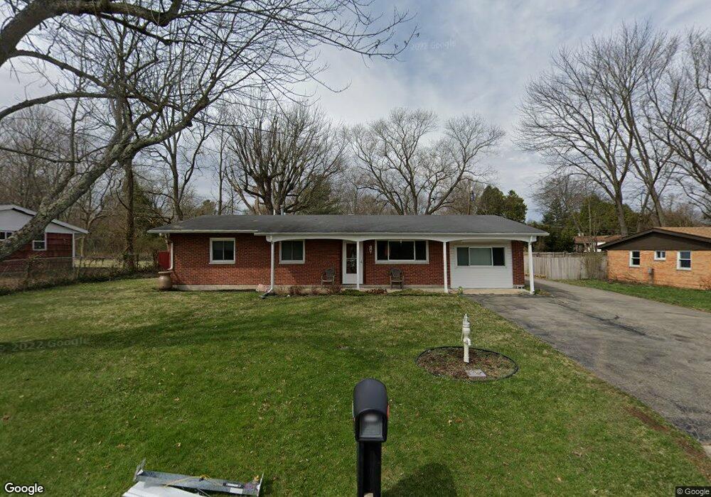
440 Polecat Rd Yellow Springs, OH 45387
Estimated Value: $292,000 - $315,000
3
Beds
2
Baths
1,537
Sq Ft
$196/Sq Ft
Est. Value
About This Home
This home is located at 440 Polecat Rd, Yellow Springs, OH 45387 and is currently estimated at $301,855, approximately $196 per square foot. 440 Polecat Rd is a home located in Greene County with nearby schools including Mills Lawn Elementary School, Yellow Springs High School & McKinney Middle School, and The Antioch School.
Ownership History
Date
Name
Owned For
Owner Type
Purchase Details
Closed on
Jul 15, 2013
Sold by
Davison Bonnie L and Davison Harold J
Bought by
Terry Bradlee and Terry Lynda H
Current Estimated Value
Home Financials for this Owner
Home Financials are based on the most recent Mortgage that was taken out on this home.
Original Mortgage
$134,512
Interest Rate
3.91%
Mortgage Type
VA
Purchase Details
Closed on
Nov 2, 1998
Sold by
Davison Harold J and Davison Bonnie L
Bought by
Thompson Linda Davison
Create a Home Valuation Report for This Property
The Home Valuation Report is an in-depth analysis detailing your home's value as well as a comparison with similar homes in the area
Home Values in the Area
Average Home Value in this Area
Purchase History
| Date | Buyer | Sale Price | Title Company |
|---|---|---|---|
| Terry Bradlee | $139,500 | None Available | |
| Thompson Linda Davison | -- | -- |
Source: Public Records
Mortgage History
| Date | Status | Borrower | Loan Amount |
|---|---|---|---|
| Previous Owner | Terry Bradlee | $134,512 |
Source: Public Records
Tax History Compared to Growth
Tax History
| Year | Tax Paid | Tax Assessment Tax Assessment Total Assessment is a certain percentage of the fair market value that is determined by local assessors to be the total taxable value of land and additions on the property. | Land | Improvement |
|---|---|---|---|---|
| 2024 | $4,736 | $85,070 | $20,880 | $64,190 |
| 2023 | $4,736 | $85,070 | $20,880 | $64,190 |
| 2022 | $3,936 | $67,070 | $17,990 | $49,080 |
| 2021 | $3,786 | $67,070 | $17,990 | $49,080 |
| 2020 | $3,799 | $67,070 | $17,990 | $49,080 |
| 2019 | $3,599 | $57,820 | $15,740 | $42,080 |
| 2018 | $3,589 | $57,820 | $15,740 | $42,080 |
| 2017 | $3,103 | $57,820 | $15,740 | $42,080 |
| 2016 | $3,103 | $50,720 | $15,100 | $35,620 |
| 2015 | $3,154 | $50,720 | $15,100 | $35,620 |
| 2014 | $3,043 | $50,720 | $15,100 | $35,620 |
Source: Public Records
Map
Nearby Homes
- 235 Northwood Dr
- 0 Xenia Ave Unit 934833
- 0 Xenia Ave Unit 1038888
- 602 Keystone Ct
- 4410 Us Route 68 N
- 513 Lincoln Ct
- 425 Snowdrop Dr
- 260 King St
- 504 Phillips St
- 414 S High St
- 125 Park Meadows Dr
- 404 Snowdrop Dr
- Danville Plan at Spring Meadows - Maple Street Collection
- Beacon Plan at Spring Meadows - Maple Street Collection
- DaVinci Plan at Spring Meadows - Maple Street Collection
- Cumberland Plan at Spring Meadows - Maple Street Collection
- Greenbriar Plan at Spring Meadows - Maple Street Collection
- Wesley Plan at Spring Meadows - Maple Street Collection
- Jensen Plan at Spring Meadows - Maple Street Collection
- Fairfax Plan at Spring Meadows - Maple Street Collection
- 460 Polecat Rd
- 430 Polecat Rd
- 219 Whitehall Dr
- 223 Whitehall Dr
- 470 Polecat Rd
- 422 Polecat Rd
- 209 Whitehall Dr
- 227 Whitehall Dr
- 218 Whitehall Dr
- 480 Polecat Rd
- 414 Polecat Rd
- 205 Northwood Dr
- 224 Whitehall Dr
- 214 Whitehall Dr
- 231 Whitehall Dr
- 203 Whitehall Dr
- 210 Whitehall Dr
- 226 Whitehall Dr
- 206 Whitehall Dr
- 413 Polecat Rd