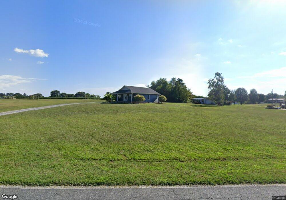
440 Range Rd Kings Mountain, NC 28086
Estimated Value: $173,000 - $253,000
Studio
--
Bath
1,089
Sq Ft
$192/Sq Ft
Est. Value
About This Home
This home is located at 440 Range Rd, Kings Mountain, NC 28086 and is currently estimated at $209,139, approximately $192 per square foot. 440 Range Rd is a home located in Cleveland County with nearby schools including Bethware Elementary School, Kings Mountain Middle, and Kings Mountain Intermediate School.
Ownership History
Date
Name
Owned For
Owner Type
Purchase Details
Closed on
Jul 31, 2025
Sold by
Ross James
Bought by
Ross Alecia
Current Estimated Value
Home Financials for this Owner
Home Financials are based on the most recent Mortgage that was taken out on this home.
Original Mortgage
$173,000
Outstanding Balance
$172,256
Interest Rate
6.81%
Mortgage Type
New Conventional
Estimated Equity
$36,883
Purchase Details
Closed on
Jan 24, 2019
Sold by
Henderson Robert Edward and Henderson Peggy
Bought by
Ross James and Ross Alecia
Home Financials for this Owner
Home Financials are based on the most recent Mortgage that was taken out on this home.
Original Mortgage
$84,300
Interest Rate
4.6%
Mortgage Type
VA
Create a Home Valuation Report for This Property
The Home Valuation Report is an in-depth analysis detailing your home's value as well as a comparison with similar homes in the area
Home Values in the Area
Average Home Value in this Area
Purchase History
| Date | Buyer | Sale Price | Title Company |
|---|---|---|---|
| Ross Alecia | -- | None Listed On Document | |
| Ross Alecia | -- | None Listed On Document | |
| Ross James | $84,500 | None Available |
Source: Public Records
Mortgage History
| Date | Status | Borrower | Loan Amount |
|---|---|---|---|
| Open | Ross Alecia | $173,000 | |
| Closed | Ross Alecia | $173,000 | |
| Previous Owner | Ross James | $84,300 |
Source: Public Records
Tax History
| Year | Tax Paid | Tax Assessment Tax Assessment Total Assessment is a certain percentage of the fair market value that is determined by local assessors to be the total taxable value of land and additions on the property. | Land | Improvement |
|---|---|---|---|---|
| 2025 | $842 | $132,619 | $19,582 | $113,037 |
| 2024 | $855 | $104,456 | $16,212 | $88,244 |
| 2023 | $908 | $104,456 | $16,212 | $88,244 |
| 2022 | $906 | $104,456 | $16,212 | $88,244 |
| 2021 | $908 | $104,456 | $16,212 | $88,244 |
| 2020 | $676 | $72,823 | $15,301 | $57,522 |
| 2019 | $676 | $72,823 | $15,301 | $57,522 |
| 2018 | $672 | $72,823 | $15,301 | $57,522 |
| 2017 | $669 | $72,823 | $15,301 | $57,522 |
| 2016 | $637 | $72,823 | $15,301 | $57,522 |
| 2015 | $596 | $67,551 | $12,751 | $54,800 |
| 2014 | $596 | $67,551 | $12,751 | $54,800 |
Source: Public Records
Map
Nearby Homes
- 105 Trotter Ln
- 707 Sandalwood Ln
- 907 Bethlehem Rd
- 507 Bethlehem Rd
- 400 El Bethel Rd
- 107 Tara Terrace
- 143 Yarbro Rd Unit 16
- 143 Yarbro Rd Unit 2
- 143 Yarbro Rd Unit 20
- 105 Barley Dr
- 132 Yarbro Rd Unit 13
- 104 Carol Lyn Rd
- 11111 High Ridge Ct Unit 11
- 114 Yarbro Rd Unit 23
- 115 High Ridge Ct Unit 26
- 210 Roy Bell Rd
- 113 High Ridge Ct Unit 25
- 213 Mullinax Dr
- 5139 E Dixon Blvd
- 127 Mullinax Dr
Your Personal Tour Guide
Ask me questions while you tour the home.