Estimated Value: $283,940 - $749,000
Studio
2
Baths
1,800
Sq Ft
$262/Sq Ft
Est. Value
About This Home
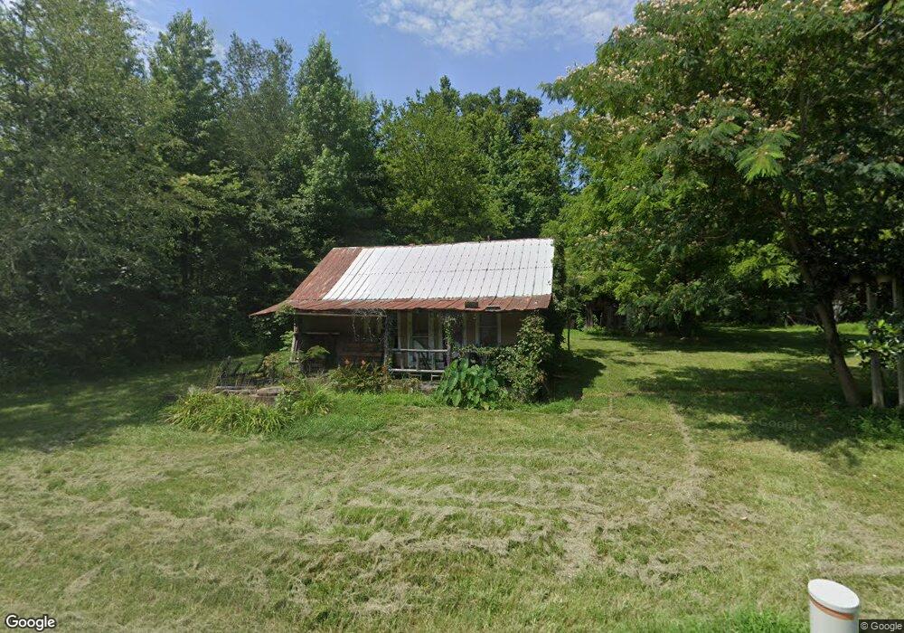
This home is located at 440 Upper Standing Rock Rd, Dover, TN 37058 and is currently estimated at $470,980, approximately $261 per square foot. 440 Upper Standing Rock Rd is a home located in Stewart County with nearby schools including Dover Elementary School, Stewart County Middle School, and Stewart County High School.
Ownership History
Date
Name
Owned For
Owner Type
Purchase Details
Closed on
Apr 13, 2011
Sold by
Pulley Peggy
Bought by
Pulley Gerry D
Current Estimated Value
Purchase Details
Closed on
Apr 30, 1990
Bought by
Pulley Glenn D
Purchase Details
Closed on
May 3, 1952
Bought by
Pulley May Dell and Pulley Louise
Create a Home Valuation Report for This Property
The Home Valuation Report is an in-depth analysis detailing your home's value as well as a comparison with similar homes in the area
Purchase History
| Date | Buyer | Sale Price | Title Company |
|---|---|---|---|
| Pulley Gerry D | -- | -- | |
| Pulley Glenn D | $100 | -- | |
| Pulley May Dell | -- | -- |
Source: Public Records
Tax History
| Year | Tax Paid | Tax Assessment Tax Assessment Total Assessment is a certain percentage of the fair market value that is determined by local assessors to be the total taxable value of land and additions on the property. | Land | Improvement |
|---|---|---|---|---|
| 2025 | $644 | $43,300 | $11,500 | $31,800 |
| 2024 | $644 | $43,300 | $11,500 | $31,800 |
| 2023 | $653 | $27,650 | $9,000 | $18,650 |
| 2022 | $653 | $27,650 | $9,000 | $18,650 |
| 2021 | $653 | $27,650 | $9,000 | $18,650 |
| 2020 | $644 | $27,650 | $9,000 | $18,650 |
| 2019 | $644 | $25,275 | $7,850 | $17,425 |
| 2018 | $644 | $25,275 | $7,850 | $17,425 |
| 2017 | $647 | $25,400 | $7,850 | $17,550 |
| 2016 | $647 | $25,400 | $7,850 | $17,550 |
| 2015 | $627 | $25,400 | $7,850 | $17,550 |
| 2014 | $643 | $28,025 | $7,850 | $20,175 |
| 2013 | $643 | $26,037 | $0 | $0 |
Source: Public Records
Map
Nearby Homes
- 0 Old Hwy 18
- 0 N Fork Rd Unit 2
- 0 N Fork Rd Unit 8A
- 0 N Fork Rd Unit 3B
- 0 N Fork Rd Unit 5
- 0 N Fork Rd Unit 7A
- 0 N Fork Rd Unit 3A
- 0 N Fork Rd Unit 7B
- 0 N Fork Rd Unit 4
- 0 N Fork Rd Unit 8B
- N Fork Tract 8
- 0 Old Highway 18 Unit 24351588
- 0 Old Highway 18 Unit 4
- 0 Old Highway 18 Unit 8
- 0 Old Highway 18 Unit 3
- 0 Old Highway 18 Unit 9
- 01 Terrapin Run Rd
- 1 Terrapin Run Rd
- E Fork Leatherwood Rd
- 0 Settle Rd
- 492 Upper Standing Rock Rd
- 330 Upper Standing Rock Rd
- 491 Upper Standing Rock Rd
- 231 Parker Ln
- 531 Upper Standing Rock Rd
- 207 Parker Ln
- 198 Parker Ln
- 305 Upper Standing Rock Rd
- 235 Upper Standing Rock Rd
- 234 Upper Standing Rock Rd
- 224 Upper Standing Rock Rd
- 226 Upper Standing Rock Rd
- 164 Maddox Rd
- 214 Upper Standing Rock Rd
- 172 Maddox Rd
- 203 Upper Standing Rock Rd
- 166 Upper Standing Rock Rd
- 115 Parker Ln
- 2061 Leatherwood Rd
- 154 Upper Standing Rock Rd
Your Personal Tour Guide
Ask me questions while you tour the home.