Estimated Value: $449,000 - $499,151
5
Beds
1
Bath
1,230
Sq Ft
$382/Sq Ft
Est. Value
About This Home
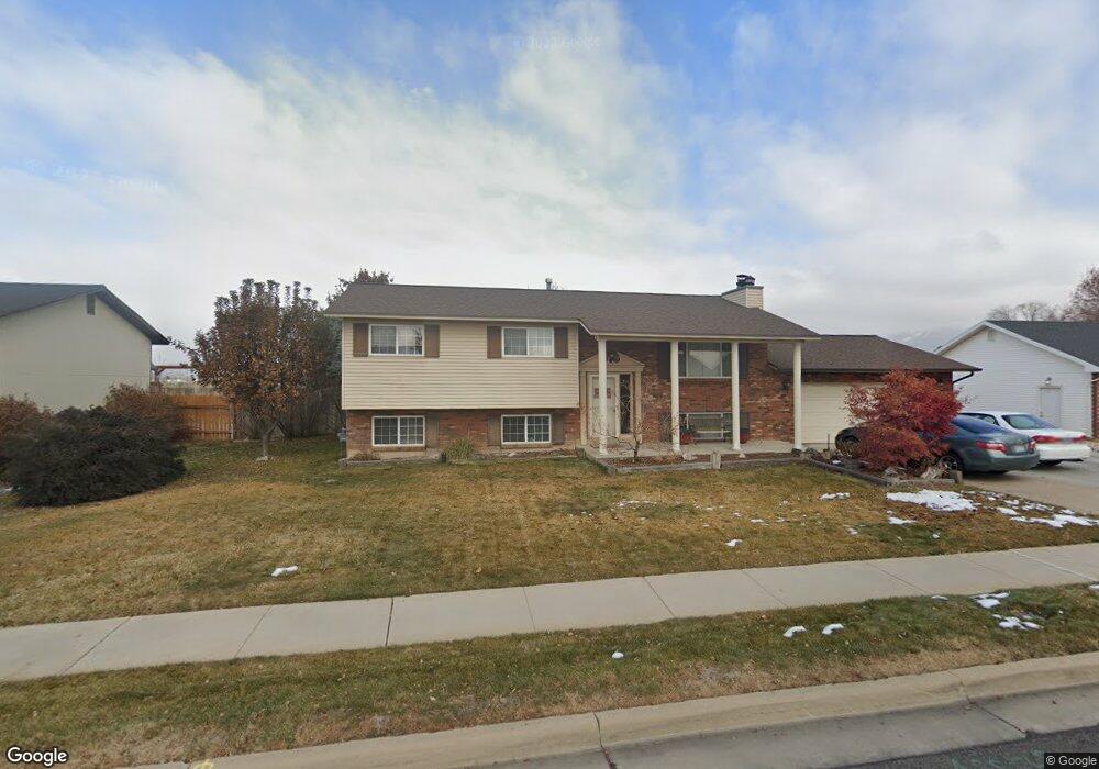
This home is located at 440 W 1550 N, Ogden, UT 84404 and is currently estimated at $469,788, approximately $381 per square foot. 440 W 1550 N is a home located in Weber County with nearby schools including Pioneer School, Orion Junior High School, and Weber High School.
Ownership History
Date
Name
Owned For
Owner Type
Purchase Details
Closed on
Aug 27, 2020
Sold by
Jorgensen Kristin
Bought by
Ben Lomond Golf Course Inc
Current Estimated Value
Purchase Details
Closed on
Oct 25, 1996
Sold by
Jorgensen Alan Lavon and Jorgensen Kristine M
Bought by
Jorgensen Alan L and Jorgensen Kristin M
Home Financials for this Owner
Home Financials are based on the most recent Mortgage that was taken out on this home.
Original Mortgage
$80,000
Interest Rate
7.64%
Create a Home Valuation Report for This Property
The Home Valuation Report is an in-depth analysis detailing your home's value as well as a comparison with similar homes in the area
Home Values in the Area
Average Home Value in this Area
Purchase History
| Date | Buyer | Sale Price | Title Company |
|---|---|---|---|
| Ben Lomond Golf Course Inc | -- | None Available | |
| Jorgensen Alan L | -- | United Title Services |
Source: Public Records
Mortgage History
| Date | Status | Borrower | Loan Amount |
|---|---|---|---|
| Previous Owner | Jorgensen Alan L | $80,000 |
Source: Public Records
Tax History Compared to Growth
Tax History
| Year | Tax Paid | Tax Assessment Tax Assessment Total Assessment is a certain percentage of the fair market value that is determined by local assessors to be the total taxable value of land and additions on the property. | Land | Improvement |
|---|---|---|---|---|
| 2025 | $3,222 | $467,438 | $162,431 | $305,007 |
| 2024 | $3,182 | $252,998 | $89,337 | $163,661 |
| 2023 | $3,140 | $252,999 | $89,319 | $163,680 |
| 2022 | $3,167 | $261,800 | $76,561 | $185,239 |
| 2021 | $2,393 | $358,000 | $81,216 | $276,784 |
| 2020 | $2,148 | $295,000 | $63,787 | $231,213 |
| 2019 | $2,142 | $279,000 | $63,787 | $215,213 |
| 2018 | $2,102 | $262,000 | $55,733 | $206,267 |
| 2017 | $1,931 | $225,284 | $51,127 | $174,157 |
| 2016 | $1,769 | $110,843 | $26,465 | $84,378 |
| 2015 | $1,655 | $102,263 | $26,465 | $75,798 |
| 2014 | $1,574 | $94,843 | $26,465 | $68,378 |
Source: Public Records
Map
Nearby Homes
- 2458 N Highway 89 Hwy
- 1743 N 400 W
- 2440 U S Highway 89
- 1307 N 225 W
- 178 W 1750 N
- 247 E 1825 N Unit 10
- 247 E 1825 N Unit 11
- 1196 N 375 W Unit 1
- Dearborn Plan at Ashlar Cove
- Harris Plan at Ashlar Cove
- 403 W 1225 N
- 403 W 1225 N Unit 7
- 112 E 1475 N
- 1953 N 275 W Unit 13
- 1960 N 275 W Unit 29
- 416 W 1925 N
- 1964 N 225 W
- 108 W 1875 N
- 1368 N 200 E
- 315 E 1650 N Unit 129