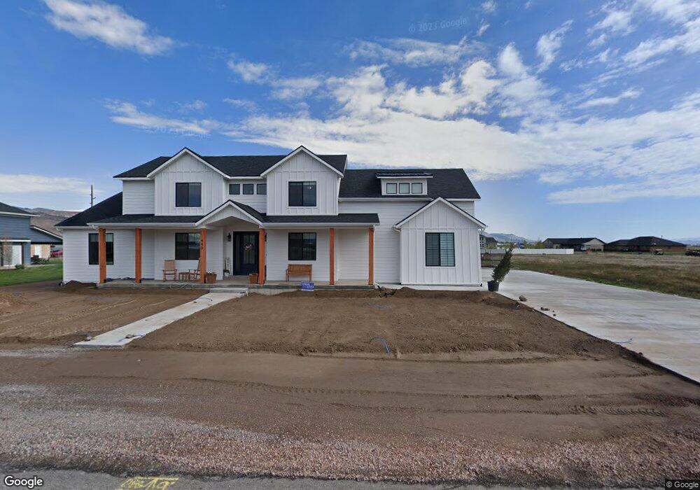
440 W 2300 S Unit 19 Richfield, UT 84701
Estimated Value: $798,064 - $962,000
--
Bed
--
Bath
3,588
Sq Ft
$247/Sq Ft
Est. Value
About This Home
This home is located at 440 W 2300 S Unit 19, Richfield, UT 84701 and is currently estimated at $886,516, approximately $247 per square foot. 440 W 2300 S Unit 19 is a home located in Sevier County with nearby schools including Ashman School, Pahvant School, and Red Hills Middle School.
Ownership History
Date
Name
Owned For
Owner Type
Purchase Details
Closed on
Sep 16, 2020
Sold by
Stronghold Storage Llc
Bought by
Schut Douglas Kenneth and Schut Charlotte Mabey
Current Estimated Value
Purchase Details
Closed on
Jul 26, 2012
Sold by
Bank Of The West
Bought by
Stonghold Storage Llc
Purchase Details
Closed on
Mar 9, 2011
Sold by
Bullock Ryan and Bullock Marisol
Bought by
Bank Of The West
Purchase Details
Closed on
Dec 19, 2007
Sold by
Alliance Ventures Llc
Bought by
Bullock Ryan and Bullock Marisol
Home Financials for this Owner
Home Financials are based on the most recent Mortgage that was taken out on this home.
Original Mortgage
$97,669
Interest Rate
6.2%
Mortgage Type
Unknown
Purchase Details
Closed on
Aug 1, 2006
Sold by
Keb Enterprises Lp
Bought by
Alliance Ventures Llc
Create a Home Valuation Report for This Property
The Home Valuation Report is an in-depth analysis detailing your home's value as well as a comparison with similar homes in the area
Home Values in the Area
Average Home Value in this Area
Purchase History
| Date | Buyer | Sale Price | Title Company |
|---|---|---|---|
| Schut Douglas Kenneth | -- | First American Title Ins Co | |
| Stonghold Storage Llc | -- | None Available | |
| Bank Of The West | -- | -- | |
| Bullock Ryan | -- | First Ameican Title Insuranc | |
| Alliance Ventures Llc | -- | First American Title Ins Age |
Source: Public Records
Mortgage History
| Date | Status | Borrower | Loan Amount |
|---|---|---|---|
| Previous Owner | Bullock Ryan | $97,669 |
Source: Public Records
Tax History Compared to Growth
Tax History
| Year | Tax Paid | Tax Assessment Tax Assessment Total Assessment is a certain percentage of the fair market value that is determined by local assessors to be the total taxable value of land and additions on the property. | Land | Improvement |
|---|---|---|---|---|
| 2024 | $3,511 | $407,124 | $32,975 | $374,149 |
| 2023 | $4,028 | $409,329 | $30,925 | $378,404 |
| 2022 | $3,700 | $337,812 | $28,493 | $309,319 |
| 2021 | $655 | $50,306 | $28,469 | $21,837 |
| 2020 | $803 | $60,000 | $60,000 | $0 |
| 2019 | $632 | $50,000 | $50,000 | $0 |
| 2018 | $706 | $50,000 | $50,000 | $0 |
| 2017 | $608 | $41,130 | $41,130 | $0 |
| 2016 | -- | $17,630 | $0 | $0 |
| 2015 | -- | $16,900 | $0 | $0 |
| 2014 | -- | $16,020 | $0 | $0 |
Source: Public Records
Map
Nearby Homes
- 471 W 2300 S
- 391 W 2300 S
- 501 W 2300 S
- 2794 S 325 W
- 2749 Mulberry Ln Unit 4
- 155 W 1500 S
- 949 W Torrey Pines Dr
- 902 W Southern Hills Vista
- 0 Parcel #1-2-57 Unit 25-261285
- 765 W 1100 S
- 690 1100 S
- 554 W 1000 S
- 195 E 650 N Unit 5
- 185 E 650 N Unit 4
- 160 E 650 N Unit 3
- 155 E 650 N Unit 1
- 165 E 650 N Unit 2
- 837 610 W
- 0 Parcel #1-7-73 Unit 25-261286
- 3150 S 1870 W Unit 3
- 472 W 2300 S Unit 18
- 408 W 2300 S Unit 20
- 405 W 2300 S Unit 11
- 471 W 2300 S Unit 13
- 270 W Country Meadow (2075 S) Ln
- 492 W 2300 S Unit 17
- 310 W Country Meadow (2075 S) Ln
- 391 W 2300 S Unit 10
- 225 W Country Meadow (2075 S) Ln
- 285 W Meadowbrook (1900 S) Ln
- 501 W 2300 S Unit 14
- 2287 S 380 W Unit 8
- 2287 S 380 W
- 2293 S 380 W Unit 9
- 355 W Meadowbrook (1900 S) Ln
- 255 W Country Meadow (2075 S) Ln
- 380 W Country Meadow (2075 S) Ln
- 275 W Country Meadow (2075 S) Ln
- 536 W 2300 S Unit 16
- 536 W 2300 S