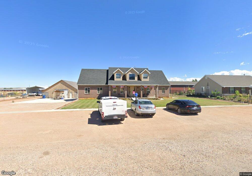
440 W 300 S Fillmore, UT 84631
Estimated Value: $300,000 - $705,041
--
Bed
--
Bath
--
Sq Ft
1.26
Acres
About This Home
This home is located at 440 W 300 S, Fillmore, UT 84631 and is currently estimated at $450,347. 440 W 300 S is a home.
Ownership History
Date
Name
Owned For
Owner Type
Purchase Details
Closed on
Mar 29, 2024
Sold by
Wilcox Curtis T and Wilcox Susan M
Bought by
Curtis And Susan Wilcox Family Trust and Wilcox
Current Estimated Value
Purchase Details
Closed on
Nov 4, 2016
Sold by
Atkin R Thomas and Atkin Marsha
Bought by
Wilcox Curtis T and Wilcox Susan M
Home Financials for this Owner
Home Financials are based on the most recent Mortgage that was taken out on this home.
Original Mortgage
$41,000
Interest Rate
3.42%
Mortgage Type
Seller Take Back
Purchase Details
Closed on
Jan 16, 2008
Sold by
The Patricia J Rasmusson Family Limited
Bought by
Atkin R Thomas and Atkin Marsha
Create a Home Valuation Report for This Property
The Home Valuation Report is an in-depth analysis detailing your home's value as well as a comparison with similar homes in the area
Home Values in the Area
Average Home Value in this Area
Purchase History
| Date | Buyer | Sale Price | Title Company |
|---|---|---|---|
| Curtis And Susan Wilcox Family Trust | -- | None Listed On Document | |
| Wilcox Curtis T | -- | First American Title | |
| Atkin R Thomas | -- | -- |
Source: Public Records
Mortgage History
| Date | Status | Borrower | Loan Amount |
|---|---|---|---|
| Previous Owner | Wilcox Curtis T | $41,000 |
Source: Public Records
Tax History Compared to Growth
Tax History
| Year | Tax Paid | Tax Assessment Tax Assessment Total Assessment is a certain percentage of the fair market value that is determined by local assessors to be the total taxable value of land and additions on the property. | Land | Improvement |
|---|---|---|---|---|
| 2025 | $3,908 | $490,796 | $50,820 | $439,976 |
| 2024 | $3,908 | $440,876 | $45,029 | $395,847 |
| 2023 | $4,641 | $440,876 | $45,029 | $395,847 |
| 2022 | $3,647 | $327,441 | $36,476 | $290,965 |
| 2021 | $3,248 | $280,012 | $23,686 | $256,326 |
| 2020 | $2,523 | $218,815 | $21,533 | $197,282 |
| 2019 | $1,297 | $112,803 | $21,533 | $91,270 |
| 2018 | $731 | $65,049 | $21,533 | $43,516 |
| 2017 | $510 | $43,150 | $39,150 | $4,000 |
| 2016 | $488 | $43,150 | $39,150 | $4,000 |
| 2015 | $488 | $43,150 | $39,150 | $4,000 |
| 2014 | -- | $43,150 | $39,150 | $4,000 |
| 2013 | -- | $43,150 | $39,150 | $4,000 |
Source: Public Records
Map
Nearby Homes
- 310 S 500 West Rd
- 190 W 400 St S
- 75 N 100 West St
- 225 W 200 St N
- 120 S 100 East Rd
- 165 N 100 W
- 40 S 100 Rd E
- 220 S 200 E
- 155 E 500 St S
- 157 E 500 South St
- 295 N 100 West St
- 335 W 400 North St
- 380 N 200 St W
- 1100 S 725 Rd W
- 390 N 100 W
- 405 E 500 St S
- 410 W 400 N
- 430 E Canyon Rd
- 760 E 700 St S
- 310 S 600 E