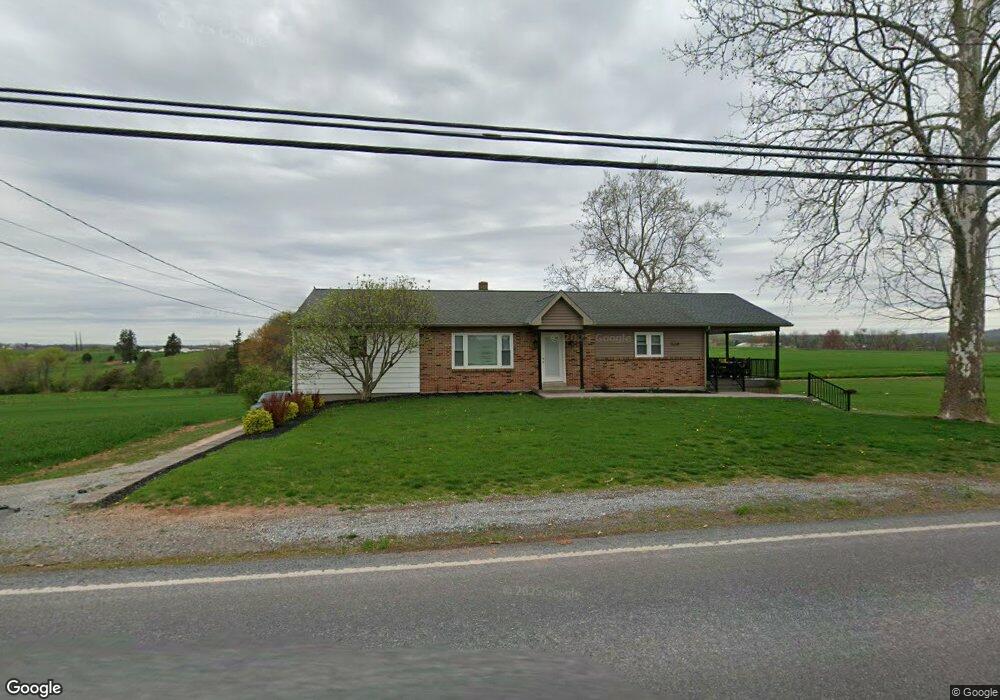
440 W Maple Grove Rd Denver, PA 17517
Estimated Value: $359,226 - $390,000
5
Beds
2
Baths
1,456
Sq Ft
$255/Sq Ft
Est. Value
About This Home
This home is located at 440 W Maple Grove Rd, Denver, PA 17517 and is currently estimated at $371,742, approximately $255 per square foot. 440 W Maple Grove Rd is a home located in Lancaster County with nearby schools including Garden Spot Middle School, Garden Spot Senior High School, and Muddy Creek Christian School.
Ownership History
Date
Name
Owned For
Owner Type
Purchase Details
Closed on
Jul 9, 2025
Sold by
Groff Marcus S and Groff Joyce M
Bought by
Groff Marcus S and Groff Joyce M
Current Estimated Value
Purchase Details
Closed on
Jan 19, 2018
Sold by
Weaver Landis M
Bought by
Groff Marcus S and Groff Joyce M
Home Financials for this Owner
Home Financials are based on the most recent Mortgage that was taken out on this home.
Original Mortgage
$181,450
Interest Rate
3.93%
Mortgage Type
New Conventional
Create a Home Valuation Report for This Property
The Home Valuation Report is an in-depth analysis detailing your home's value as well as a comparison with similar homes in the area
Home Values in the Area
Average Home Value in this Area
Purchase History
| Date | Buyer | Sale Price | Title Company |
|---|---|---|---|
| Groff Marcus S | -- | None Listed On Document | |
| Groff Marcus S | $191,000 | None Available |
Source: Public Records
Mortgage History
| Date | Status | Borrower | Loan Amount |
|---|---|---|---|
| Previous Owner | Groff Marcus S | $181,450 |
Source: Public Records
Tax History Compared to Growth
Tax History
| Year | Tax Paid | Tax Assessment Tax Assessment Total Assessment is a certain percentage of the fair market value that is determined by local assessors to be the total taxable value of land and additions on the property. | Land | Improvement |
|---|---|---|---|---|
| 2025 | $3,163 | $183,800 | $49,900 | $133,900 |
| 2024 | $3,163 | $183,800 | $49,900 | $133,900 |
| 2023 | $3,098 | $183,800 | $49,900 | $133,900 |
| 2022 | $2,856 | $172,400 | $49,900 | $122,500 |
| 2021 | $2,713 | $172,400 | $49,900 | $122,500 |
| 2020 | $2,713 | $172,400 | $49,900 | $122,500 |
| 2019 | $2,681 | $172,400 | $49,900 | $122,500 |
| 2017 | $2,645 | $138,900 | $29,300 | $109,600 |
| 2016 | $2,645 | $138,900 | $29,300 | $109,600 |
| 2015 | $556 | $138,900 | $29,300 | $109,600 |
| 2014 | $1,937 | $138,900 | $29,300 | $109,600 |
Source: Public Records
Map
Nearby Homes
- 534 High Point Dr
- 602 Greenview Dr
- 117 Hawk Valley Ln Unit 105
- 114 Hawk Valley Ln Unit 104
- 101 Hawk Valley Ln
- 55 Hawk Valley Ln
- 111 Oatfield Dr
- 01 W Valley Rd
- Bridgemont Plan at Hawk Valley Estates
- Sullivan Plan at Hawk Valley Estates
- Silverbrooke Plan at Hawk Valley Estates
- Wesley Plan at Hawk Valley Estates
- Kingston Plan at Hawk Valley Estates
- Logan Plan at Hawk Valley Estates
- Brookfield Plan at Hawk Valley Estates
- Westbrooke Plan at Hawk Valley Estates
- Berkley Plan at Hawk Valley Estates
- Callahan Plan at Hawk Valley Estates
- 32 Hawk Valley Ln
- 133 Millstone Dr
- 443 W Maple Grove Rd
- 451 W Maple Grove Rd
- 402 W Maple Grove Rd
- 1088 Messner Ln
- 1031 Messner Ln
- 1047 Messner Ln
- 1029 Messner Ln
- 499 W Maple Grove Rd
- 368 W Maple Grove Rd
- 510 Pleasant Valley Rd
- 520 W Maple Grove Rd
- 1112 Village Cir
- 430 Pleasant Valley Rd
- 1108 Village Cir
- 1114 Village Cir
- 1016 Messner Ln
- 480 Pleasant Valley Rd
- 1104 Village Cir
- 500 High Point Dr
- 1118 Village Cir