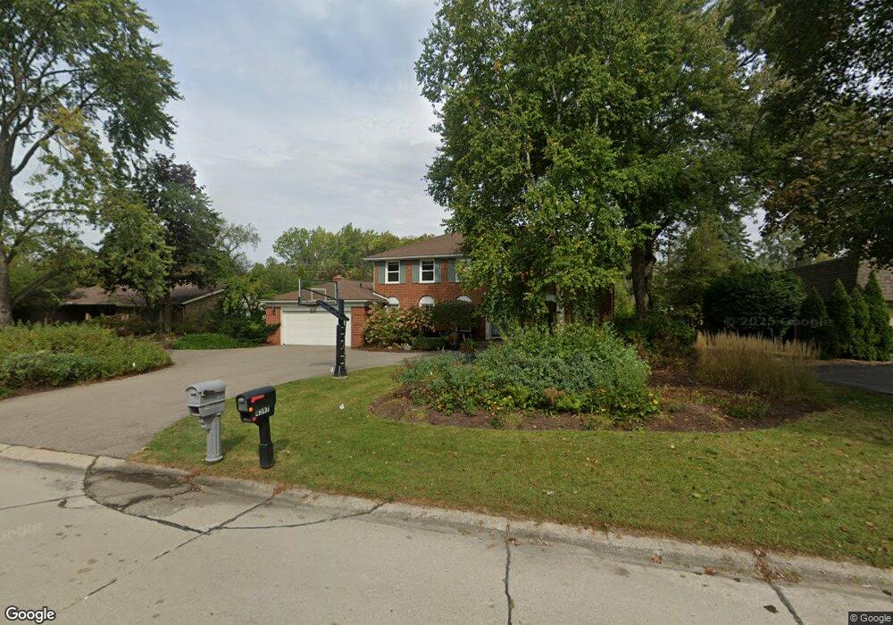
4400 Dorian Dr Bloomfield Hills, MI 48301
Estimated Value: $585,000 - $866,000
5
Beds
5
Baths
2,788
Sq Ft
$250/Sq Ft
Est. Value
About This Home
This home is located at 4400 Dorian Dr, Bloomfield Hills, MI 48301 and is currently estimated at $696,078, approximately $249 per square foot. 4400 Dorian Dr is a home located in Oakland County with nearby schools including Conant Elementary School, South Hills Middle School, and Bloomfield Hills High School.
Ownership History
Date
Name
Owned For
Owner Type
Purchase Details
Closed on
Apr 16, 1998
Sold by
Newman Christopher
Bought by
Ellis Edward J
Current Estimated Value
Purchase Details
Closed on
Oct 5, 1995
Sold by
Peracha Khadija
Bought by
Newman Christopher
Home Financials for this Owner
Home Financials are based on the most recent Mortgage that was taken out on this home.
Original Mortgage
$256,000
Interest Rate
7.8%
Create a Home Valuation Report for This Property
The Home Valuation Report is an in-depth analysis detailing your home's value as well as a comparison with similar homes in the area
Home Values in the Area
Average Home Value in this Area
Purchase History
| Date | Buyer | Sale Price | Title Company |
|---|---|---|---|
| Ellis Edward J | $333,000 | -- | |
| Newman Christopher | $286,000 | -- |
Source: Public Records
Mortgage History
| Date | Status | Borrower | Loan Amount |
|---|---|---|---|
| Previous Owner | Newman Christopher | $256,000 |
Source: Public Records
Tax History Compared to Growth
Tax History
| Year | Tax Paid | Tax Assessment Tax Assessment Total Assessment is a certain percentage of the fair market value that is determined by local assessors to be the total taxable value of land and additions on the property. | Land | Improvement |
|---|---|---|---|---|
| 2024 | $3,791 | $307,020 | $0 | $0 |
| 2023 | $3,669 | $273,050 | $0 | $0 |
| 2022 | $6,895 | $252,400 | $0 | $0 |
| 2021 | $6,845 | $229,120 | $0 | $0 |
| 2020 | $3,356 | $213,860 | $0 | $0 |
| 2019 | $6,403 | $206,870 | $0 | $0 |
| 2018 | $6,432 | $205,720 | $0 | $0 |
| 2017 | $6,143 | $196,000 | $0 | $0 |
| 2016 | $6,155 | $171,410 | $0 | $0 |
| 2015 | -- | $145,860 | $0 | $0 |
| 2014 | -- | $153,430 | $0 | $0 |
| 2011 | -- | $157,990 | $0 | $0 |
Source: Public Records
Map
Nearby Homes
- 6750 Wing Lake Rd
- 6701 Franklin Rd
- 4456 W Maple Rd
- 6572 Spruce Dr
- 7100 Wing Lake Rd
- 4428 Old Trinity Ct
- 6720 Castle Dr
- 7005 Cathedral Dr
- 6660 Woodbank Dr
- 4200 Surrey Cross
- 6940 Castle Dr
- 7303 Brookside Village Ct
- 6952 Sandalwood Dr
- 4665 W Maple Rd
- 750 Trailwood Path Unit B
- 450 Billingsgate Ct Unit C
- 1760 Trailwood Path
- 4647 Private Lake Dr
- 6041 Eastmoor Rd
- 7200 Telegraph Rd
- 4392 Dorian Dr
- 4408 Dorian Dr
- 4397 Dorian Dr
- 4395 Sly Ct
- 4416 Dorian Dr
- 4385 Sly Ct
- 6891 Vachon Dr
- 4387 Dorian Dr
- 6884 Vachon Dr
- 4421 Dorian Dr
- 4424 Dorian Dr
- 6804 Wing Lake Rd
- 6679 Vachon Ct Unit Bldg-Unit
- 6679 Vachon Ct
- 6881 Vachon Dr
- 6876 Vachon Dr
- 4429 Dorian Dr
- 4432 Dorian Dr
- 0000 Orinoco Cir
- 6824 Wing Lake Rd