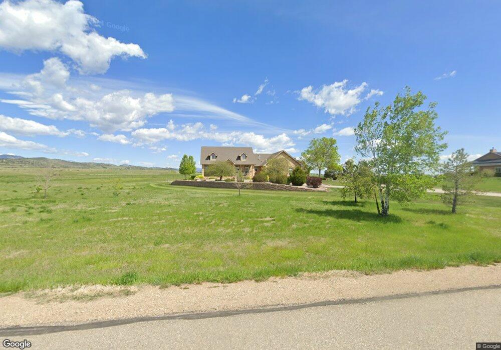
4400 Malibu Dr Berthoud, CO 80513
Estimated Value: $1,048,000 - $1,396,000
4
Beds
5
Baths
4,252
Sq Ft
$285/Sq Ft
Est. Value
About This Home
This home is located at 4400 Malibu Dr, Berthoud, CO 80513 and is currently estimated at $1,209,855, approximately $284 per square foot. 4400 Malibu Dr is a home located in Larimer County with nearby schools including Berthoud Elementary School, Turner Middle School, and Berthoud High School.
Ownership History
Date
Name
Owned For
Owner Type
Purchase Details
Closed on
Mar 1, 2011
Sold by
Breunig Mary Cay
Bought by
Mary Cay Breunig Trust
Current Estimated Value
Purchase Details
Closed on
Mar 31, 2006
Sold by
Dennis Julie A
Bought by
Breunig William L and Breunig Mary Cay
Home Financials for this Owner
Home Financials are based on the most recent Mortgage that was taken out on this home.
Original Mortgage
$265,000
Outstanding Balance
$150,964
Interest Rate
6.21%
Mortgage Type
Fannie Mae Freddie Mac
Estimated Equity
$1,058,891
Purchase Details
Closed on
Jul 26, 2002
Sold by
Conder Steve
Bought by
Dennis Julie A
Create a Home Valuation Report for This Property
The Home Valuation Report is an in-depth analysis detailing your home's value as well as a comparison with similar homes in the area
Home Values in the Area
Average Home Value in this Area
Purchase History
| Date | Buyer | Sale Price | Title Company |
|---|---|---|---|
| Mary Cay Breunig Trust | -- | None Available | |
| Breunig Mary Cay | -- | None Available | |
| Breunig William L | $765,000 | None Available | |
| Dennis Julie A | $49,255 | -- |
Source: Public Records
Mortgage History
| Date | Status | Borrower | Loan Amount |
|---|---|---|---|
| Open | Breunig William L | $265,000 |
Source: Public Records
Tax History Compared to Growth
Tax History
| Year | Tax Paid | Tax Assessment Tax Assessment Total Assessment is a certain percentage of the fair market value that is determined by local assessors to be the total taxable value of land and additions on the property. | Land | Improvement |
|---|---|---|---|---|
| 2025 | $6,110 | $73,700 | $18,090 | $55,610 |
| 2024 | $5,930 | $73,700 | $18,090 | $55,610 |
| 2022 | $5,125 | $60,201 | $13,831 | $46,370 |
| 2021 | $5,268 | $61,934 | $14,229 | $47,705 |
| 2020 | $4,652 | $55,513 | $12,799 | $42,714 |
| 2019 | $4,592 | $55,513 | $12,799 | $42,714 |
| 2018 | $4,236 | $50,018 | $9,864 | $40,154 |
| 2017 | $4,377 | $50,018 | $9,864 | $40,154 |
| 2016 | $4,410 | $49,033 | $10,666 | $38,367 |
| 2015 | $4,384 | $49,040 | $10,670 | $38,370 |
| 2014 | $3,701 | $39,670 | $7,160 | $32,510 |
Source: Public Records
Map
Nearby Homes
- 871 N County Road 23e
- 1932 N County Road 23
- 1822 Quarter Ln
- 0 W County Road 8e Unit RECIR1018960
- 3520 W County Road 8
- 2102 Shoreside Dr
- 6502 & 6200 Kiva Ridge Dr
- 2366 Shoreside Dr
- 3412 Erving Ct
- 5644 Kiva Ridge Dr
- 6319 Sedona Hills Dr
- 560 Talons Reach Run
- 4707 Lonetree Dr
- 5306 Foothills Dr
- 4616 Lonetree Dr
- 4260 S County Road 23
- 2517 Southwind Rd
- 2237 W County Road 8
- 5714 Bluff Ln
- 2237 W Cr8