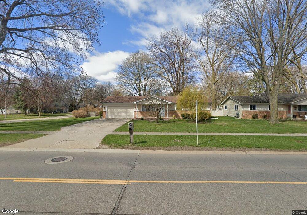
44015 Merrill Rd Sterling Heights, MI 48314
Estimated Value: $268,000 - $299,000
3
Beds
1
Bath
1,332
Sq Ft
$213/Sq Ft
Est. Value
About This Home
This home is located at 44015 Merrill Rd, Sterling Heights, MI 48314 and is currently estimated at $283,275, approximately $212 per square foot. 44015 Merrill Rd is a home located in Macomb County with nearby schools including Burr Elementary School, Frank Jeannette Junior High School, and Adlai Stevenson High School.
Ownership History
Date
Name
Owned For
Owner Type
Purchase Details
Closed on
Jul 9, 2013
Sold by
Dewilde Donna and Dewilde Donna Kay
Bought by
Dewilde Donna Kay and Dewilde Brandon Dennis
Current Estimated Value
Home Financials for this Owner
Home Financials are based on the most recent Mortgage that was taken out on this home.
Original Mortgage
$139,370
Outstanding Balance
$103,782
Interest Rate
4.5%
Mortgage Type
New Conventional
Estimated Equity
$179,493
Purchase Details
Closed on
Sep 25, 2006
Sold by
Dewilde Richard and Dewilde Donna
Bought by
Dewilde Richard and Dewilde Donna
Home Financials for this Owner
Home Financials are based on the most recent Mortgage that was taken out on this home.
Original Mortgage
$145,600
Interest Rate
6.36%
Mortgage Type
Stand Alone Refi Refinance Of Original Loan
Purchase Details
Closed on
Aug 8, 1996
Sold by
Browarski S
Bought by
Dewilde R and Dewilde D
Create a Home Valuation Report for This Property
The Home Valuation Report is an in-depth analysis detailing your home's value as well as a comparison with similar homes in the area
Home Values in the Area
Average Home Value in this Area
Purchase History
| Date | Buyer | Sale Price | Title Company |
|---|---|---|---|
| Dewilde Donna Kay | -- | None Available | |
| Dewilde Richard | -- | Enterprise Title | |
| Dewilde R | $105,000 | -- |
Source: Public Records
Mortgage History
| Date | Status | Borrower | Loan Amount |
|---|---|---|---|
| Open | Dewilde Donna Kay | $139,370 | |
| Closed | Dewilde Richard | $145,600 |
Source: Public Records
Tax History Compared to Growth
Tax History
| Year | Tax Paid | Tax Assessment Tax Assessment Total Assessment is a certain percentage of the fair market value that is determined by local assessors to be the total taxable value of land and additions on the property. | Land | Improvement |
|---|---|---|---|---|
| 2025 | $3,111 | $134,600 | $0 | $0 |
| 2024 | $2,845 | $123,000 | $0 | $0 |
| 2023 | $2,686 | $113,200 | $0 | $0 |
| 2022 | $2,800 | $102,900 | $0 | $0 |
| 2021 | $2,742 | $96,900 | $0 | $0 |
| 2020 | $2,446 | $95,700 | $0 | $0 |
| 2019 | $2,339 | $86,700 | $0 | $0 |
| 2018 | $2,534 | $79,900 | $0 | $0 |
| 2017 | $2,421 | $73,900 | $16,000 | $57,900 |
| 2016 | $2,339 | $73,900 | $0 | $0 |
| 2015 | -- | $68,800 | $0 | $0 |
| 2014 | -- | $63,000 | $0 | $0 |
Source: Public Records
Map
Nearby Homes
- 5847 Heights Dr Unit 2 / Building 1
- 5811 Heights Dr Unit 4 / Building 2
- 43739 Mound Rd
- 6063 Catalpa Ave
- 43298 Mound #206
- 43437 Mound Rd
- 6008 Burroughs Ave
- 5283 Twin Oaks Dr Unit 120
- 5793 Heights Blvd
- 5379 Twin Oaks Dr Unit 132
- 43366 Frontenac Ave Unit 513
- 43240 Frontenac Ave Unit 502
- 42389 Mound Rd
- 42401 Mound Rd
- 5820 Heights Blvd
- 5793 Heights Dr Unit 5 / Building 3
- 7474 River Vista St
- 7553 Nichols St
- 43176 Crissman Ct
- 43044 Pontchartrain Ave Unit 63
- 44031 Merrill Rd
- 6155 Stacy Ave
- 43945 Merrill Rd
- 44047 Merrill Rd
- 6152 Stacy Ave
- 6139 Stacy Ave
- 6136 Stacy Ave
- 6125 Stacy Ave
- 43925 Merrill Rd
- 6124 Stacy Ave
- 6115 Stacy Ave
- 6154 Higgins Ave
- 6148 Higgins Ave
- 6158 Higgins Ave
- 6124 Higgins Ave
- 6105 Stacy Ave
- 6167 Mulberry Dr
- 6155 Mulberry Dr
- 6143 Mulberry Dr
- 6132 Higgins Ave