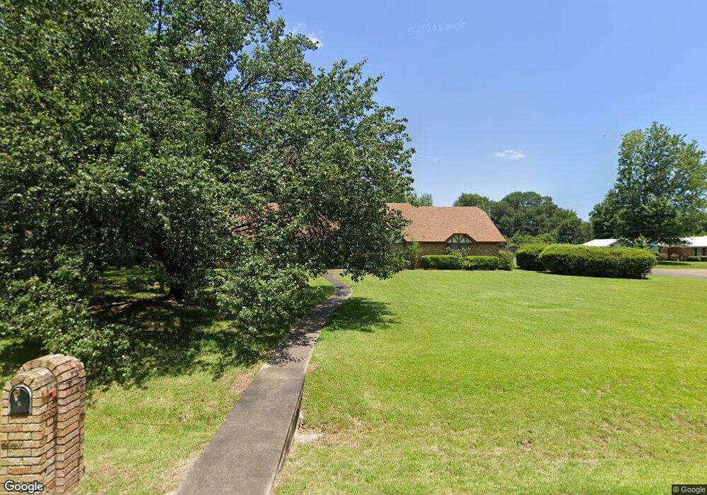
4402 Woodstock Ln Texarkana, TX 75503
Estimated Value: $270,527 - $368,000
--
Bed
--
Bath
2,442
Sq Ft
$135/Sq Ft
Est. Value
About This Home
This home is located at 4402 Woodstock Ln, Texarkana, TX 75503 and is currently estimated at $329,132, approximately $134 per square foot. 4402 Woodstock Ln is a home located in Bowie County with nearby schools including Margaret Fischer Davis Elementary School, Pleasant Grove Intermediate School, and Pleasant Grove Middle School.
Ownership History
Date
Name
Owned For
Owner Type
Purchase Details
Closed on
Mar 18, 2022
Sold by
Jeanette Cherry Marguerite
Bought by
Fugitt Barbara and Fugitt Justin
Current Estimated Value
Home Financials for this Owner
Home Financials are based on the most recent Mortgage that was taken out on this home.
Original Mortgage
$76,312
Outstanding Balance
$71,490
Interest Rate
4.16%
Mortgage Type
FHA
Estimated Equity
$257,642
Purchase Details
Closed on
Oct 14, 2008
Sold by
Caldwell Phillip L
Bought by
Smith Martha G
Create a Home Valuation Report for This Property
The Home Valuation Report is an in-depth analysis detailing your home's value as well as a comparison with similar homes in the area
Home Values in the Area
Average Home Value in this Area
Purchase History
| Date | Buyer | Sale Price | Title Company |
|---|---|---|---|
| Fugitt Barbara | -- | Twin City Title | |
| Smith Martha G | -- | Twin City Title Co |
Source: Public Records
Mortgage History
| Date | Status | Borrower | Loan Amount |
|---|---|---|---|
| Open | Fugitt Barbara | $76,312 |
Source: Public Records
Tax History Compared to Growth
Tax History
| Year | Tax Paid | Tax Assessment Tax Assessment Total Assessment is a certain percentage of the fair market value that is determined by local assessors to be the total taxable value of land and additions on the property. | Land | Improvement |
|---|---|---|---|---|
| 2025 | $4,534 | $264,085 | $25,000 | $239,085 |
| 2024 | $4,534 | $261,013 | $25,000 | $236,013 |
| 2023 | $5,585 | $248,091 | $25,000 | $223,091 |
| 2022 | $5,264 | $227,436 | $25,000 | $202,436 |
| 2021 | $5,097 | $194,891 | $24,000 | $170,891 |
| 2020 | $4,916 | $186,998 | $24,000 | $162,998 |
| 2019 | $4,841 | $179,472 | $24,000 | $155,472 |
| 2018 | $4,659 | $173,685 | $24,000 | $149,685 |
| 2017 | $4,552 | $170,151 | $24,000 | $146,151 |
| 2016 | $4,552 | $170,151 | $24,000 | $146,151 |
| 2015 | $3,380 | $172,563 | $24,000 | $148,563 |
| 2014 | $3,380 | $160,414 | $24,000 | $136,414 |
Source: Public Records
Map
Nearby Homes
- 6203 Belair Dr
- 4604 Suzanne Ave
- 5902 Richmond Rd
- 6408 Prestige Ln
- 5614 Deaton Place
- 36 Briarwood Cir
- 5617 Deaton Place
- 5619 Deaton Place
- 0 Briarwood Cir
- 6010 Shadyside Ln
- TBD Lionel Ave
- 6005 Stoneridge Dr
- 3707 Maplecrest St
- 5703 Forest Grove Rd
- 5703 Sleepy Hollow Ave
- 3703 Maplecrest St
- 6106 Sagebrush Ave
- hwy 71 N 71 N
- 0 Greenbriar Lot 14
- TBD Hidden Ac Dr Lot 17
- 4404 Woodstock Ln
- 0 Airline Dr Unit 113638
- 0 Airline Dr Unit 107295
- 0 Airline Dr Unit 107292
- 0 Airline Dr
- TBD Airline Dr
- 4311 Idalou Dr
- 4310 Idalou Dr
- 4401 Suzanne Ave
- 4401 Woodstock Ln
- 4403 Suzanne Ave
- 4309 Idalou Dr
- 4403 Woodstock Ln
- 4308 Idalou Dr
- 4311 Marcell Cir
- 4317 Jan Cir
- 4405 Suzanne Ave
- 4501 Woodstock Ln
- 4309 Marcell Cir
- W Marcell Cir