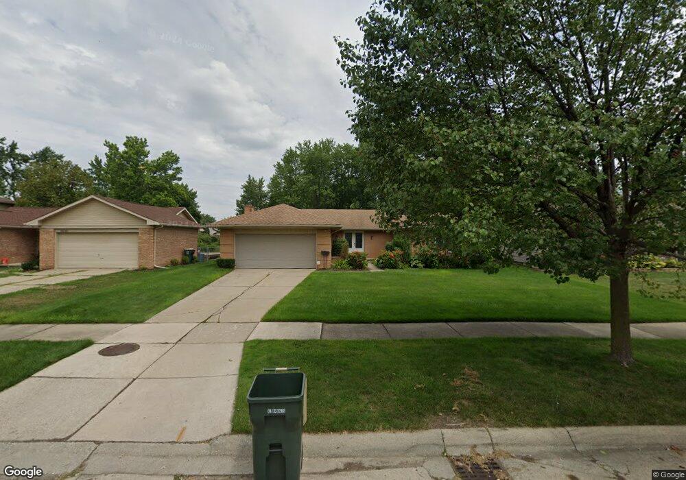
44026 N Umberland Cir Canton, MI 48187
Estimated Value: $362,000 - $380,000
3
Beds
2
Baths
1,471
Sq Ft
$251/Sq Ft
Est. Value
About This Home
This home is located at 44026 N Umberland Cir, Canton, MI 48187 and is currently estimated at $368,804, approximately $250 per square foot. 44026 N Umberland Cir is a home located in Wayne County with nearby schools including Canton High School, Discovery Middle School, and Salem High School.
Ownership History
Date
Name
Owned For
Owner Type
Purchase Details
Closed on
Aug 30, 1994
Sold by
Mazda North America Inc
Bought by
Murphy Margaret L
Current Estimated Value
Home Financials for this Owner
Home Financials are based on the most recent Mortgage that was taken out on this home.
Original Mortgage
$112,050
Interest Rate
6.5%
Mortgage Type
New Conventional
Create a Home Valuation Report for This Property
The Home Valuation Report is an in-depth analysis detailing your home's value as well as a comparison with similar homes in the area
Home Values in the Area
Average Home Value in this Area
Purchase History
| Date | Buyer | Sale Price | Title Company |
|---|---|---|---|
| Murphy Margaret L | $124,500 | -- |
Source: Public Records
Mortgage History
| Date | Status | Borrower | Loan Amount |
|---|---|---|---|
| Closed | Murphy Margaret L | $112,050 |
Source: Public Records
Tax History Compared to Growth
Tax History
| Year | Tax Paid | Tax Assessment Tax Assessment Total Assessment is a certain percentage of the fair market value that is determined by local assessors to be the total taxable value of land and additions on the property. | Land | Improvement |
|---|---|---|---|---|
| 2025 | $1,662 | $160,500 | $0 | $0 |
| 2024 | $1,662 | $152,600 | $0 | $0 |
| 2023 | $1,584 | $133,600 | $0 | $0 |
| 2022 | $3,591 | $123,800 | $0 | $0 |
| 2021 | $3,479 | $120,400 | $0 | $0 |
| 2020 | $3,425 | $113,700 | $0 | $0 |
| 2019 | $3,365 | $108,750 | $0 | $0 |
| 2018 | $1,346 | $98,730 | $0 | $0 |
| 2017 | $3,570 | $97,500 | $0 | $0 |
| 2016 | $3,090 | $94,100 | $0 | $0 |
| 2015 | $7,398 | $86,030 | $0 | $0 |
| 2013 | $7,167 | $76,680 | $0 | $0 |
| 2010 | -- | $72,130 | $35,750 | $36,380 |
Source: Public Records
Map
Nearby Homes
- 6877 Pittsford St
- 43875 Leeann Ln
- 43783 Leeann Ln
- 44018 Bannockburn Dr
- 6972 Harvard Ln
- 6986 Harvard Ln Unit 129
- 835 Coldrose Way
- 6907 Harvard Ln
- 44409 Newburyport Dr Unit 133
- 43764 Hanford Rd
- 43425 Warren Rd
- 6586 Carriage Hills Dr
- 7060 Bunkerhill Ln
- 6838 Bostonhill Ln
- 44609 Meadowcreek Ln Unit 24
- 44995 Quaker Hill Dr
- 7085 London Ct
- 43737 Westminister Way
- 44999 N Spring Dr
- 43625 Westminister Way
- 44012 N Umberland Cir
- 44054 N Umberland Cir
- 43998 N Umberland Cir Unit Bldg-Unit
- 43998 N Umberland Cir
- 7045 Pittsford St
- 7031 Pittsford St
- 44068 N Umberland Cir
- 43984 N Umberland Cir
- 7059 Pittsford St
- 7017 Pittsford St
- 44029 N Umberland Cir
- 44015 N Umberland Cir
- 44043 N Umberland Cir
- 7073 Pittsford St
- 44001 N Umberland Cir
- 7003 Pittsford St
- 44057 N Umberland Cir
- 44082 N Umberland Cir
- 43970 N Umberland Cir
- 44071 N Umberland Cir