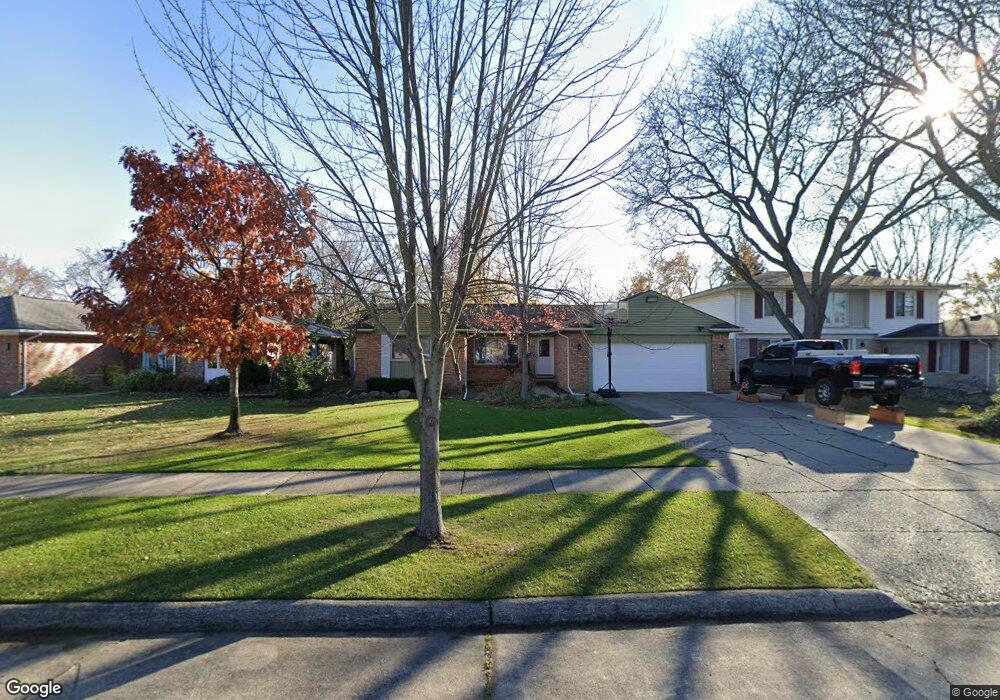
44029 S Umberland Cir Canton, MI 48187
Estimated Value: $319,000 - $363,000
3
Beds
2
Baths
1,246
Sq Ft
$272/Sq Ft
Est. Value
About This Home
This home is located at 44029 S Umberland Cir, Canton, MI 48187 and is currently estimated at $339,311, approximately $272 per square foot. 44029 S Umberland Cir is a home located in Wayne County with nearby schools including Canton High School, Discovery Middle School, and Salem High School.
Ownership History
Date
Name
Owned For
Owner Type
Purchase Details
Closed on
Nov 21, 2008
Sold by
Maxam Mark and Maxam Michelle M
Bought by
Lehoczky Michael
Current Estimated Value
Purchase Details
Closed on
May 2, 2008
Sold by
Kratos Inc
Bought by
Maxam Mark
Purchase Details
Closed on
Mar 19, 2008
Sold by
Mortgage Electronic Registration Systems
Bought by
Us Bank Na and Residential Funding Co Llc
Purchase Details
Closed on
May 30, 2007
Sold by
Stopchinski Claud
Bought by
Mortgage Electronic Registration Systems
Create a Home Valuation Report for This Property
The Home Valuation Report is an in-depth analysis detailing your home's value as well as a comparison with similar homes in the area
Home Values in the Area
Average Home Value in this Area
Purchase History
| Date | Buyer | Sale Price | Title Company |
|---|---|---|---|
| Lehoczky Michael | $135,500 | Vanguard Title Ins Agency | |
| Maxam Mark | $95,000 | E Title Agency Inc | |
| Us Bank Na | -- | E Title Agency Inc | |
| Mortgage Electronic Registration Systems | $160,650 | None Available |
Source: Public Records
Tax History Compared to Growth
Tax History
| Year | Tax Paid | Tax Assessment Tax Assessment Total Assessment is a certain percentage of the fair market value that is determined by local assessors to be the total taxable value of land and additions on the property. | Land | Improvement |
|---|---|---|---|---|
| 2025 | $1,540 | $151,100 | $0 | $0 |
| 2024 | $1,540 | $143,400 | $0 | $0 |
| 2023 | $1,468 | $125,100 | $0 | $0 |
| 2022 | $3,346 | $115,900 | $0 | $0 |
| 2021 | $3,117 | $109,800 | $0 | $0 |
| 2020 | $3,067 | $103,200 | $0 | $0 |
| 2019 | $3,014 | $98,980 | $0 | $0 |
| 2018 | $1,196 | $89,540 | $0 | $0 |
| 2017 | $3,225 | $88,700 | $0 | $0 |
| 2016 | $2,772 | $85,400 | $0 | $0 |
| 2015 | $6,573 | $77,330 | $0 | $0 |
| 2013 | $6,367 | $67,870 | $0 | $0 |
| 2010 | -- | $68,110 | $35,750 | $32,360 |
Source: Public Records
Map
Nearby Homes
- 43875 Leeann Ln
- 43783 Leeann Ln
- 6877 Pittsford St
- 44018 Bannockburn Dr
- 835 Coldrose Way
- 43764 Hanford Rd
- 6586 Carriage Hills Dr
- 6907 Harvard Ln
- 6972 Harvard Ln
- 6986 Harvard Ln Unit 129
- 44409 Newburyport Dr Unit 133
- 43737 Westminister Way
- 43425 Warren Rd
- 43625 Westminister Way
- 6838 Bostonhill Ln
- 7060 Bunkerhill Ln
- 44585 Nantucket Dr
- 44995 Quaker Hill Dr
- 43051 Fernwood St
- 45139 Indian Creek Dr
- 44015 S Umberland Cir
- 44043 S Umberland Cir
- 44001 S Umberland Cir Unit Bldg-Unit
- 44001 S Umberland Cir
- 43932 Leeann Ln
- 0 Montfort Dr
- 43918 Leeann Ln
- 43929 S Umberland Cir
- 43946 Leeann Ln
- 44028 S Umberland Cir
- 44117 S Umberland Cir
- 44042 S Umberland Cir
- 44014 S Umberland Cir
- 43904 Leeann Ln
- 43936 S Umberland Cir
- 43915 S Umberland Cir
- 43898 Leeann Ln
- 44125 S Umberland Cir
- 44112 Leeann Ln
- 6801 Montfort Dr