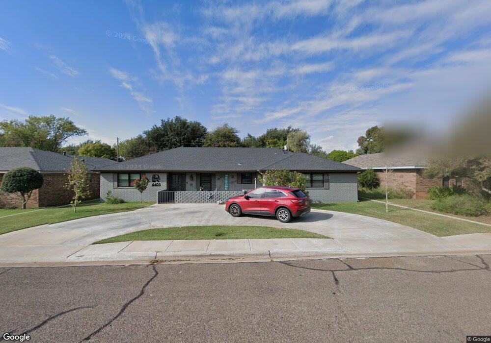
4403 Parkhurst Dr Midland, TX 79707
Skyline Terrace NeighborhoodEstimated Value: $394,292 - $439,000
--
Bed
2
Baths
2,486
Sq Ft
$165/Sq Ft
Est. Value
About This Home
This home is located at 4403 Parkhurst Dr, Midland, TX 79707 and is currently estimated at $410,573, approximately $165 per square foot. 4403 Parkhurst Dr is a home located in Midland County with nearby schools including Parker Elementary School, Alamo Junior High School, and Robert H. Goddard Junior High School.
Ownership History
Date
Name
Owned For
Owner Type
Purchase Details
Closed on
Oct 7, 2011
Sold by
Morgan Jason G and Morgan Natasha S
Bought by
Reynolds Randy Wayne and Reynolds Diana Gail
Current Estimated Value
Home Financials for this Owner
Home Financials are based on the most recent Mortgage that was taken out on this home.
Original Mortgage
$219,296
Outstanding Balance
$150,316
Interest Rate
4.28%
Mortgage Type
FHA
Estimated Equity
$260,257
Purchase Details
Closed on
Feb 28, 2005
Sold by
Gillette William L and Gillette Kim S
Bought by
Morgan Jason G and Morgan Natasha S
Home Financials for this Owner
Home Financials are based on the most recent Mortgage that was taken out on this home.
Original Mortgage
$131,000
Interest Rate
5.71%
Mortgage Type
New Conventional
Purchase Details
Closed on
Aug 1, 1983
Bought by
Reynolds Randy Wayne
Create a Home Valuation Report for This Property
The Home Valuation Report is an in-depth analysis detailing your home's value as well as a comparison with similar homes in the area
Home Values in the Area
Average Home Value in this Area
Purchase History
| Date | Buyer | Sale Price | Title Company |
|---|---|---|---|
| Reynolds Randy Wayne | -- | None Available | |
| Morgan Jason G | -- | None Available | |
| Reynolds Randy Wayne | -- | -- |
Source: Public Records
Mortgage History
| Date | Status | Borrower | Loan Amount |
|---|---|---|---|
| Open | Reynolds Randy Wayne | $219,296 | |
| Previous Owner | Morgan Jason G | $131,000 |
Source: Public Records
Tax History Compared to Growth
Tax History
| Year | Tax Paid | Tax Assessment Tax Assessment Total Assessment is a certain percentage of the fair market value that is determined by local assessors to be the total taxable value of land and additions on the property. | Land | Improvement |
|---|---|---|---|---|
| 2025 | $3,031 | $378,800 | $20,290 | $358,510 |
| 2024 | $3,038 | $384,960 | $20,290 | $364,670 |
| 2023 | $2,890 | $360,810 | $20,290 | $340,520 |
| 2022 | $5,283 | $343,820 | $20,290 | $323,530 |
| 2021 | $5,355 | $307,370 | $20,290 | $287,080 |
| 2020 | $4,229 | $298,450 | $20,290 | $278,160 |
| 2019 | $5,650 | $298,450 | $20,290 | $278,160 |
| 2018 | $5,538 | $284,820 | $20,290 | $264,530 |
| 2017 | $5,383 | $276,860 | $20,290 | $256,570 |
| 2016 | $4,970 | $255,130 | $20,290 | $234,840 |
| 2015 | -- | $253,200 | $20,290 | $232,910 |
| 2014 | -- | $245,980 | $20,290 | $225,690 |
Source: Public Records
Map
Nearby Homes
- 4512 Norwood St
- 4502 Parkhurst Dr
- 3907 Westminister Dr
- 4000 W Loop 250 N
- 4505 Westminister Dr
- 4500 Westminister Dr
- 4002 Crestwood Ave
- 4003 Compton Dr
- 4315 Lehigh Dr
- 4700 Boulder Dr Unit 710
- 4700 Boulder Dr Unit 611
- 4700 Boulder Dr Unit 103
- 4700 Boulder Dr Unit 303
- 4700 Boulder Dr Unit 1112
- 4700 Boulder Dr Unit 1504
- 4700 Boulder Dr Unit 1605
- 4700 Boulder Dr
- 4700 Boulder Dr Unit 1303
- 4700 Boulder Dr Unit 1601
- 4700 Boulder Dr Unit 902
- 4405 Parkhurst Dr
- 4401 Parkhurst Dr
- 4410 Norwood St
- 4408 Norwood St
- 4412 Norwood St
- 4407 Parkhurst Dr
- 4406 Norwood St
- 4414 Norwood St
- 4404 Parkhurst Dr
- 4404 Norwood St
- 4402 Parkhurst Dr
- 4100 Westminister Dr
- 4416 Norwood St
- 4406 Parkhurst Dr
- 4402 Norwood St
- 4102 Westminister Dr
- 4418 Norwood St
- 4010 Westminister Dr
- 4408 Parkhurst Dr
- 4104 Westminister Dr