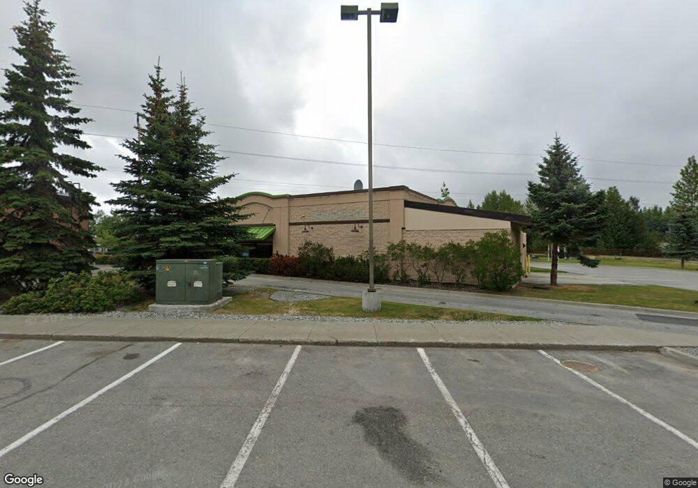
4403 Spenard Rd Anchorage, AK 99517
Spenard Neighborhood
--
Bed
--
Bath
4,726
Sq Ft
7,841
Sq Ft Lot
About This Home
This home is located at 4403 Spenard Rd, Anchorage, AK 99517. 4403 Spenard Rd is a home located in Anchorage Municipality with nearby schools including Northwood Elementary School, Romig Middle School, and West High School.
Ownership History
Date
Name
Owned For
Owner Type
Purchase Details
Closed on
Jul 30, 2021
Sold by
Palmer Park Limited Partnership
Bought by
S & A Development Llc
Home Financials for this Owner
Home Financials are based on the most recent Mortgage that was taken out on this home.
Original Mortgage
$715,000
Outstanding Balance
$650,376
Interest Rate
2.93%
Mortgage Type
Commercial
Purchase Details
Closed on
Jul 27, 2001
Sold by
Spenard Limited Partnership
Bought by
Palmer Park Limited Partnership
Purchase Details
Closed on
Jul 10, 2000
Sold by
Spenard Ltd Partnership
Bought by
Palmer Park Ltd Partnership
Create a Home Valuation Report for This Property
The Home Valuation Report is an in-depth analysis detailing your home's value as well as a comparison with similar homes in the area
Home Values in the Area
Average Home Value in this Area
Purchase History
| Date | Buyer | Sale Price | Title Company |
|---|---|---|---|
| S & A Development Llc | -- | None Listed On Document | |
| Palmer Park Limited Partnership | -- | -- | |
| Palmer Park Limited Partnership | -- | -- | |
| Palmer Park Ltd Partnership | -- | First American Title |
Source: Public Records
Mortgage History
| Date | Status | Borrower | Loan Amount |
|---|---|---|---|
| Open | S & A Development Llc | $715,000 |
Source: Public Records
Tax History Compared to Growth
Tax History
| Year | Tax Paid | Tax Assessment Tax Assessment Total Assessment is a certain percentage of the fair market value that is determined by local assessors to be the total taxable value of land and additions on the property. | Land | Improvement |
|---|---|---|---|---|
| 2025 | $9,222 | $631,700 | $168,900 | $462,800 |
| 2024 | $9,222 | $571,200 | $168,900 | $402,300 |
| 2023 | $9,477 | $556,500 | $162,400 | $394,100 |
| 2022 | $9,329 | $554,000 | $152,400 | $401,600 |
| 2021 | $10,113 | $561,200 | $149,400 | $411,800 |
| 2020 | $10,192 | $599,500 | $146,400 | $453,100 |
| 2019 | $9,911 | $605,800 | $143,500 | $462,300 |
| 2018 | $9,784 | $596,600 | $143,500 | $453,100 |
| 2017 | $9,311 | $594,600 | $143,500 | $451,100 |
| 2016 | $8,514 | $584,600 | $143,500 | $441,100 |
| 2015 | $8,514 | $573,500 | $143,500 | $430,000 |
| 2014 | $8,514 | $568,400 | $143,500 | $424,900 |
Source: Public Records
Map
Nearby Homes
- 4302 Forrest Rd
- 2808 Iris Dr
- 3913 Barbara Dr
- NHN Northwood Dr
- 5000 Northwood Dr
- 4000 Iowa Dr
- 3333 Lakeshore Dr Unit 5
- 3333 Lakeshore Dr Unit 2
- 3900 Crosson Dr
- 2201 W 47th Ave
- 2815 W International Airport Rd Unit B104
- 2891 W Intl Airport Rd Unit C108
- 2820 Wiley Post Ave
- 2202 Lincoln Ave
- 2101 W 47th Ave
- 2925 W 36th Ave
- 2040 Wenmatt Cir
- 2702 Mcrae Rd
- 3517 Vintage Cir
- 3516 Vintage Cir
- 4407 Spenard Rd
- 4411 Spenard Rd
- 4411 Spenard Rd
- 4406 Forrest Rd
- 4400 Forrest Rd
- 4404 Forrest Rd Unit 2
- 4404 Forrest Rd
- 4402 Forrest Rd
- 4408 Forrest Rd
- 4404 Forest Rd
- 4505 Spenard Rd Unit C
- 4505 Spenard Rd Unit D
- 4505 Spenard Rd Unit B
- 4505 Spenard Rd Unit A
- 4304 Forrest Rd
- 4400 Spenard Rd
- 4302 Forrest Rd
- 4360 Spenard Rd
- 2903 Iris Dr
- 2901 Iris Dr