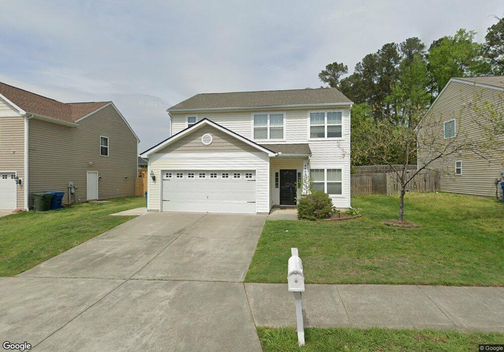
4405 Broomstraw Ct Durham, NC 27704
Northeast Durham NeighborhoodEstimated Value: $369,000 - $418,000
About This Home
This home is located at 4405 Broomstraw Ct, Durham, NC 27704 and is currently estimated at $390,683, approximately $201 per square foot. 4405 Broomstraw Ct is a home located in Durham County with nearby schools including Glenn Elementary, John W Neal Middle School, and Southern School of Energy & Sustainability.
Ownership History
We collect this data history from publicly available records. To have your information removed, we recommend requesting removal directly through your county’s website.
Purchase Details
Home Financials for this Owner
Home Financials are based on the most recent Mortgage that was taken out on this home.Purchase Details
Home Financials for this Owner
Home Financials are based on the most recent Mortgage that was taken out on this home.Home Values in the Area
Average Home Value in this Area
Purchase History
We collect this data history from publicly available records. To have your information removed, we recommend requesting removal directly through your county’s website.
| Date | Buyer | Sale Price | Title Company |
|---|---|---|---|
| $220,000 | None Available | ||
| $147,000 | Attorney |
Mortgage History
We collect this data history from publicly available records. To have your information removed, we recommend requesting removal directly through your county’s website.
| Date | Status | Borrower | Loan Amount |
|---|---|---|---|
| Open | $216,015 | ||
| Previous Owner | $179,742 |
Tax History
We collect this data history from publicly available records. To have your information removed, we recommend requesting removal directly through your county’s website.
| Year | Tax Paid | Tax Assessment Tax Assessment Total Assessment is a certain percentage of the fair market value that is determined by local assessors to be the total taxable value of land and additions on the property. | Land | Improvement |
|---|---|---|---|---|
| 2025 | $4,016 | $405,112 | $73,750 | $331,362 |
| 2024 | $2,939 | $210,708 | $35,370 | $175,338 |
| 2023 | $2,760 | $210,708 | $35,370 | $175,338 |
| 2022 | $2,697 | $210,708 | $35,370 | $175,338 |
| 2021 | $2,684 | $210,708 | $35,370 | $175,338 |
| 2020 | $2,621 | $210,708 | $35,370 | $175,338 |
| 2019 | $2,621 | $210,708 | $35,370 | $175,338 |
| 2018 | $2,266 | $167,083 | $29,475 | $137,608 |
| 2017 | $2,250 | $167,083 | $29,475 | $137,608 |
| 2016 | $2,174 | $167,083 | $29,475 | $137,608 |
| 2015 | $2,745 | $198,299 | $32,662 | $165,637 |
| 2014 | $2,745 | $198,299 | $32,662 | $165,637 |
Map
- 2830 Tulip Poplar Cir
- 2810 Catamount Ct
- 4109 Endor Ln
- 3519 E Geer St
- 2805 Redwood #4b Rd
- 613 Timber Terrace Dr
- 2917 Redwood Rd
- 611 Timber Terrace Dr
- 1138 Sawmill Grove Dr
- 2616 Bullock Rd
- 1142 Sawmill Grove Dr
- 605 Timber Terrace Dr
- 610 Timber Terrace Dr
- 1144 Sawmill Grove Dr
- 2805 Redwood Rd
- 1135 Sawmill Grove Dr
- 1131 Sawmill Grove Dr
- 607 Timber Terrace Dr
- 1113 Sawmill Grove Dr
- 3022 Hammer Creek Rd
- 4405 Broomstraw Ct
- 4403 Broomstraw Ct
- 4407 Broomstraw Ct
- 2935 Cherrybark Dr
- 4401 Broomstraw Ct
- 2933 Cherrybark Dr
- 2602 Tulip Poplar Cir
- 3013 Stone Fence Ct
- 2604 Tulip Poplar Cir
- 2512 Tulip Poplar Cir
- 4303 Broomstraw Ct
- 3011 Stone Fence Ct
- 2931 Cherrybark Dr
- 2510 Tulip Poplar Cir
- 4301 Broomstraw Ct
- 2936 Cherrybark Dr
- 3009 Stone Fence Ct
- 2508 Tulip Poplar Cir
- 3012 Stone Fence Ct
- 2603 Cooksbury Dr
Ask me questions while you tour the home.