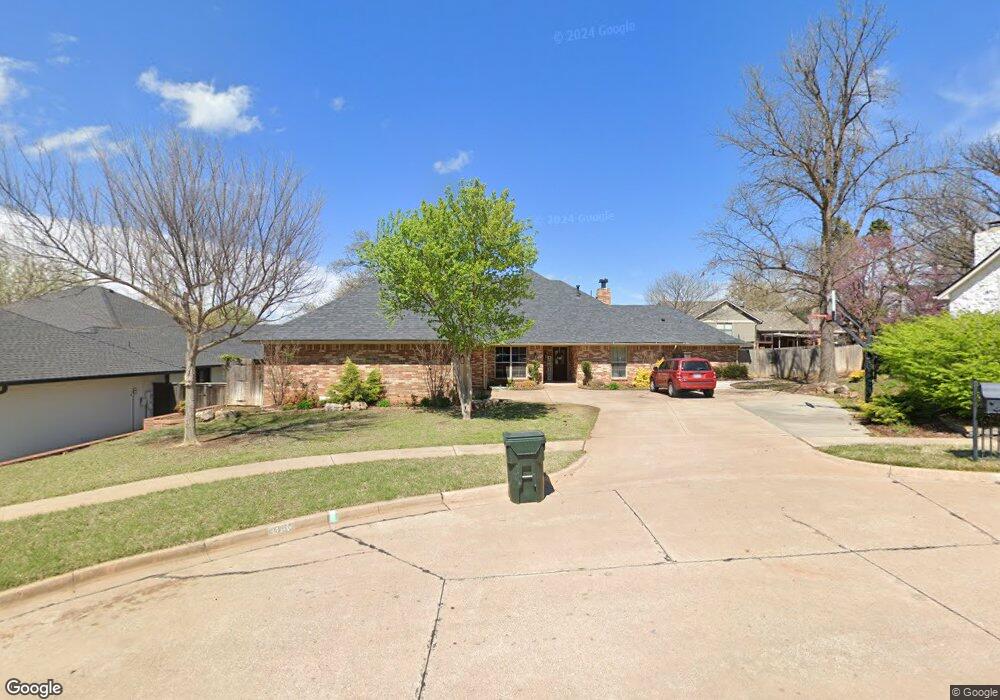
4405 Saint Andrews Ct Norman, OK 73072
Northwest Norman NeighborhoodEstimated Value: $398,000 - $473,000
4
Beds
3
Baths
3,057
Sq Ft
$144/Sq Ft
Est. Value
About This Home
This home is located at 4405 Saint Andrews Ct, Norman, OK 73072 and is currently estimated at $438,987, approximately $143 per square foot. 4405 Saint Andrews Ct is a home located in Cleveland County with nearby schools including Cleveland Elementary School, Whittier Middle School, and Norman North High School.
Ownership History
Date
Name
Owned For
Owner Type
Purchase Details
Closed on
Jan 17, 2018
Sold by
Roney John C
Bought by
Roney Family Revocable Trust
Current Estimated Value
Purchase Details
Closed on
Dec 9, 2013
Sold by
Morgan Steven K and Morgan Sherry E
Bought by
Roney John C
Home Financials for this Owner
Home Financials are based on the most recent Mortgage that was taken out on this home.
Original Mortgage
$192,000
Outstanding Balance
$143,110
Interest Rate
4.14%
Mortgage Type
New Conventional
Estimated Equity
$295,877
Create a Home Valuation Report for This Property
The Home Valuation Report is an in-depth analysis detailing your home's value as well as a comparison with similar homes in the area
Home Values in the Area
Average Home Value in this Area
Purchase History
| Date | Buyer | Sale Price | Title Company |
|---|---|---|---|
| Roney Family Revocable Trust | -- | None Available | |
| Roney John C | $240,000 | Fatco |
Source: Public Records
Mortgage History
| Date | Status | Borrower | Loan Amount |
|---|---|---|---|
| Open | Roney John C | $192,000 |
Source: Public Records
Tax History Compared to Growth
Tax History
| Year | Tax Paid | Tax Assessment Tax Assessment Total Assessment is a certain percentage of the fair market value that is determined by local assessors to be the total taxable value of land and additions on the property. | Land | Improvement |
|---|---|---|---|---|
| 2024 | $3,542 | $30,565 | $6,356 | $24,209 |
| 2023 | $3,443 | $29,674 | $6,355 | $23,319 |
| 2022 | $3,203 | $28,810 | $4,800 | $24,010 |
| 2021 | $3,377 | $28,810 | $4,800 | $24,010 |
| 2020 | $3,304 | $28,810 | $4,800 | $24,010 |
| 2019 | $3,361 | $28,810 | $4,800 | $24,010 |
| 2018 | $3,259 | $28,811 | $4,800 | $24,011 |
| 2017 | $3,296 | $28,811 | $0 | $0 |
| 2016 | $3,350 | $28,811 | $4,800 | $24,011 |
| 2015 | $3,153 | $27,991 | $3,980 | $24,011 |
| 2014 | $3,301 | $27,991 | $3,980 | $24,011 |
Source: Public Records
Map
Nearby Homes
- 4511 Polo Ridge Cir
- 4506 Alexander Ct
- 4208 Briarcrest Dr
- 1406 Broad Acres Dr
- 1816 Robin Ridge Dr
- 1402 Broad Acres Dr
- 4409 Hidden Hill Rd
- 4420 Trophy Dr
- 3926 Briarcrest Dr
- 1899 Saddleback Blvd Unit 14
- 1822 Brookhaven Blvd
- 3921 Coventry Ln
- 3801 Waverly Ct
- 4107 Northhampton Dr
- 4211 Blue Sage Rd
- 2010 Saddleback Blvd
- 2105 Wyckham Place
- 4609 Summerfield Ct
- 1005 Bentbrook Place
- 4320 Hunters Hill Rd
- 4409 Saint Andrews Ct
- 4401 Saint Andrews Ct
- 4406 Oxford Way
- 4413 Saint Andrews Ct
- 4316 Oxford Way
- 4400 Saint Andrews Ct
- 1605 Winding Ridge Rd
- 4408 Saint Andrews Ct
- 4404 Saint Andrews Ct
- 4412 Saint Andrews Ct
- 4312 Oxford Way
- 4238 Brookview
- 4235 Brookview
- 4405 Oxford Way
- 4401 Oxford Way
- 4319 Oxford Way
- 4409 Oxford Way
- 1604 Winding Ridge Rd
- 1600 Winding Ridge Rd
- 4310 Oxford Way