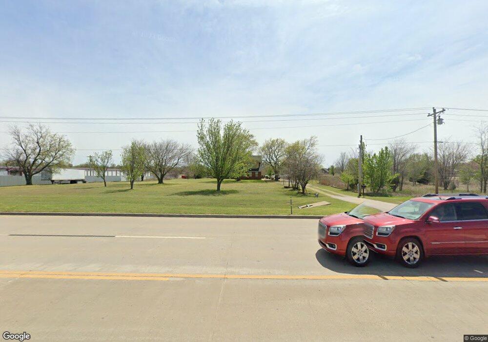
4406 E Highway 20 Claremore, OK 74019
Estimated Value: $341,000 - $459,000
4
Beds
3
Baths
2,522
Sq Ft
$158/Sq Ft
Est. Value
About This Home
This home is located at 4406 E Highway 20, Claremore, OK 74019 and is currently estimated at $398,680, approximately $158 per square foot. 4406 E Highway 20 is a home with nearby schools including Pamela Hodson Elementary School, Owasso 6th Grade Center, and Owasso 8th Grade Center.
Ownership History
Date
Name
Owned For
Owner Type
Purchase Details
Closed on
Aug 18, 2025
Sold by
George S Fullerton Family Trust and Rainwater Linda
Bought by
Skyview Properties Llc
Current Estimated Value
Purchase Details
Closed on
Aug 23, 2024
Sold by
Tallman Timothy J
Bought by
Roberts Randy D and Roberts Carol A
Purchase Details
Closed on
Mar 24, 2005
Sold by
Tallman Timothy J and Tallman Denise L
Bought by
Department Of Transportation
Create a Home Valuation Report for This Property
The Home Valuation Report is an in-depth analysis detailing your home's value as well as a comparison with similar homes in the area
Home Values in the Area
Average Home Value in this Area
Purchase History
| Date | Buyer | Sale Price | Title Company |
|---|---|---|---|
| Skyview Properties Llc | -- | None Listed On Document | |
| Roberts Randy D | $350,000 | None Listed On Document | |
| Department Of Transportation | -- | None Available |
Source: Public Records
Tax History Compared to Growth
Tax History
| Year | Tax Paid | Tax Assessment Tax Assessment Total Assessment is a certain percentage of the fair market value that is determined by local assessors to be the total taxable value of land and additions on the property. | Land | Improvement |
|---|---|---|---|---|
| 2025 | $2,136 | $38,500 | $16,769 | $21,731 |
| 2024 | $2,136 | $20,230 | $5,803 | $14,427 |
| 2023 | $2,136 | $19,640 | $5,543 | $14,097 |
| 2022 | $2,042 | $19,069 | $5,061 | $14,008 |
| 2021 | $1,958 | $19,069 | $4,979 | $14,090 |
| 2020 | $1,897 | $18,513 | $4,681 | $13,832 |
| 2019 | $1,839 | $17,975 | $4,463 | $13,512 |
| 2018 | $1,726 | $17,451 | $4,098 | $13,353 |
| 2017 | $1,688 | $16,450 | $3,536 | $12,914 |
| 2016 | $1,637 | $15,970 | $3,258 | $12,712 |
| 2015 | $1,596 | $15,505 | $2,968 | $12,537 |
| 2014 | $1,560 | $15,054 | $2,666 | $12,388 |
Source: Public Records
Map
Nearby Homes
- 11743 N 194th East Ave
- 11610 N 191st East Place
- 11671 N 191st Ave E
- 12047 N 193rd East Ave
- 11855 Gunsmoke Dr
- 12225 N 194th East Ave
- 11381 N 209th E
- 4728 E Hwy 20
- 19914 E 126th St N
- 4608 E 472 Rd
- 20624 S Brentwood Ave
- 20823 S Concord Ave
- 20603 S Concord Ave
- 20932 S Addison Ave
- 5132 E Madison St
- 5113 E Madison St
- 20903 S Richmond Ave
- 5226 E Madison St
- 5207 E Brookhaven St
- 0 Hobbs Creek Dr Unit 2541616
- 4354 E Highway 20
- 0 E 116th St N Unit 1837604
- 0 E 116th St N Unit 1912589
- 0 E 116th St N Unit 1936086
- 13712 Cozy Corner Rd
- 4252 E Highway 20
- 11619 N 195th
- 19412 E 116th St N
- 19424 E 116th St N
- 11623 N 195th East Ave
- 11602 N 195th Ave E
- 11641 N 195th East Ave
- 11641 N 195th Ave E
- 11609 N 194th East Ave
- 11611 N 194th East Ave
- 11624 N 195th East Ave
- 11621 N 194th East Ave
- 11611 N 194th Ave E
- 6917 N 194th E Ave
- 0 N 195th Ave Unit 1709944
