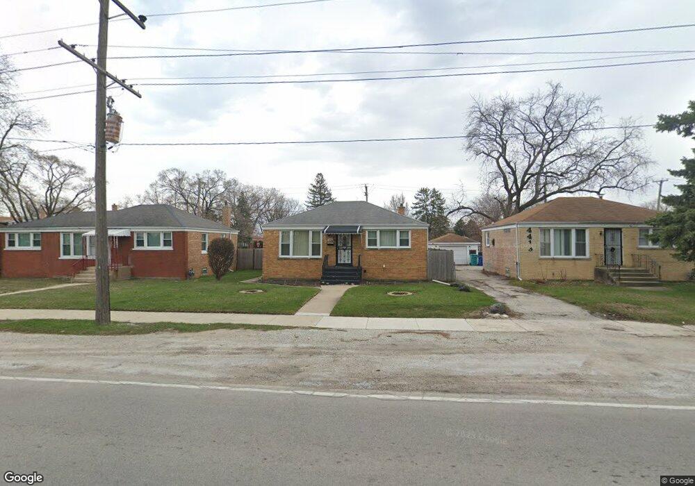
4409 Butterfield Rd Hillside, IL 60162
Estimated Value: $192,000 - $246,362
2
Beds
1
Bath
858
Sq Ft
$264/Sq Ft
Est. Value
About This Home
This home is located at 4409 Butterfield Rd, Hillside, IL 60162 and is currently estimated at $226,091, approximately $263 per square foot. 4409 Butterfield Rd is a home located in Cook County with nearby schools including Jefferson Primary School, Macarthur Intermediate School, and Proviso West High School.
Ownership History
Date
Name
Owned For
Owner Type
Purchase Details
Closed on
Nov 16, 1999
Sold by
Dunn Daniel W and Dunn Carolyn R
Bought by
Scott Ronald and Smith Leona
Current Estimated Value
Home Financials for this Owner
Home Financials are based on the most recent Mortgage that was taken out on this home.
Original Mortgage
$115,160
Interest Rate
8.26%
Mortgage Type
FHA
Create a Home Valuation Report for This Property
The Home Valuation Report is an in-depth analysis detailing your home's value as well as a comparison with similar homes in the area
Home Values in the Area
Average Home Value in this Area
Purchase History
| Date | Buyer | Sale Price | Title Company |
|---|---|---|---|
| Scott Ronald | $116,000 | -- |
Source: Public Records
Mortgage History
| Date | Status | Borrower | Loan Amount |
|---|---|---|---|
| Previous Owner | Scott Ronald | $115,160 |
Source: Public Records
Tax History Compared to Growth
Tax History
| Year | Tax Paid | Tax Assessment Tax Assessment Total Assessment is a certain percentage of the fair market value that is determined by local assessors to be the total taxable value of land and additions on the property. | Land | Improvement |
|---|---|---|---|---|
| 2024 | $3,568 | $10,277 | $1,650 | $8,627 |
| 2023 | $3,053 | $10,277 | $1,650 | $8,627 |
| 2022 | $3,053 | $8,161 | $1,425 | $6,736 |
| 2021 | $3,082 | $8,160 | $1,425 | $6,735 |
| 2020 | $3,183 | $8,571 | $1,425 | $7,146 |
| 2019 | $1,667 | $5,320 | $1,275 | $4,045 |
| 2018 | $1,647 | $5,321 | $1,275 | $4,046 |
| 2017 | $1,887 | $5,994 | $1,275 | $4,719 |
| 2016 | $1,687 | $5,050 | $1,125 | $3,925 |
| 2015 | $1,623 | $5,050 | $1,125 | $3,925 |
| 2014 | $1,606 | $5,050 | $1,125 | $3,925 |
| 2013 | $1,776 | $5,857 | $1,125 | $4,732 |
Source: Public Records
Map
Nearby Homes
- 529 49th Ave
- 549 51st Ave
- 543 Geneva Ave Unit 104A
- 425 47th Ave
- 502 Clayton Rd
- 408 51st Ave
- 417 Hyde Park Ave
- 429 Geneva Ave
- 4718 Butterfield Rd
- 330 Geneva Ave
- 514 Iroquois Rd
- 327 Geneva Ave
- 307 Geneva Ave
- 605 N Wolf Rd Unit B9
- 605 N Wolf Rd Unit C12
- 520 N Wolf Rd Unit 301
- 241 51st Ave
- 3914 Madison St
- 3900 Saint Paul Ave
- 1509 Morris Ave
- 4409 Butterfield Rd
- 4405 Butterfield Rd
- 4405 Butterfield Rd
- 4413 Butterfield Rd
- 4413 Butterfield Rd
- 458 N Forest Ave
- 4417 Butterfield Rd
- 4417 Butterfield Rd
- 4356 Warren Ave
- 4353 Butterfield Rd
- 4418 Butterfield Rd
- 4421 Butterfield Rd
- 4421 Butterfield Rd
- 456 N Forest Ave
- 457 N Jackson Blvd
- 4354 Warren Ave Unit 2
- 4354 Warren Ave
- 4351 Butterfield Rd
- 4350 Warren Ave Unit 2
- 4350 Warren Ave Unit 3