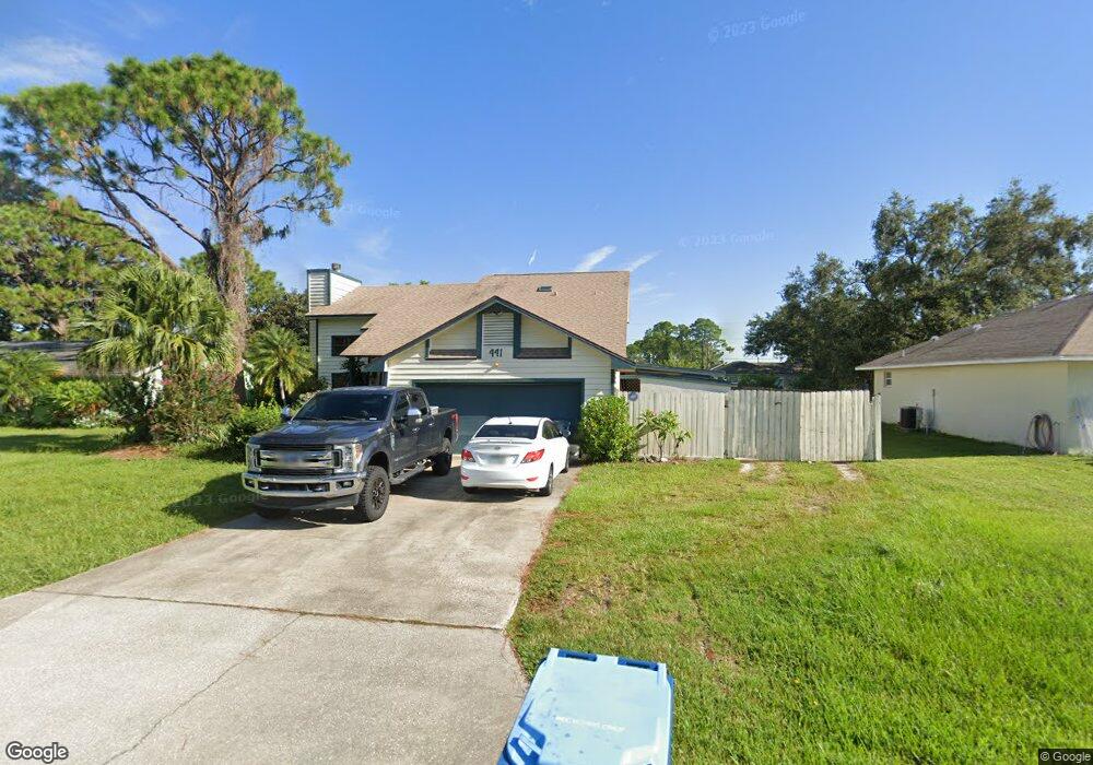
441 Brookedge St NE Palm Bay, FL 32907
Estimated Value: $272,000 - $313,000
3
Beds
2
Baths
1,574
Sq Ft
$183/Sq Ft
Est. Value
About This Home
This home is located at 441 Brookedge St NE, Palm Bay, FL 32907 and is currently estimated at $287,728, approximately $182 per square foot. 441 Brookedge St NE is a home located in Brevard County with nearby schools including Christa McAuliffe Elementary School, Southwest Middle School, and Palm Bay Magnet Senior High School.
Ownership History
Date
Name
Owned For
Owner Type
Purchase Details
Closed on
Oct 11, 2021
Sold by
Daniel Jeffrey
Bought by
Jeffrey Daniel and Jeffrey Laura
Current Estimated Value
Purchase Details
Closed on
Apr 11, 2005
Sold by
Jeffrey Daniel and Satira Diane
Bought by
Jeffrey Daniel
Purchase Details
Closed on
Aug 2, 1993
Sold by
Secretary Veterans Affairs
Bought by
Jeffrey Daniel T and Jeffrey Diana M
Home Financials for this Owner
Home Financials are based on the most recent Mortgage that was taken out on this home.
Original Mortgage
$74,550
Interest Rate
7.26%
Create a Home Valuation Report for This Property
The Home Valuation Report is an in-depth analysis detailing your home's value as well as a comparison with similar homes in the area
Home Values in the Area
Average Home Value in this Area
Purchase History
| Date | Buyer | Sale Price | Title Company |
|---|---|---|---|
| Jeffrey Daniel | $58,000 | Equity Settlement Services Inc | |
| Jeffrey Daniel | -- | -- | |
| Jeffrey Daniel T | $75,200 | -- |
Source: Public Records
Mortgage History
| Date | Status | Borrower | Loan Amount |
|---|---|---|---|
| Previous Owner | Jeffrey Daniel T | $74,550 |
Source: Public Records
Tax History Compared to Growth
Tax History
| Year | Tax Paid | Tax Assessment Tax Assessment Total Assessment is a certain percentage of the fair market value that is determined by local assessors to be the total taxable value of land and additions on the property. | Land | Improvement |
|---|---|---|---|---|
| 2025 | $1,001 | $93,700 | -- | -- |
| 2024 | $961 | $91,060 | -- | -- |
| 2023 | $961 | $88,410 | $0 | $0 |
| 2022 | $894 | $85,840 | $0 | $0 |
| 2021 | $892 | $83,340 | $0 | $0 |
| 2020 | $869 | $82,190 | $0 | $0 |
| 2019 | $1,006 | $80,350 | $0 | $0 |
| 2018 | $982 | $78,860 | $0 | $0 |
| 2017 | $992 | $77,240 | $0 | $0 |
| 2016 | $806 | $75,660 | $7,500 | $68,160 |
| 2015 | $818 | $75,140 | $7,000 | $68,140 |
| 2014 | $823 | $74,550 | $5,400 | $69,150 |
Source: Public Records
Map
Nearby Homes
- 426 Almansa St NE
- 177 Chicory Ave NE
- 481 Almansa St NE
- 147 Oakcrest Ave NE
- 357 Brookedge St NE
- 170 Chestnut Ave NE
- 128 Crown Ave NE
- 626 Almansa St NE
- 265 Delmonico St NE
- 450 di Lido St NE
- 627 Binney St NE
- 521 Dinner St NE
- 171 Battersea Ave NE
- 200 Delmonico St NE
- 328 Malabar Rd SE
- 650 Binney St NE
- 325 Eva St NE
- 122 Anderson Ave NE
- 372 Croquet Ave NE
- 162 Anderson Ave NE
- 449 Brookedge St NE
- 433 Brookedge St NE
- 116 Frante Ave NE
- 457 Brookedge St NE
- 425 Brookedge St NE
- 194 Frante Ave NE
- 195 Chicory Ave NE
- 430 Almansa St NE
- 420 Almansa St NE
- 436 Almansa St NE
- 416 Almansa St NE
- 465 Brookedge St NE
- 417 Brookedge St NE
- 188 Frante Ave NE
- 195 Frante Ave NE
- 440 Almansa St NE
- 410 Almansa St NE
- 188 Chicory Ave NE
- 473 Brookedge St NE
- 189 Frante Ave NE