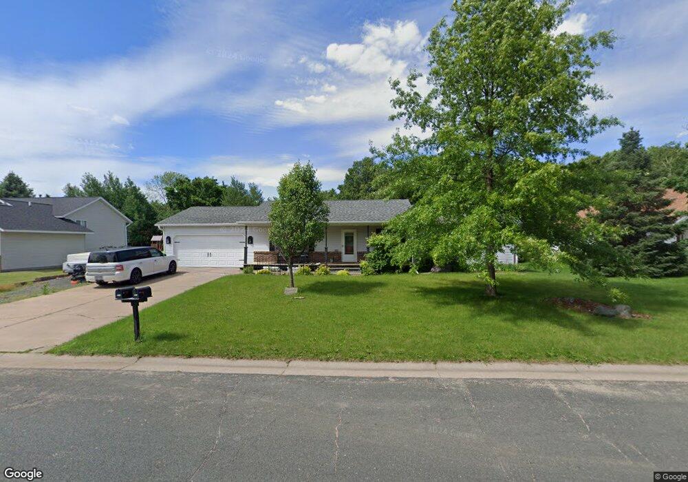
441 Chestnut Dr New Richmond, WI 54017
Estimated Value: $364,000 - $390,000
3
Beds
3
Baths
2,428
Sq Ft
$157/Sq Ft
Est. Value
About This Home
This home is located at 441 Chestnut Dr, New Richmond, WI 54017 and is currently estimated at $380,720, approximately $156 per square foot. 441 Chestnut Dr is a home located in St. Croix County with nearby schools including New Richmond High School and St. Mary School.
Ownership History
Date
Name
Owned For
Owner Type
Purchase Details
Closed on
Sep 30, 2022
Sold by
Strawn Troy G and Strawn Gayle C
Bought by
Bressler-Cutsforth Thomas W and Bressler-Cutsforth Kate L
Current Estimated Value
Home Financials for this Owner
Home Financials are based on the most recent Mortgage that was taken out on this home.
Original Mortgage
$250,000
Outstanding Balance
$239,727
Interest Rate
5.55%
Mortgage Type
New Conventional
Estimated Equity
$140,993
Create a Home Valuation Report for This Property
The Home Valuation Report is an in-depth analysis detailing your home's value as well as a comparison with similar homes in the area
Home Values in the Area
Average Home Value in this Area
Purchase History
| Date | Buyer | Sale Price | Title Company |
|---|---|---|---|
| Bressler-Cutsforth Thomas W | $340,000 | St Croix County Abstract & Tit |
Source: Public Records
Mortgage History
| Date | Status | Borrower | Loan Amount |
|---|---|---|---|
| Open | Bressler-Cutsforth Thomas W | $250,000 |
Source: Public Records
Tax History Compared to Growth
Tax History
| Year | Tax Paid | Tax Assessment Tax Assessment Total Assessment is a certain percentage of the fair market value that is determined by local assessors to be the total taxable value of land and additions on the property. | Land | Improvement |
|---|---|---|---|---|
| 2024 | $50 | $349,200 | $29,000 | $320,200 |
| 2023 | $4,332 | $340,000 | $29,000 | $311,000 |
| 2022 | $3,787 | $279,000 | $29,000 | $250,000 |
| 2021 | $3,770 | $253,500 | $29,000 | $224,500 |
| 2020 | $3,823 | $164,000 | $20,500 | $143,500 |
| 2019 | $3,642 | $164,000 | $20,500 | $143,500 |
| 2018 | $3,683 | $164,000 | $20,500 | $143,500 |
| 2017 | $3,535 | $164,000 | $20,500 | $143,500 |
| 2016 | $3,535 | $164,000 | $20,500 | $143,500 |
| 2015 | $3,597 | $164,000 | $20,500 | $143,500 |
| 2014 | $3,508 | $164,000 | $20,500 | $143,500 |
| 2013 | $3,439 | $164,000 | $20,500 | $143,500 |
Source: Public Records
Map
Nearby Homes
- 619 Chestnut Dr
- 637 Maple Ct
- 425 W 8th St Unit 23
- 425 W 8th St Unit 24
- 425 W 8th St Unit 19
- 425 W 8th St Unit 20
- 425 W 8th St Unit 22
- 425 W 8th St Unit 21
- 1016 W Ridge Ct
- 941 W Edge Place Unit 14
- 1141 Pinewood Trail
- 1343 Creekwood Dr
- 1050 Pheasant Run
- 1272 Pheasant Run
- 1131 Alfred Place
- 1208 Tierney Dr
- 114 E 6th St Unit A
- 548 W 4th St
- 1142 W Edge Place
- 1422 Creekwood Dr
- 427 Chestnut Dr
- 444 Chestnut Dr
- 509 Chestnut Dr
- 415 Chestnut Dr
- 424 Chestnut Dr
- 506 Chestnut Dr
- 408 Chestnut Dr
- 521 Chestnut Dr
- 514 Chestnut Dr
- 401 Chestnut Dr
- 443 Laurel Dr
- 425 Laurel Dr
- 457 Laurel Dr
- 530 Chestnut Dr
- 543 Chestnut Dr
- 515 Laurel Dr
- 1107 Circle Pine Dr
- 1120 Circle Pine Dr
- 531 Laurel Dr
- 1170 Circle Pine Dr