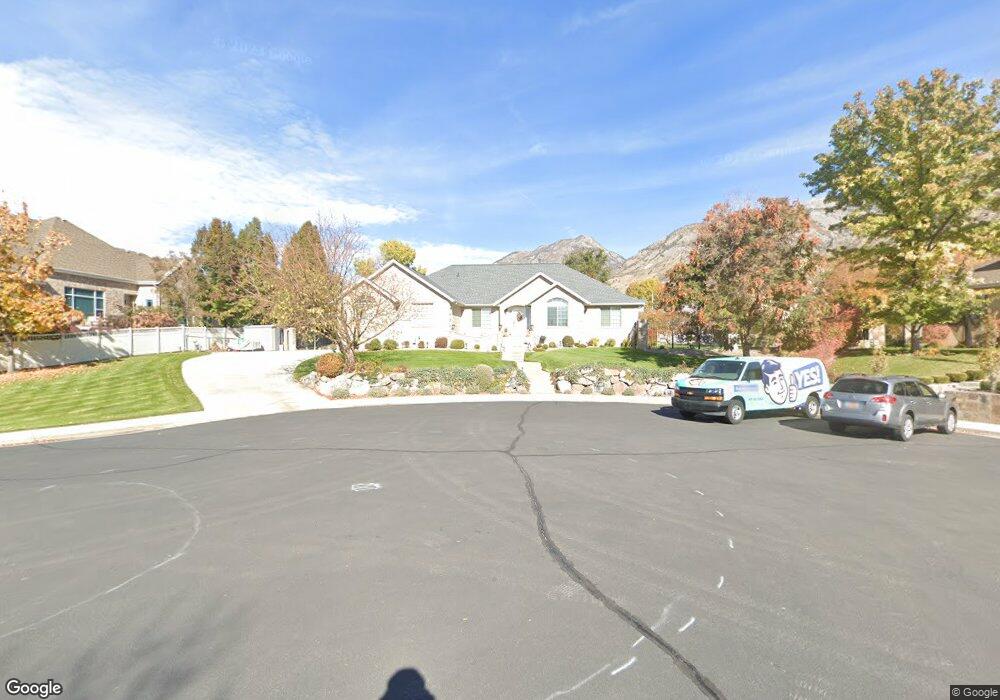
441 E 760 N Unit 27 Lindon, UT 84042
Estimated Value: $819,905 - $1,007,000
3
Beds
4
Baths
2,230
Sq Ft
$399/Sq Ft
Est. Value
About This Home
This home is located at 441 E 760 N Unit 27, Lindon, UT 84042 and is currently estimated at $890,226, approximately $399 per square foot. 441 E 760 N Unit 27 is a home located in Utah County with nearby schools including Lindon Elementary School, Oak Canyon Junior High School, and Pleasant Grove High School.
Ownership History
Date
Name
Owned For
Owner Type
Purchase Details
Closed on
Sep 17, 2024
Sold by
Burns Stephen R
Bought by
Burns Family Revocable Trust and Burns
Current Estimated Value
Home Financials for this Owner
Home Financials are based on the most recent Mortgage that was taken out on this home.
Original Mortgage
$400,000
Outstanding Balance
$395,504
Interest Rate
6.47%
Mortgage Type
Credit Line Revolving
Estimated Equity
$494,722
Purchase Details
Closed on
Feb 11, 2021
Sold by
Burns Stpehen R and Burns Andrea
Bought by
Burns Stephen R and Burns Andrea
Home Financials for this Owner
Home Financials are based on the most recent Mortgage that was taken out on this home.
Original Mortgage
$470,000
Interest Rate
2.6%
Mortgage Type
Credit Line Revolving
Purchase Details
Closed on
Apr 16, 2019
Sold by
Burns Stephen and Burns Andrea
Bought by
Burns Stephen R and Burns Andrea
Purchase Details
Closed on
Apr 20, 2012
Sold by
Burns Stephen
Bought by
Burns Stephen and Burns Andria
Home Financials for this Owner
Home Financials are based on the most recent Mortgage that was taken out on this home.
Original Mortgage
$295,000
Interest Rate
3.9%
Mortgage Type
New Conventional
Purchase Details
Closed on
Dec 27, 2002
Sold by
Burns Stephen
Bought by
Burns Stephen and Burns Andrea
Home Financials for this Owner
Home Financials are based on the most recent Mortgage that was taken out on this home.
Original Mortgage
$246,500
Interest Rate
5.96%
Mortgage Type
Balloon
Purchase Details
Closed on
Jan 12, 1999
Sold by
Hardcastle C Brent and Hardcastle Homes
Bought by
Burns Stephen and Burns Andrea
Home Financials for this Owner
Home Financials are based on the most recent Mortgage that was taken out on this home.
Original Mortgage
$227,000
Interest Rate
6.63%
Purchase Details
Closed on
Mar 31, 1998
Sold by
Lad Enterprises L C
Bought by
Hardcastle Homes
Create a Home Valuation Report for This Property
The Home Valuation Report is an in-depth analysis detailing your home's value as well as a comparison with similar homes in the area
Home Values in the Area
Average Home Value in this Area
Purchase History
| Date | Buyer | Sale Price | Title Company |
|---|---|---|---|
| Burns Family Revocable Trust | -- | Meridian Title | |
| Burns Stephen R | -- | Meridian Title | |
| Burns Stephen R | -- | Meridian Title Co | |
| Bruns Stephen R | -- | Meridian Title Co | |
| Burns Stephen R | -- | None Available | |
| Burns Stephen | -- | Morgan Title & Escrow Inc | |
| Burns Stephen | -- | Morgan Title & Escrow Inc | |
| Burns Stephen | -- | Security Title & Abstract | |
| Burns Stephen | -- | Security Title & Abstract | |
| Burns Stephen | -- | Security Title & Abstract | |
| Hardcastle Homes | -- | -- |
Source: Public Records
Mortgage History
| Date | Status | Borrower | Loan Amount |
|---|---|---|---|
| Open | Burns Stephen R | $400,000 | |
| Previous Owner | Burns Stephen R | $470,000 | |
| Previous Owner | Burns Stephen | $295,000 | |
| Previous Owner | Burns Stephen | $246,500 | |
| Previous Owner | Burns Stephen | $227,000 |
Source: Public Records
Tax History
| Year | Tax Paid | Tax Assessment Tax Assessment Total Assessment is a certain percentage of the fair market value that is determined by local assessors to be the total taxable value of land and additions on the property. | Land | Improvement |
|---|---|---|---|---|
| 2025 | $3,389 | $436,425 | -- | -- |
| 2024 | $3,389 | $417,835 | $0 | $0 |
| 2023 | $3,165 | $419,045 | $0 | $0 |
| 2022 | $3,094 | $395,780 | $0 | $0 |
| 2021 | $2,976 | $574,000 | $241,200 | $332,800 |
| 2020 | $2,840 | $539,300 | $219,300 | $320,000 |
| 2019 | $2,516 | $498,300 | $202,100 | $296,200 |
| 2018 | $2,370 | $442,500 | $184,900 | $257,600 |
| 2017 | $2,407 | $241,010 | $0 | $0 |
| 2016 | $2,375 | $220,000 | $0 | $0 |
| 2015 | $2,513 | $264,605 | $0 | $0 |
| 2014 | -- | $252,010 | $0 | $0 |
Source: Public Records
Map
Nearby Homes
- 441 E 760 N
- 752 N 400 E
- 427 E 760 N
- 764 N 400 E
- 453 E 760 N
- 1560 E Murdock Dr
- 448 E 760 N
- 448 E 760 N Unit 29
- 1540 E Murdock Dr
- 1580 E Murdock Dr
- 436 E 760 N
- 424 E 760 N
- 424 E 760 N Unit 31
- 1520 E Murdock Dr
- 779 N 400 E
- 779 N 400 E Unit 25
- 787 N 400 E
- 755 N Coulson Dr
- 755 N 400 E
- 755 N 400 E Unit 24
Your Personal Tour Guide
Ask me questions while you tour the home.