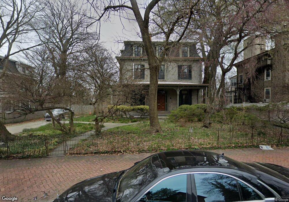
441 E Locust Ave Philadelphia, PA 19144
East Germantown NeighborhoodEstimated Value: $443,000 - $790,000
--
Bed
--
Bath
3,856
Sq Ft
$145/Sq Ft
Est. Value
About This Home
This home is located at 441 E Locust Ave, Philadelphia, PA 19144 and is currently estimated at $557,787, approximately $144 per square foot. 441 E Locust Ave is a home located in Philadelphia County with nearby schools including Roosevelt Theodore Middle School, Martin Luther King High School, and Mastery Charter School - Francis D. Pastorius Elemen.
Ownership History
Date
Name
Owned For
Owner Type
Purchase Details
Closed on
Jan 31, 2001
Sold by
Mcneely Joan I
Bought by
Davis James Earl
Current Estimated Value
Home Financials for this Owner
Home Financials are based on the most recent Mortgage that was taken out on this home.
Original Mortgage
$144,000
Outstanding Balance
$50,885
Interest Rate
7.13%
Estimated Equity
$506,902
Create a Home Valuation Report for This Property
The Home Valuation Report is an in-depth analysis detailing your home's value as well as a comparison with similar homes in the area
Home Values in the Area
Average Home Value in this Area
Purchase History
| Date | Buyer | Sale Price | Title Company |
|---|---|---|---|
| Davis James Earl | $180,000 | -- |
Source: Public Records
Mortgage History
| Date | Status | Borrower | Loan Amount |
|---|---|---|---|
| Open | Davis James Earl | $144,000 |
Source: Public Records
Tax History Compared to Growth
Tax History
| Year | Tax Paid | Tax Assessment Tax Assessment Total Assessment is a certain percentage of the fair market value that is determined by local assessors to be the total taxable value of land and additions on the property. | Land | Improvement |
|---|---|---|---|---|
| 2026 | $3,946 | $389,800 | $77,960 | $311,840 |
| 2025 | $3,946 | $389,800 | $77,960 | $311,840 |
| 2024 | $3,946 | $389,800 | $77,960 | $311,840 |
| 2023 | $3,946 | $281,900 | $56,380 | $225,520 |
| 2022 | $1,792 | $236,900 | $56,380 | $180,520 |
| 2021 | $2,422 | $0 | $0 | $0 |
| 2020 | $2,422 | $0 | $0 | $0 |
| 2019 | $2,528 | $0 | $0 | $0 |
| 2018 | $2,926 | $0 | $0 | $0 |
| 2017 | $2,926 | $0 | $0 | $0 |
| 2016 | $2,506 | $0 | $0 | $0 |
| 2015 | $1,583 | $0 | $0 | $0 |
| 2014 | -- | $193,700 | $115,490 | $78,210 |
| 2012 | -- | $28,416 | $10,068 | $18,348 |
Source: Public Records
Map
Nearby Homes
- 5638 Morton St
- 5634 Morton St
- 345 E Armat St
- 5630 Heiskell St
- 335 E Armat St
- 5634 Heiskell St
- 436 E Chelten Ave
- 5688 90 Magnolia St
- 328 E Armat St
- 5612 Utah St
- 5604 6 Utah St
- 543 E Locust Ave
- 5357 Belfield Ave
- 527 E Chelten Ave
- 604 E Locust Ave
- 459 E Price St
- 617 E Locust Ave
- 1000 E Woodlawn St
- 5301 Belfield Ave
- 222 E Price St
- 449 E Locust Ave
- 461 E Locust Ave
- 458 E Locust Ave Unit 60
- 456 E Locust Ave
- 470 E Locust Ave
- 411 E Locust Ave
- 469 E Locust Ave
- 424 E Woodlawn St
- 5646 Morton St
- 5636 Morton St
- 5654 Morton St
- 5632 Morton St
- 477 E Locust Ave
- 434 E Woodlawn St
- 5644 Morton St
- 5648 Morton St
- 5640 Morton St
- 5630 Morton St
- 5650 Morton St
- 5652 Morton St