Estimated Value: $178,000 - $227,000
3
Beds
1
Bath
1,040
Sq Ft
$193/Sq Ft
Est. Value
About This Home
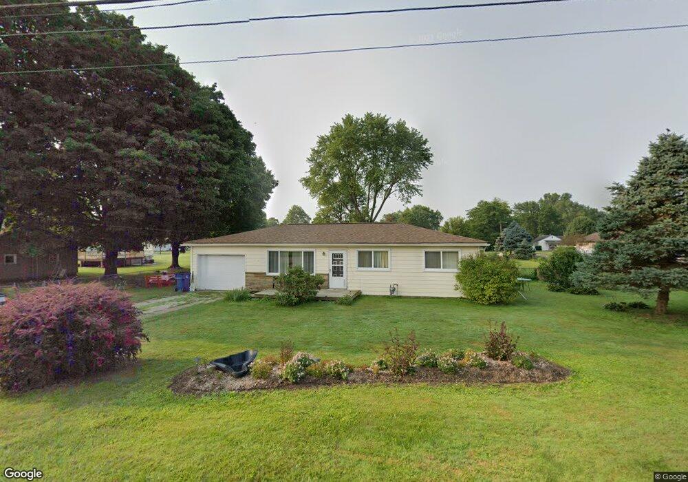
This home is located at 441 Heath Rd, Heath, OH 43056 and is currently estimated at $201,016, approximately $193 per square foot. 441 Heath Rd is a home located in Licking County with nearby schools including Garfield Elementary School, Stevenson Elementary School, and Heath Middle School.
Ownership History
Date
Name
Owned For
Owner Type
Purchase Details
Closed on
Apr 2, 2002
Sold by
Napier Colin R
Bought by
Mcginnis Teresa S
Current Estimated Value
Home Financials for this Owner
Home Financials are based on the most recent Mortgage that was taken out on this home.
Original Mortgage
$45,500
Interest Rate
6.93%
Mortgage Type
New Conventional
Purchase Details
Closed on
Jun 8, 2001
Sold by
Davis Rhea F
Bought by
Napier Colin R
Home Financials for this Owner
Home Financials are based on the most recent Mortgage that was taken out on this home.
Original Mortgage
$75,750
Interest Rate
7.18%
Mortgage Type
New Conventional
Create a Home Valuation Report for This Property
The Home Valuation Report is an in-depth analysis detailing your home's value as well as a comparison with similar homes in the area
Home Values in the Area
Average Home Value in this Area
Purchase History
| Date | Buyer | Sale Price | Title Company |
|---|---|---|---|
| Mcginnis Teresa S | $80,000 | -- | |
| Napier Colin R | $79,770 | -- |
Source: Public Records
Mortgage History
| Date | Status | Borrower | Loan Amount |
|---|---|---|---|
| Closed | Mcginnis Teresa S | $45,500 | |
| Previous Owner | Napier Colin R | $75,750 |
Source: Public Records
Tax History
| Year | Tax Paid | Tax Assessment Tax Assessment Total Assessment is a certain percentage of the fair market value that is determined by local assessors to be the total taxable value of land and additions on the property. | Land | Improvement |
|---|---|---|---|---|
| 2024 | $2,219 | $51,560 | $18,870 | $32,690 |
| 2023 | $2,455 | $51,560 | $18,870 | $32,690 |
| 2022 | $2,035 | $37,520 | $13,230 | $24,290 |
| 2021 | $2,077 | $37,520 | $13,230 | $24,290 |
| 2020 | $2,090 | $37,520 | $13,230 | $24,290 |
| 2019 | $1,713 | $31,290 | $12,600 | $18,690 |
| 2018 | $1,731 | $0 | $0 | $0 |
| 2017 | $1,655 | $0 | $0 | $0 |
| 2016 | $1,553 | $0 | $0 | $0 |
| 2015 | $1,580 | $0 | $0 | $0 |
| 2014 | $2,220 | $0 | $0 | $0 |
| 2013 | $1,572 | $0 | $0 | $0 |
Source: Public Records
Map
Nearby Homes
- 489 Heath Rd
- 229 Heath Rd
- 1192 Conn Way Dr
- 105 Clark Ave
- 79 James Ave
- 1100 Thornwood Dr Unit Lot 1005
- 1100 Thornwood Dr SW Unit 1018
- 1100 Thornwood Dr SW Unit Lot 1008
- 1100 Thornwood Dr SW Unit Lot 65
- 875 Terrace Dr
- 878 Oberlin Dr
- 944 Fieldson Dr
- 101 Fieldpoint Rd
- 91 Fieldpoint Rd
- 80 Maureen Dr
- 514 S 30th St
- 605 Turning Leaf Ln
- 1863 Cherry Valley Rd
- 521 Partridge Rd
- 175 Oak Valley Ct