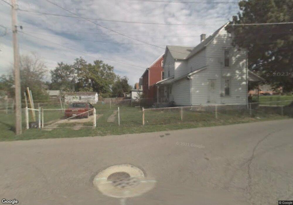
441 Johns Ave Mansfield, OH 44903
Estimated Value: $70,000 - $102,000
3
Beds
1
Bath
1,176
Sq Ft
$71/Sq Ft
Est. Value
About This Home
This home is located at 441 Johns Ave, Mansfield, OH 44903 and is currently estimated at $83,023, approximately $70 per square foot. 441 Johns Ave is a home located in Richland County with nearby schools including Goal Digital Academy, St. Peter's Elementary/Montessori School, and St. Peter's Junior High / High School.
Ownership History
Date
Name
Owned For
Owner Type
Purchase Details
Closed on
Jul 11, 2018
Sold by
Watts Ezra J and Watts Patricia L
Bought by
Matheny Lois I
Current Estimated Value
Purchase Details
Closed on
Nov 24, 1999
Sold by
Flannery Stephen
Bought by
Watts Ezra J and Watts Patricia L
Home Financials for this Owner
Home Financials are based on the most recent Mortgage that was taken out on this home.
Original Mortgage
$23,996
Interest Rate
7.9%
Mortgage Type
New Conventional
Create a Home Valuation Report for This Property
The Home Valuation Report is an in-depth analysis detailing your home's value as well as a comparison with similar homes in the area
Home Values in the Area
Average Home Value in this Area
Purchase History
| Date | Buyer | Sale Price | Title Company |
|---|---|---|---|
| Matheny Lois I | $8,100 | None Available | |
| Watts Ezra J | $20,000 | -- |
Source: Public Records
Mortgage History
| Date | Status | Borrower | Loan Amount |
|---|---|---|---|
| Previous Owner | Watts Ezra J | $23,996 |
Source: Public Records
Tax History Compared to Growth
Tax History
| Year | Tax Paid | Tax Assessment Tax Assessment Total Assessment is a certain percentage of the fair market value that is determined by local assessors to be the total taxable value of land and additions on the property. | Land | Improvement |
|---|---|---|---|---|
| 2024 | $368 | $17,280 | $1,300 | $15,980 |
| 2023 | $350 | $17,280 | $1,300 | $15,980 |
| 2022 | $293 | $13,990 | $1,180 | $12,810 |
| 2021 | $295 | $13,990 | $1,180 | $12,810 |
| 2020 | $301 | $13,990 | $1,180 | $12,810 |
| 2019 | $334 | $13,990 | $1,180 | $12,810 |
| 2018 | $900 | $13,990 | $1,180 | $12,810 |
| 2017 | $876 | $13,990 | $1,180 | $12,810 |
| 2016 | $833 | $12,900 | $1,870 | $11,030 |
| 2015 | $796 | $12,900 | $1,870 | $11,030 |
| 2014 | $785 | $12,900 | $1,870 | $11,030 |
| 2012 | $301 | $12,900 | $1,970 | $10,930 |
Source: Public Records
Map
Nearby Homes
- 0 Voegele Ave Unit Lot 6048, 6049, 6
- 526 Bowman St
- 524 Lida St
- 701 Springmill St
- 319 Prescott St
- 480 Mcpherson St
- 118 Raymond Ave
- 362-364 W 6th St
- 368 W 6th St
- 219 W 5th St
- 212 Penn Ave
- 0 Highway 30
- 169 W 5th St
- 572 France St
- 237 Helen Ave
- 492 Stark St
- 149 W 4th St
- 0 State Route 314 Unit 9069650
- 0 State Route 314 Unit 9067316
- 0 State Route 314 Unit 225021979
- 437 Johns Ave
- 445 Johns Ave
- 431 Johns Ave
- 449 Johns Ave
- 429 Johns Ave
- 438 Woodland Ave
- 442 Woodland Ave
- 275 Harker St
- 434 Woodland Ave
- 444 Woodland Ave
- 430 Woodland Ave
- 279 Harker St
- 426 Woodland Ave
- 417 Blust Ave
- 289 Harker St
- 413 Blust Ave
- 418 Woodland Ave
- 276 Harker St
- 411 Blust Ave
- 427 Woodland Ave