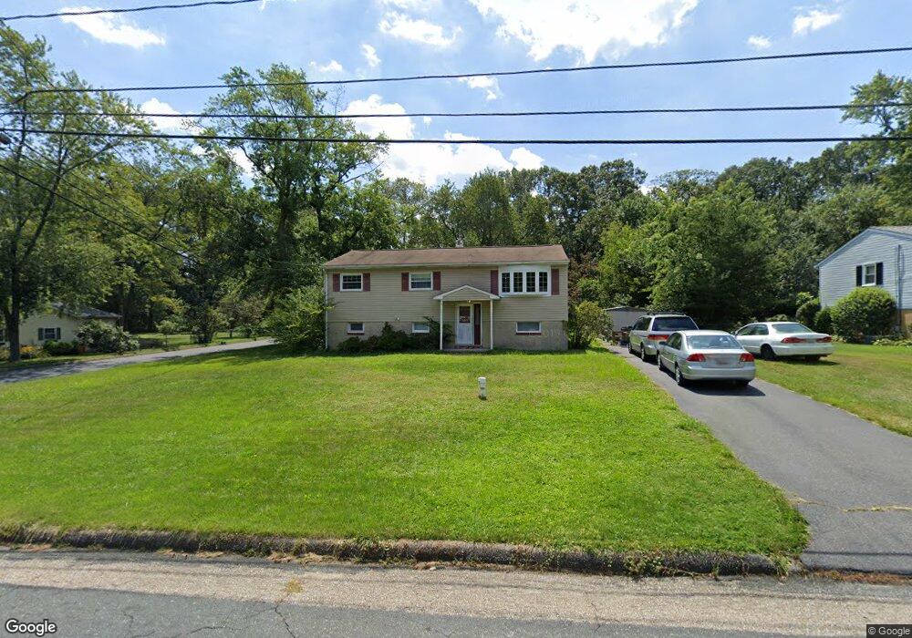
441 Martin Dr Millersville, MD 21108
Estimated Value: $351,000 - $484,000
4
Beds
1
Bath
1,040
Sq Ft
$408/Sq Ft
Est. Value
About This Home
This home is located at 441 Martin Dr, Millersville, MD 21108 and is currently estimated at $424,513, approximately $408 per square foot. 441 Martin Dr is a home located in Anne Arundel County with nearby schools including Southgate Elementary School, Old Mill Middle School North, and Old Mill High School.
Ownership History
Date
Name
Owned For
Owner Type
Purchase Details
Closed on
Feb 2, 2006
Sold by
Zaukus Jos J
Bought by
Miller Eric and Miller Rachel
Current Estimated Value
Home Financials for this Owner
Home Financials are based on the most recent Mortgage that was taken out on this home.
Original Mortgage
$100,000
Outstanding Balance
$56,529
Interest Rate
6.27%
Mortgage Type
Credit Line Revolving
Estimated Equity
$367,984
Purchase Details
Closed on
Jan 27, 2006
Sold by
Zaukus Jos J
Bought by
Miller Eric and Miller Rachel
Home Financials for this Owner
Home Financials are based on the most recent Mortgage that was taken out on this home.
Original Mortgage
$100,000
Outstanding Balance
$56,529
Interest Rate
6.27%
Mortgage Type
Credit Line Revolving
Estimated Equity
$367,984
Create a Home Valuation Report for This Property
The Home Valuation Report is an in-depth analysis detailing your home's value as well as a comparison with similar homes in the area
Home Values in the Area
Average Home Value in this Area
Purchase History
| Date | Buyer | Sale Price | Title Company |
|---|---|---|---|
| Miller Eric | $330,000 | -- | |
| Miller Eric | $330,000 | -- |
Source: Public Records
Mortgage History
| Date | Status | Borrower | Loan Amount |
|---|---|---|---|
| Open | Miller Eric | $100,000 | |
| Open | Miller Eric | $179,900 | |
| Closed | Miller Eric | $100,000 | |
| Closed | Miller Eric | $179,900 |
Source: Public Records
Tax History Compared to Growth
Tax History
| Year | Tax Paid | Tax Assessment Tax Assessment Total Assessment is a certain percentage of the fair market value that is determined by local assessors to be the total taxable value of land and additions on the property. | Land | Improvement |
|---|---|---|---|---|
| 2025 | $4,015 | $374,300 | -- | -- |
| 2024 | $4,015 | $359,800 | $248,500 | $111,300 |
| 2023 | $3,906 | $349,400 | $0 | $0 |
| 2022 | $3,652 | $339,000 | $0 | $0 |
| 2021 | $7,172 | $328,600 | $216,500 | $112,100 |
| 2020 | $3,488 | $324,800 | $0 | $0 |
| 2019 | $3,434 | $321,000 | $0 | $0 |
| 2018 | $3,216 | $317,200 | $206,500 | $110,700 |
| 2017 | $3,226 | $298,000 | $0 | $0 |
| 2016 | -- | $278,800 | $0 | $0 |
| 2015 | -- | $259,600 | $0 | $0 |
| 2014 | -- | $259,600 | $0 | $0 |
Source: Public Records
Map
Nearby Homes
- 8206 Derrymore Ct
- 0 Connors Ln
- 8262 Kippis Rd
- 8297 Kippis Rd
- 8253 Rupert Rd S
- 401 Green Grove Ct
- 8251 Rupert Rd S
- 8333 Kippis Rd
- 460 Marianna Dr
- 307 Sorel Ct
- 759 Stacy Oak Way
- 8224 Bernard Dr N
- 601 Brightwood Rd
- 304 W Pasadena Rd
- 258 Poplar Rd
- 15 Tremont Dr
- 8383 Sycamore Rd
- 8011 Horicon Point Dr
- 8381 Amber Beacon Cir
- 584 Brightview Dr
- 447 Martin Dr
- 435 Martin Dr
- 462 Brightwood Rd
- 453 Martin Dr
- 468 Brightwood Rd
- 456 Brightwood Rd
- 429 Martin Dr
- 440 Martin Dr
- 434 Martin Dr
- 446 Martin Dr
- 459 Martin Dr
- 428 Martin Dr
- 478 Brightwood Rd
- 452 Martin Dr
- 450 Brightwood Rd
- 423 Martin Dr
- 422 Martin Dr
- 465 Martin Dr
- 467 Brightwood Rd
- 458 Martin Dr