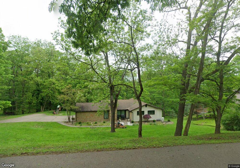
441 Munntown Rd Eighty Four, PA 15330
Estimated Value: $312,712 - $367,000
4
Beds
3
Baths
1,494
Sq Ft
$226/Sq Ft
Est. Value
About This Home
This home is located at 441 Munntown Rd, Eighty Four, PA 15330 and is currently estimated at $337,178, approximately $225 per square foot. 441 Munntown Rd is a home with nearby schools including Ringgold High School.
Ownership History
Date
Name
Owned For
Owner Type
Purchase Details
Closed on
Sep 23, 2002
Sold by
Lewis Lowry F
Bought by
Smith Rae Neil
Current Estimated Value
Home Financials for this Owner
Home Financials are based on the most recent Mortgage that was taken out on this home.
Original Mortgage
$131,750
Outstanding Balance
$55,157
Interest Rate
6.27%
Estimated Equity
$282,021
Create a Home Valuation Report for This Property
The Home Valuation Report is an in-depth analysis detailing your home's value as well as a comparison with similar homes in the area
Home Values in the Area
Average Home Value in this Area
Purchase History
| Date | Buyer | Sale Price | Title Company |
|---|---|---|---|
| Smith Rae Neil | $165,000 | -- |
Source: Public Records
Mortgage History
| Date | Status | Borrower | Loan Amount |
|---|---|---|---|
| Open | Smith Rae Neil | $131,750 |
Source: Public Records
Tax History
| Year | Tax Paid | Tax Assessment Tax Assessment Total Assessment is a certain percentage of the fair market value that is determined by local assessors to be the total taxable value of land and additions on the property. | Land | Improvement |
|---|---|---|---|---|
| 2025 | $3,825 | $183,000 | $69,300 | $113,700 |
| 2024 | $3,404 | $183,000 | $69,300 | $113,700 |
| 2023 | $3,404 | $183,000 | $69,300 | $113,700 |
| 2022 | $3,331 | $183,000 | $69,300 | $113,700 |
| 2021 | $3,285 | $183,000 | $69,300 | $113,700 |
| 2020 | $3,212 | $183,000 | $69,300 | $113,700 |
| 2019 | $3,175 | $183,000 | $69,300 | $113,700 |
| 2018 | $3,139 | $183,000 | $69,300 | $113,700 |
| 2017 | $471 | $183,000 | $69,300 | $113,700 |
| 2016 | $471 | $18,916 | $3,266 | $15,650 |
| 2015 | -- | $18,916 | $3,266 | $15,650 |
| 2014 | $471 | $18,916 | $3,266 | $15,650 |
| 2013 | $471 | $18,916 | $3,266 | $15,650 |
Source: Public Records
Map
Nearby Homes
- LOT Dovercrest Rd
- Lot 7 Munntown Rd
- Lot 6 Munntown Rd
- Lot 8 Munntown Rd
- 246 Arrowhead Ln
- TBD Lutes Rd
- 412 Barons Ct
- 424 Barons Ct
- 408 Barons Ct
- 406 Barons Ct
- 108 Walnut Dr
- 221 Arrowhead Ln
- 110 Cornerstone Ct
- 120 Dana Dr
- 357 Buckingham Dr
- 390 Dana Dr
- 256 Dana Dr
- 246 Dana Dr
- 308 Sutherland Dr
- 217 Canterwood Dr
- 453 Munntown Rd
- 494 Munntown Rd
- 433 Munntown Rd
- 442 Munntown Rd
- 448 Munntown Rd
- 436 Munntown Rd
- 452 Munntown Rd
- 459 Munntown Rd
- 430 Munntown Rd
- 462 Munntown Rd
- 467 Munntown Rd
- 415 Munntown Rd
- 418 Munntown Rd
- 26 Dovercrest Rd
- 478 Munntown Rd
- 34 Dovercrest Rd
- 42 Dovercrest Rd
- 31 Dovercrest Rd
- 50 Dovercrest Rd
- 402 Munntown Rd
Your Personal Tour Guide
Ask me questions while you tour the home.