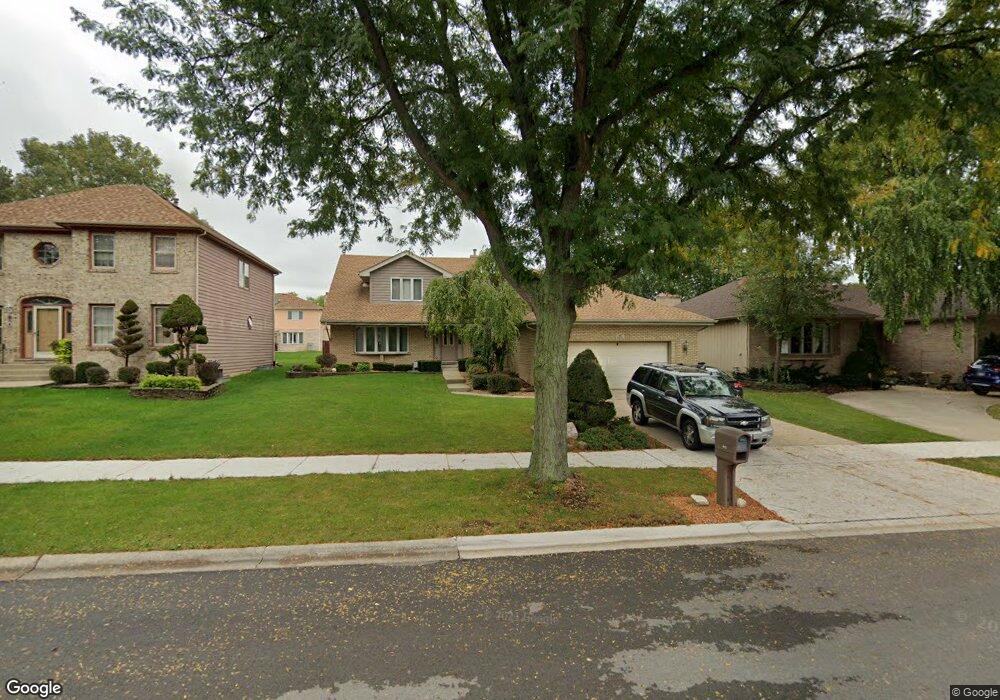
441 N Kevin Dr Addison, IL 60101
Estimated Value: $478,000 - $565,000
--
Bed
--
Bath
3,135
Sq Ft
$169/Sq Ft
Est. Value
About This Home
This home is located at 441 N Kevin Dr, Addison, IL 60101 and is currently estimated at $529,718, approximately $168 per square foot. 441 N Kevin Dr is a home located in DuPage County with nearby schools including Wesley Elementary School, Indian Trail Jr High School, and Addison Trail High School.
Ownership History
Date
Name
Owned For
Owner Type
Purchase Details
Closed on
Oct 10, 2023
Sold by
Capuani Frank S and Capuani Kimberly R
Bought by
Frank S Capuani And Kimberly Rcapuani Declara
Current Estimated Value
Create a Home Valuation Report for This Property
The Home Valuation Report is an in-depth analysis detailing your home's value as well as a comparison with similar homes in the area
Home Values in the Area
Average Home Value in this Area
Purchase History
| Date | Buyer | Sale Price | Title Company |
|---|---|---|---|
| Frank S Capuani And Kimberly Rcapuani Declara | -- | None Listed On Document |
Source: Public Records
Tax History Compared to Growth
Tax History
| Year | Tax Paid | Tax Assessment Tax Assessment Total Assessment is a certain percentage of the fair market value that is determined by local assessors to be the total taxable value of land and additions on the property. | Land | Improvement |
|---|---|---|---|---|
| 2024 | $12,008 | $178,378 | $57,284 | $121,094 |
| 2023 | $11,482 | $163,980 | $52,660 | $111,320 |
| 2022 | $11,464 | $161,660 | $50,550 | $111,110 |
| 2021 | $10,994 | $154,850 | $48,420 | $106,430 |
| 2020 | $10,704 | $148,320 | $46,380 | $101,940 |
| 2019 | $10,638 | $142,620 | $44,600 | $98,020 |
| 2018 | $10,475 | $135,040 | $43,310 | $91,730 |
| 2017 | $10,214 | $129,060 | $41,390 | $87,670 |
| 2016 | $9,958 | $119,150 | $38,210 | $80,940 |
| 2015 | $9,728 | $110,070 | $35,300 | $74,770 |
| 2014 | $9,358 | $105,460 | $29,130 | $76,330 |
| 2013 | $9,163 | $107,610 | $29,720 | $77,890 |
Source: Public Records
Map
Nearby Homes
- 465 N Mill Rd
- 6221 Links Dr Unit 27002
- 6201 Links Dr Unit 24001
- 6232 Links Dr Unit 3001
- 6213 Links Dr Unit 26001
- 6219 Links Dr Unit 27001
- 6225 Links Dr Unit 28001
- 6231 Links Dr Unit 29001
- 6233 Links Dr Unit 29002
- 385 Masters Dr
- 379 Masters Dr
- 551 N 6th Ave
- 329 Masters Dr
- 330 Masters Dr
- 276 Masters Dr
- 257 Masters Dr
- 231 N Mill Rd Unit 11
- 235 N Mill Rd Unit 115B
- 769 W Fairway Dr
- 768 W St Johns Place