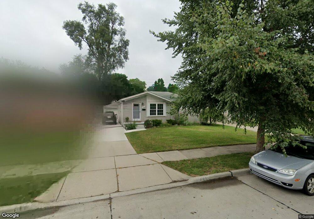
441 W Rose Ave Unit Bldg-Unit Garden City, MI 48135
Estimated Value: $188,000 - $249,000
--
Bed
2
Baths
967
Sq Ft
$221/Sq Ft
Est. Value
About This Home
This home is located at 441 W Rose Ave Unit Bldg-Unit, Garden City, MI 48135 and is currently estimated at $213,926, approximately $221 per square foot. 441 W Rose Ave Unit Bldg-Unit is a home located in Wayne County with nearby schools including Memorial Elementary 1-2 Campus, Douglas Elementary 3-4 Campus, and Farmington 5-6 Campus.
Ownership History
Date
Name
Owned For
Owner Type
Purchase Details
Closed on
Apr 19, 2018
Sold by
Schovers Raymond A and Schovers Diane E
Bought by
Myers Katie M
Current Estimated Value
Home Financials for this Owner
Home Financials are based on the most recent Mortgage that was taken out on this home.
Original Mortgage
$117,600
Outstanding Balance
$101,158
Interest Rate
4.45%
Mortgage Type
Commercial
Estimated Equity
$112,769
Create a Home Valuation Report for This Property
The Home Valuation Report is an in-depth analysis detailing your home's value as well as a comparison with similar homes in the area
Home Values in the Area
Average Home Value in this Area
Purchase History
| Date | Buyer | Sale Price | Title Company |
|---|---|---|---|
| Myers Katie M | $147,000 | None Available |
Source: Public Records
Mortgage History
| Date | Status | Borrower | Loan Amount |
|---|---|---|---|
| Open | Myers Katie M | $117,600 |
Source: Public Records
Tax History Compared to Growth
Tax History
| Year | Tax Paid | Tax Assessment Tax Assessment Total Assessment is a certain percentage of the fair market value that is determined by local assessors to be the total taxable value of land and additions on the property. | Land | Improvement |
|---|---|---|---|---|
| 2025 | $3,054 | $88,300 | $0 | $0 |
| 2024 | $3,054 | $79,900 | $0 | $0 |
| 2023 | $2,913 | $69,100 | $0 | $0 |
| 2022 | $3,260 | $63,600 | $0 | $0 |
| 2021 | $3,188 | $61,500 | $0 | $0 |
| 2020 | $3,195 | $58,100 | $0 | $0 |
| 2019 | $2,628 | $50,400 | $0 | $0 |
| 2018 | $1,679 | $41,900 | $0 | $0 |
| 2017 | $1,159 | $39,600 | $0 | $0 |
| 2016 | $2,519 | $39,100 | $0 | $0 |
| 2015 | $3,343 | $37,000 | $0 | $0 |
| 2013 | $3,400 | $34,600 | $0 | $0 |
| 2012 | $2,633 | $36,900 | $11,600 | $25,300 |
Source: Public Records
Map
Nearby Homes
- 489 Henry Ruff Rd
- 30414 Cherry Hill Rd
- 577 Brandt St
- 30639 Florence St
- 29487 Florence St
- 30808 Sheridan St
- 1125 Brandt St
- 329 Shotka St
- 30806 Fernwood St
- 30901 Cherry Hill Rd
- 30915 Cherry Hill Rd
- 30931 Fernwood St
- 29578 Brown Ct
- 724 Clair St
- 30822 Steinhauer St
- 29760 Birchwood St
- 29643 Steinhauer St
- 29031 Rosslyn Ave
- 31255 Marquette St
- 0000 Brandt St
- 441 W Rose Ave
- 451 W Rose Ave
- 431 W Rose Ave
- 461 W Rose Ave
- 421 W Rose Ave
- 464 Henry Ruff Rd
- 482 Henry Ruff Rd
- 503 W Rose Ave
- 500 Henry Ruff Rd
- 411 W Rose Ave
- 430 Henry Ruff Rd
- 440 W Rose Ave
- 450 W Rose Ave
- 430 W Rose Ave
- 510 Henry Ruff Rd
- 460 W Rose Ave
- 418 Henry Ruff Rd
- 420 W Rose Ave
- 511 W Rose Ave
- 401 W Rose Ave