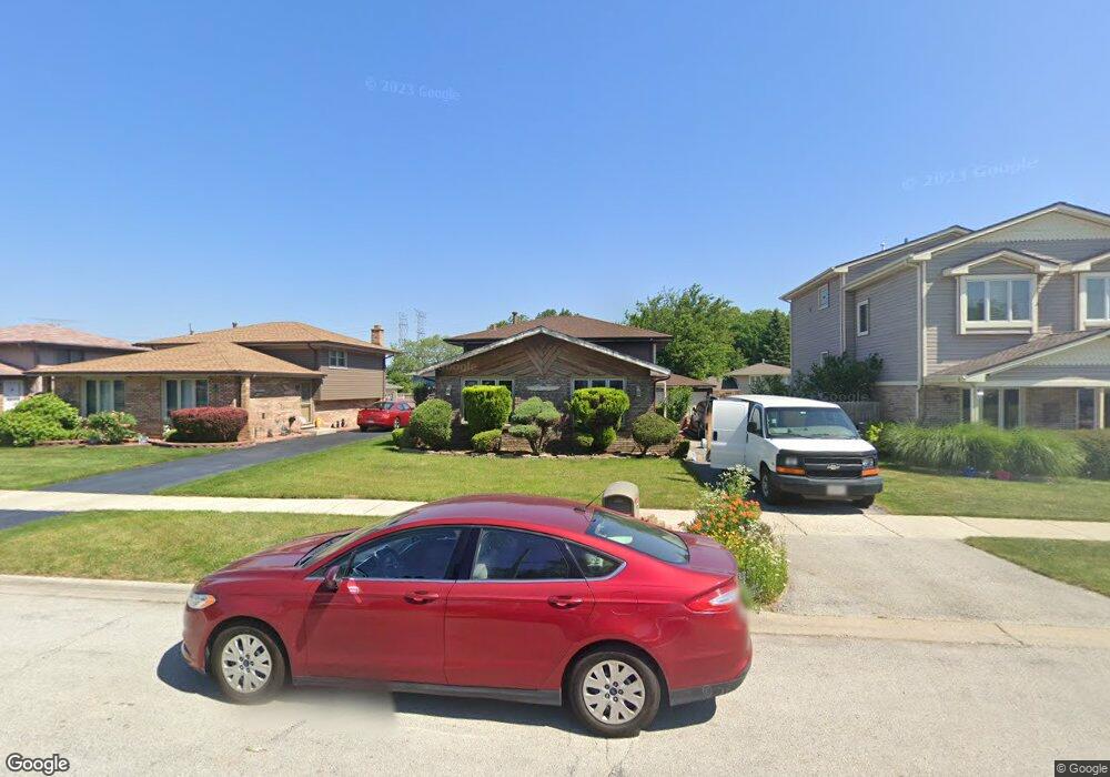
4410 142nd St Crestwood, IL 60445
Estimated Value: $250,000 - $345,000
3
Beds
2
Baths
1,069
Sq Ft
$277/Sq Ft
Est. Value
About This Home
This home is located at 4410 142nd St, Crestwood, IL 60445 and is currently estimated at $296,575, approximately $277 per square foot. 4410 142nd St is a home located in Cook County with nearby schools including Kolmar Elementary School, A B Shepard High School, and St. Christopher School.
Ownership History
Date
Name
Owned For
Owner Type
Purchase Details
Closed on
Jul 26, 2000
Sold by
Bankers Trust Company Of California
Bought by
Pickering Patricia
Current Estimated Value
Home Financials for this Owner
Home Financials are based on the most recent Mortgage that was taken out on this home.
Original Mortgage
$110,675
Outstanding Balance
$39,960
Interest Rate
8.16%
Estimated Equity
$256,615
Purchase Details
Closed on
Nov 12, 1999
Sold by
Mcelligott Martin T
Bought by
Pacific America Home Equity Loan Trust S
Create a Home Valuation Report for This Property
The Home Valuation Report is an in-depth analysis detailing your home's value as well as a comparison with similar homes in the area
Home Values in the Area
Average Home Value in this Area
Purchase History
| Date | Buyer | Sale Price | Title Company |
|---|---|---|---|
| Pickering Patricia | $116,500 | Professional National Title | |
| Pacific America Home Equity Loan Trust S | -- | -- |
Source: Public Records
Mortgage History
| Date | Status | Borrower | Loan Amount |
|---|---|---|---|
| Open | Pickering Patricia | $110,675 |
Source: Public Records
Tax History Compared to Growth
Tax History
| Year | Tax Paid | Tax Assessment Tax Assessment Total Assessment is a certain percentage of the fair market value that is determined by local assessors to be the total taxable value of land and additions on the property. | Land | Improvement |
|---|---|---|---|---|
| 2024 | $4,704 | $21,000 | $2,680 | $18,320 |
| 2023 | $3,712 | $21,000 | $2,680 | $18,320 |
| 2022 | $3,712 | $15,051 | $2,345 | $12,706 |
| 2021 | $3,497 | $15,051 | $2,345 | $12,706 |
| 2020 | $3,492 | $15,051 | $2,345 | $12,706 |
| 2019 | $3,533 | $15,358 | $2,177 | $13,181 |
| 2018 | $3,383 | $15,358 | $2,177 | $13,181 |
| 2017 | $3,467 | $15,358 | $2,177 | $13,181 |
| 2016 | $3,631 | $14,513 | $1,842 | $12,671 |
| 2015 | $3,537 | $14,513 | $1,842 | $12,671 |
| 2014 | $3,476 | $14,513 | $1,842 | $12,671 |
| 2013 | $3,517 | $15,767 | $1,842 | $13,925 |
Source: Public Records
Map
Nearby Homes
- 14244 Kostner Ave
- 14341 Kenton Ave
- 14401 Kolin Ave
- 14309 Kilpatrick Ave
- 4424 Midlothian Turnpike
- 14348 Knox Ave
- 14431 Tripp Ave
- 14501 Tripp Ave
- 14544 Kostner Ave
- 4210 Midlothian Turnpike
- 14632 Kostner Ave
- 14602 Kenton Ave
- 14612 Kolmar Ave
- 14601 Tripp Ave
- 14624 Kolmar Ave
- 4653 146th St
- 4118 W Midlothian Turnpike
- 14631 Knox Ave
- 14401 Pulaski Rd
- 14501 Keystone Ave Unit 8
- 4424 142nd St
- 4408 142nd St
- 4414 142nd St
- 4406 142nd St
- 4415 141st Place
- 4411 141st Place
- 4432 142nd St
- 4411 142nd St
- 14146 Kostner Ave
- 14146 Kostner Ave
- 14142 Kostner Ave
- 14144 Kostner Ave
- 4407 142nd St
- 4427 141st Place
- 4434 142nd St
- 4434 142nd St
- 14140 Kostner Ave
- 4431 141st Place
- 4444 142nd St
- 4423 142nd St