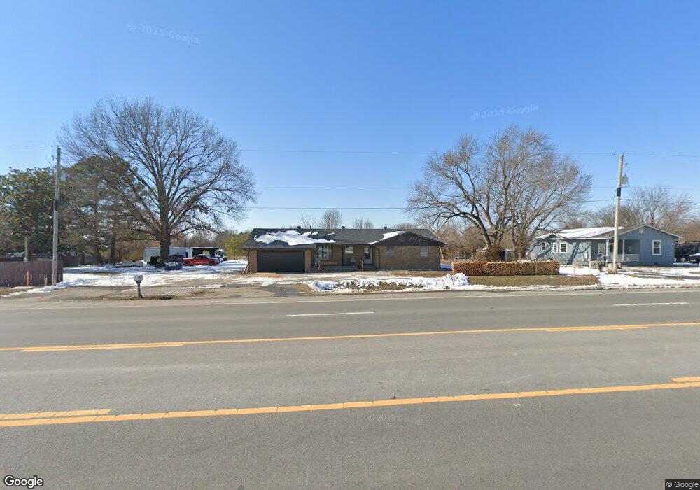
4410 NE Hudson Rd Rogers, AR 72756
Estimated Value: $299,000 - $324,913
--
Bed
2
Baths
1,780
Sq Ft
$176/Sq Ft
Est. Value
About This Home
This home is located at 4410 NE Hudson Rd, Rogers, AR 72756 and is currently estimated at $313,728, approximately $176 per square foot. 4410 NE Hudson Rd is a home located in Benton County with nearby schools including Northside Elementary School, Lingle Middle School, and Rogers Heritage High School.
Ownership History
Date
Name
Owned For
Owner Type
Purchase Details
Closed on
Sep 13, 2024
Sold by
Fred J Sulzberger Irrevocable Trust and Campbell Amy
Bought by
Alvarenga Saray and Segovia Oscar Alvarenga
Current Estimated Value
Home Financials for this Owner
Home Financials are based on the most recent Mortgage that was taken out on this home.
Original Mortgage
$222,450
Outstanding Balance
$219,949
Interest Rate
6.47%
Mortgage Type
FHA
Estimated Equity
$93,779
Purchase Details
Closed on
Apr 7, 2016
Sold by
Sulzberger Fred J
Bought by
Irrevocable Sulzberger Fred J and Fred J Sulzberger Irrevocable Trust
Purchase Details
Closed on
Feb 25, 2002
Bought by
Ar St Hwy Comm(.13)
Purchase Details
Closed on
Nov 21, 2001
Bought by
Sulzberger
Purchase Details
Closed on
Dec 29, 1989
Bought by
Sulzberger
Purchase Details
Closed on
Oct 16, 1989
Bought by
Thomas
Create a Home Valuation Report for This Property
The Home Valuation Report is an in-depth analysis detailing your home's value as well as a comparison with similar homes in the area
Home Values in the Area
Average Home Value in this Area
Purchase History
| Date | Buyer | Sale Price | Title Company |
|---|---|---|---|
| Alvarenga Saray | $291,500 | Waco Title | |
| Irrevocable Sulzberger Fred J | -- | Attorney | |
| Ar St Hwy Comm(.13) | -- | -- | |
| Sulzberger | -- | -- | |
| Sulzberger | $54,000 | -- | |
| Thomas | -- | -- |
Source: Public Records
Mortgage History
| Date | Status | Borrower | Loan Amount |
|---|---|---|---|
| Open | Alvarenga Saray | $222,450 |
Source: Public Records
Tax History Compared to Growth
Tax History
| Year | Tax Paid | Tax Assessment Tax Assessment Total Assessment is a certain percentage of the fair market value that is determined by local assessors to be the total taxable value of land and additions on the property. | Land | Improvement |
|---|---|---|---|---|
| 2025 | $2,788 | $54,668 | $8,000 | $46,668 |
| 2024 | $1,582 | $54,668 | $8,000 | $46,668 |
| 2023 | $1,438 | $33,570 | $4,400 | $29,170 |
| 2022 | $1,576 | $33,570 | $4,400 | $29,170 |
| 2021 | $1,454 | $33,570 | $4,400 | $29,170 |
| 2020 | $1,336 | $24,100 | $4,000 | $20,100 |
| 2019 | $1,257 | $24,100 | $4,000 | $20,100 |
| 2018 | $1,178 | $24,100 | $4,000 | $20,100 |
| 2017 | $888 | $24,100 | $4,000 | $20,100 |
| 2016 | $888 | $24,100 | $4,000 | $20,100 |
| 2015 | $888 | $15,340 | $2,000 | $13,340 |
| 2014 | $888 | $15,340 | $2,000 | $13,340 |
Source: Public Records
Map
Nearby Homes
- 0 Trotter Rd
- 11511 & 11503 Landers Rd
- 11511 Landers Rd
- 10491 Cartown Rd
- 12620 Lindy Ln
- 10508 Kays Ln
- 10484 Kays Ln
- 200 Kayla Dr
- 11010 Meadow Lark Rd
- 22 Howard Place
- 12437 Wildwood Dr
- 905 Prairie Creek Rd N
- 12400 Wildwood Dr
- 202 Buttry Rd
- 3816 N 2nd Place
- 3813 N 3rd St
- HOLDEN Plan at Tall Tree
- GARLAND Plan at Tall Tree
- 959 Nadine Dr
- 206 W Camelot Dr
- 4420 NE Hudson Rd
- 4430 NE Hudson Rd
- 4404 NE Hudson Rd
- 1525 N Airport Loop
- 10993 N Old Wire Rd
- 11150 N Old Wire Rd
- 1601 N Airport Loop
- 1501 N Airport Loop
- 1420 N Airport Loop
- 1521 N Airport Loop
- 3.59 Acres N Old Wire Rd
- 2.36 Acres N Old Wire Rd
- 1.23 Acres N Old Wire Rd
- 4353 Landers Rd
- 10989 N Old Wire Rd
- 11054 N Old Wire Rd
- 1320 N Airport Loop
- 13003 N Hwy 62
- 10990 N Old Wire Rd
- 10987 N Old Wire Rd