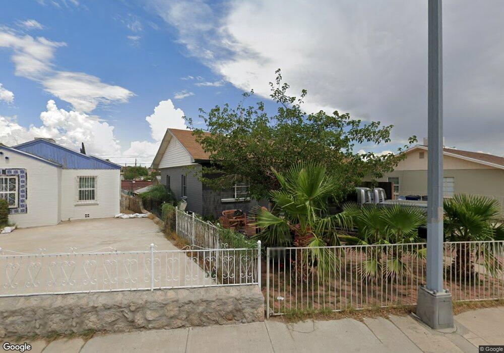
4410 Pershing Dr El Paso, TX 79903
Five Points NeighborhoodEstimated Value: $169,898 - $193,000
3
Beds
1
Bath
1,131
Sq Ft
$158/Sq Ft
Est. Value
About This Home
This home is located at 4410 Pershing Dr, El Paso, TX 79903 and is currently estimated at $178,475, approximately $157 per square foot. 4410 Pershing Dr is a home located in El Paso County with nearby schools including Coldwell Elementary School, Armendariz Middle School, and Middle School-5 NW Middle.
Ownership History
Date
Name
Owned For
Owner Type
Purchase Details
Closed on
May 27, 2011
Sold by
Cady Ophelia E
Bought by
Quiroz Victor Manuel Salazar
Current Estimated Value
Home Financials for this Owner
Home Financials are based on the most recent Mortgage that was taken out on this home.
Original Mortgage
$81,810
Outstanding Balance
$58,644
Interest Rate
5.5%
Mortgage Type
FHA
Estimated Equity
$119,831
Purchase Details
Closed on
Feb 22, 2001
Sold by
Cady Ophelia E and Estate Of Roger Theodore Cady
Bought by
Cady Ophelia E
Create a Home Valuation Report for This Property
The Home Valuation Report is an in-depth analysis detailing your home's value as well as a comparison with similar homes in the area
Home Values in the Area
Average Home Value in this Area
Purchase History
| Date | Buyer | Sale Price | Title Company |
|---|---|---|---|
| Quiroz Victor Manuel Salazar | -- | None Available | |
| Cady Ophelia E | -- | -- |
Source: Public Records
Mortgage History
| Date | Status | Borrower | Loan Amount |
|---|---|---|---|
| Open | Quiroz Victor Manuel Salazar | $81,810 |
Source: Public Records
Tax History Compared to Growth
Tax History
| Year | Tax Paid | Tax Assessment Tax Assessment Total Assessment is a certain percentage of the fair market value that is determined by local assessors to be the total taxable value of land and additions on the property. | Land | Improvement |
|---|---|---|---|---|
| 2025 | $1,433 | $138,794 | -- | -- |
| 2024 | $1,433 | $126,176 | -- | -- |
| 2023 | $1,353 | $114,705 | $0 | $0 |
| 2022 | $3,087 | $104,277 | $0 | $0 |
| 2021 | $2,960 | $94,797 | $18,018 | $76,779 |
| 2020 | $2,907 | $94,596 | $15,107 | $79,489 |
| 2018 | $2,778 | $93,864 | $15,107 | $78,757 |
| 2017 | $2,498 | $88,693 | $15,107 | $73,586 |
| 2016 | $2,498 | $88,693 | $15,107 | $73,586 |
| 2015 | $2,449 | $88,693 | $15,107 | $73,586 |
| 2014 | $2,449 | $89,517 | $15,107 | $74,410 |
Source: Public Records
Map
Nearby Homes
- 3816 Hastings Dr
- 3919 Cumberland Ave
- 3625 Richmond Ave
- 4122 Cumberland Ave
- 2518 Partello St
- 3817 Frankfort Ave
- 4000 Oxford Ave
- 4101 Trowbridge Dr
- 3905 Nashville Ave
- 4327 Chester Ave
- 4405 Cumberland Ave
- 3408 Lebanon Ave
- 1401 N Boone St
- 4325 Oxford Ave
- 4308 Oxford Ave
- 3921 Mobile Ave
- 19 Cumberland Cir
- 4013 Hueco Ave
- 4420 Oxford Ave
- 1234 Lamar St
- 4412 Pershing Dr
- 4408 Pershing Dr
- 4416 Pershing Dr
- 4400 Pershing Dr
- 3923 Hastings Dr
- 3912 Altura Ave
- 4411 Pershing Dr
- 4415 Pershing Dr
- 4409 Pershing Dr
- 3925 Hastings Dr
- 3821 Hastings Dr Unit 3823
- 3821 Hastings Dr Unit 3823
- 3920 Altura Ave
- 4001 Hastings Dr
- 4500 Pershing Dr
- 4318 Pershing Dr
- 3916 Hastings Dr
- 3918 Hastings Dr
- 3819 Hastings Dr