
4410 Rangeline Rd Mobile, AL 36619
Cypress Shores NeighborhoodEstimated payment $4,384/month
Highlights
- City View
- Fenced
- Level Lot
About This Lot
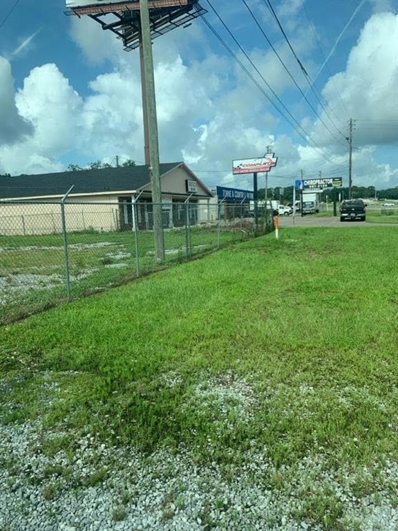
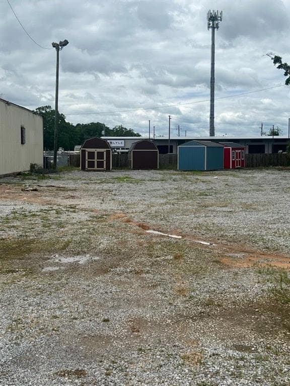
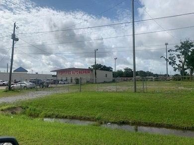
Build your business here!! Zoned B3 & located at the corner of busy Rangeline & Highway 90 intersection! Right off I-10! This property is .65 of an acre, level & cleared with 103 ft on Rangeline Service Rd, property goes back to 261 ft and is completely fenced. This is a busy intersection across from the Lowes Home Improvement store. Great location for retail stores, restaurants, drive-thru business, any franchise, banks, gas stations, auto dealerships, personal service businesses, medical clinics, and more. Seller may consider leasing property.
Property Details
Property Type
- Land
Est. Annual Taxes
- $2,021
Lot Details
- 0.64 Acre Lot
- Fenced
- Level Lot
- Property is zoned B3
Property Views
- City Views
Schools
- Mary W Burroughs Elementary School
- Burns Middle School
- Theodore High School
Utilities
- Phone Available
- Cable TV Available
Community Details
- Noble Heights Subdivision
Listing and Financial Details
- Assessor Parcel Number 3305223000013
Map
Home Values in the Area
Average Home Value in this Area
Tax History
| Year | Tax Paid | Tax Assessment Tax Assessment Total Assessment is a certain percentage of the fair market value that is determined by local assessors to be the total taxable value of land and additions on the property. | Land | Improvement |
|---|---|---|---|---|
| 2024 | $2,159 | $31,820 | $31,820 | $0 |
| 2023 | $2,159 | $31,820 | $31,820 | $0 |
| 2022 | $2,255 | $33,340 | $33,340 | $0 |
| 2021 | $2,117 | $33,340 | $33,340 | $0 |
| 2020 | $2,255 | $33,340 | $33,340 | $0 |
| 2019 | $2,117 | $33,340 | $33,340 | $0 |
| 2018 | $2,117 | $33,340 | $0 | $0 |
| 2017 | $2,117 | $33,340 | $0 | $0 |
| 2016 | $2,117 | $33,340 | $0 | $0 |
| 2013 | $1,078 | $22,220 | $0 | $0 |
Property History
| Date | Event | Price | List to Sale | Price per Sq Ft |
|---|---|---|---|---|
| 05/09/2025 05/09/25 | For Sale | $799,900 | -- | -- |
Source: Gulf Coast MLS (Mobile Area Association of REALTORS®)
MLS Number: 7576935
APN: 33-05-22-3-000-013
Disclaimer: Certain information contained herein is derived from information provided by parties other than Homes.com. All information provided is deemed reliable, but is not guaranteed to be accurate and should be independently verified.
![]() IDX information is provided exclusively for personal, non-commercial use, and may not be used for any purpose other than to identify prospective properties consumers may be interested in purchasing. Information is deemed reliable but not guaranteed.
IDX information is provided exclusively for personal, non-commercial use, and may not be used for any purpose other than to identify prospective properties consumers may be interested in purchasing. Information is deemed reliable but not guaranteed.
- 4323 Downey Dr
- 0 Rangeline Rd Unit 7655799
- 4100 Todd Blvd
- 4082 Dawson Dr
- 4083 Todd Blvd
- 5334 Worth Dr
- 5316 Worth Dr
- 5420 Worth Dr
- 4156 Furman Dr
- 4077 Higgins Rd
- 4219 Canal Dr
- 3765 Rabbit Creek Ct
- 5436 Rabbit Creek Dr Unit 4
- 5489 Rabbit Creek Dr
- 5517 Rabbit Creek Dr
- 5698 Spring Landing Dr
- 4087 Canal Cir E
- 4073 Canal Cir E
- 0 Rabbit Creek Dr E Unit 7270001
- 0 Rabbit Creek Dr E Unit 7659147
- 5463 Henning Dr W
- 5675 Old Pascagoula Rd
- 5725 Old Pascagoula Rd
- 4850 General Rd
- 5089 Government Blvd
- 4752 Halls Mill Rd
- 3210 Ward Rd Unit ID1043617P
- 4368 Fathbrook Ln
- 3908 Brookmont Dr
- 4008 Anna Dr
- 3257 Riverside Dr
- 4950 Government Blvd
- 6204 Old Pascagoula Rd
- 2750 Gill Rd
- 6134 Stream Bank Dr
- 6147 Stream Bank Dr
- 6240 Old Pascagoula Rd
- 6680 Carol Plantation Rd
- 2020 Boykin Blvd
- 3105 Demetropolis Rd
