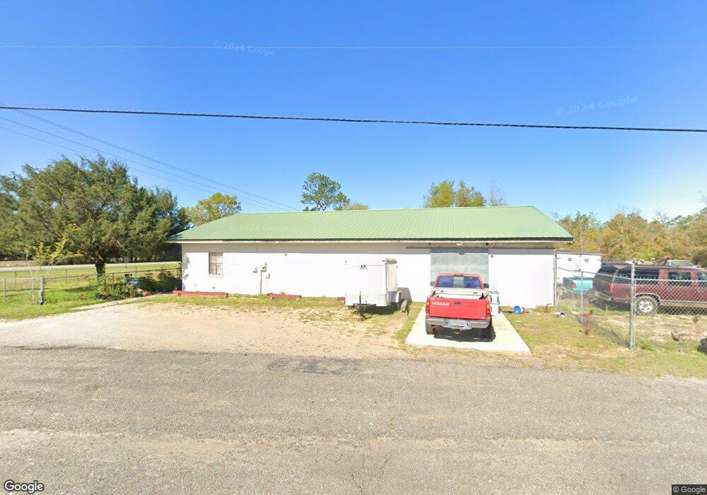
4410 U S 90 Defuniak Springs, FL 32433
Estimated Value: $249,802
--
Bed
1
Bath
3,466
Sq Ft
$72/Sq Ft
Est. Value
About This Home
This home is located at 4410 U S 90, Defuniak Springs, FL 32433 and is currently estimated at $249,802, approximately $72 per square foot. 4410 U S 90 is a home located in Walton County with nearby schools including West Defuniak Elementary School, Maude Saunders Elementary School, and Walton Middle School.
Ownership History
Date
Name
Owned For
Owner Type
Purchase Details
Closed on
Jul 15, 2020
Sold by
Platt Ronald and Platt Norma Jean
Bought by
Hall Eugene and Hall Kelly K
Current Estimated Value
Home Financials for this Owner
Home Financials are based on the most recent Mortgage that was taken out on this home.
Original Mortgage
$135,000
Outstanding Balance
$95,380
Interest Rate
3.1%
Mortgage Type
Seller Take Back
Estimated Equity
$154,422
Purchase Details
Closed on
May 3, 2019
Sold by
Platt Ronald
Bought by
Platt Ronald and Platt Norma Jean
Purchase Details
Closed on
Mar 1, 2016
Bought by
Platt Ronald R
Create a Home Valuation Report for This Property
The Home Valuation Report is an in-depth analysis detailing your home's value as well as a comparison with similar homes in the area
Home Values in the Area
Average Home Value in this Area
Purchase History
| Date | Buyer | Sale Price | Title Company |
|---|---|---|---|
| Hall Eugene | $165,000 | Mitchell Land & Title Inc | |
| Platt Ronald | -- | Attorney | |
| Platt Ronald R | $100 | -- |
Source: Public Records
Mortgage History
| Date | Status | Borrower | Loan Amount |
|---|---|---|---|
| Open | Hall Eugene | $135,000 |
Source: Public Records
Tax History Compared to Growth
Tax History
| Year | Tax Paid | Tax Assessment Tax Assessment Total Assessment is a certain percentage of the fair market value that is determined by local assessors to be the total taxable value of land and additions on the property. | Land | Improvement |
|---|---|---|---|---|
| 2024 | $390 | $38,032 | $18,000 | $20,032 |
| 2023 | $390 | $27,280 | $5,830 | $21,450 |
| 2022 | $409 | $29,339 | $6,471 | $22,868 |
| 2021 | $392 | $25,646 | $5,500 | $20,146 |
| 2020 | $392 | $24,768 | $5,500 | $19,268 |
| 2019 | $399 | $25,663 | $5,500 | $20,163 |
| 2018 | $408 | $26,558 | $0 | $0 |
| 2017 | $417 | $27,453 | $5,500 | $21,953 |
| 2016 | $428 | $28,348 | $0 | $0 |
| 2015 | $440 | $29,064 | $0 | $0 |
| 2014 | $451 | $29,780 | $0 | $0 |
Source: Public Records
Map
Nearby Homes
- TBD Owens Rd
- 714 E Picasso Cir
- 0 E Picasso Cir
- TBD Picasso Ln
- Lot 48 Howlin Rd
- 1192 Oakwood Lakes Blvd
- 135 Rembrandt Cir
- 115 Rembrandt Cir
- 31 Rembrandt Cir
- 19 N Raphael Rd
- 93 W Raphael Rd
- 40 Acres Brooklyn Dr
- 63 E Raphael Rd
- 585 Huckaba Rd E
- 75 Evergreen Pkwy
- 2 Wildwood Lakes Dr
- 22 Wildwood Lakes Dr
- 00 Boy Scout Rd
- Lot 15 Black Bear Ct
- Lot 7 Black Bear Ct
- 4410 Us Highway 90 W
- 20AC Us Highway 90
- 86 Peacock Rd
- 139 Peacock Rd
- 174 Peacock Rd
- 4558 Us Highway 90 W
- 8.9 acres Linda Ln
- 212 Peacock Rd
- 212 Peacock Rd
- 219 Peacock Rd
- 19 AC Us Highway 90
- 0000 Sussex Dr
- 4660 Us Highway 90 W
- 330 Peacock Rd
- 88 Willow Ln
- 2 ac Darby Ln
- 00 Christian Camp Rd
- 85 Sussex Dr
- Lot 2 Fairfield Dr
- 000 Darby Ln