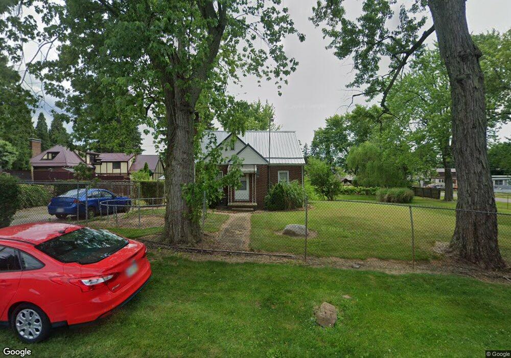
4411 Dupont St NW Massillon, OH 44646
Estimated Value: $140,000 - $225,000
2
Beds
1
Bath
1,097
Sq Ft
$156/Sq Ft
Est. Value
About This Home
This home is located at 4411 Dupont St NW, Massillon, OH 44646 and is currently estimated at $171,022, approximately $155 per square foot. 4411 Dupont St NW is a home located in Stark County with nearby schools including Pfeiffer Intermediate School, Edison Middle School, and Perry High School.
Ownership History
Date
Name
Owned For
Owner Type
Purchase Details
Closed on
Feb 16, 2023
Sold by
Simone Vincent J and Simone Annette M
Bought by
Vnaco Llc
Current Estimated Value
Purchase Details
Closed on
Aug 8, 2000
Sold by
Petersen Jean M
Bought by
Simone Vincent J and Simone Annette M
Home Financials for this Owner
Home Financials are based on the most recent Mortgage that was taken out on this home.
Original Mortgage
$52,000
Interest Rate
8.24%
Mortgage Type
Purchase Money Mortgage
Purchase Details
Closed on
May 11, 1994
Create a Home Valuation Report for This Property
The Home Valuation Report is an in-depth analysis detailing your home's value as well as a comparison with similar homes in the area
Home Values in the Area
Average Home Value in this Area
Purchase History
| Date | Buyer | Sale Price | Title Company |
|---|---|---|---|
| Vnaco Llc | -- | -- | |
| Simone Vincent J | $65,000 | -- | |
| -- | -- | -- |
Source: Public Records
Mortgage History
| Date | Status | Borrower | Loan Amount |
|---|---|---|---|
| Previous Owner | Simone Vincent J | $52,000 |
Source: Public Records
Tax History Compared to Growth
Tax History
| Year | Tax Paid | Tax Assessment Tax Assessment Total Assessment is a certain percentage of the fair market value that is determined by local assessors to be the total taxable value of land and additions on the property. | Land | Improvement |
|---|---|---|---|---|
| 2025 | -- | $49,250 | $16,910 | $32,340 |
| 2024 | -- | $49,250 | $16,910 | $32,340 |
| 2023 | $1,967 | $38,370 | $14,530 | $23,840 |
| 2022 | $1,972 | $38,370 | $14,530 | $23,840 |
| 2021 | $2,098 | $38,370 | $14,530 | $23,840 |
| 2020 | $1,616 | $31,050 | $12,220 | $18,830 |
| 2019 | $1,607 | $30,250 | $12,220 | $18,030 |
| 2018 | $1,549 | $30,250 | $12,220 | $18,030 |
| 2017 | $1,461 | $26,440 | $10,330 | $16,110 |
| 2016 | $1,469 | $26,440 | $10,330 | $16,110 |
| 2015 | $1,482 | $26,440 | $10,330 | $16,110 |
| 2014 | $1,427 | $25,030 | $9,800 | $15,230 |
| 2013 | $682 | $25,030 | $9,800 | $15,230 |
Source: Public Records
Map
Nearby Homes
- 122 Westland Ave SW
- 212 Westland Ave SW
- 200 Stewart Ave NW
- 1205 Sippo Ave SW
- 134 Shore Line Ave NW
- 326 Locke Ave NW
- 334 Locke Ave NW
- 337 Harding Ave NW
- 1209 Brooklyn Ave SW
- 138 Wrexham Ave SW
- 5040 2nd St NW
- 4955 Aurora St NW
- 5117 4th St NW
- 141 Ingall Ave NW
- 3626 Hazelbrook St SW
- 149 Marsden Ave SW
- 515 Oneida Ave NW
- 150 Hinderer Ave SW
- 703 Western Ave SW
- 4735 7th St SW
- 200 Roxbury Ave NW
- 141 Pershing Ave NW
- 141 Pershing Ave NW
- 141 Pershing Ave NW
- 141 Pershing Ave NW
- 201 Pershing Ave NW
- 145 Roxbury Ave NW
- 4334 Lincoln Way E
- 209 Pershing Ave NW
- 201 Roxbury Ave NW
- 214 Roxbury Ave NW
- 215 Roxbury Ave NW
- 220 Roxbury Ave NW
- 221 Pershing Ave NW
- 4307 Dupont St NW
- 4400 Lincoln Way E Unit C
- 4400 Lincoln Way E
- 226 Roxbury Ave NW
- 221 Roxbury Ave NW
- 200 Eden Ave NW